Property Record
203 N Thistle Ln, Benson, AZ 85602
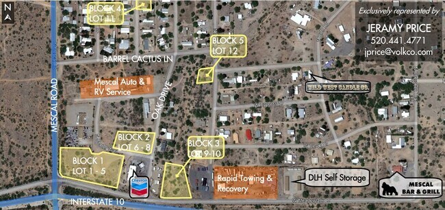
NEARBY LISTINGS FOR SALE OR LEASE
Property Detail
203 N Thistle Ln
Sierra Vista-Douglas, AZ
Mescal Lakes
124-15-191
MESCAL LAKES UNIT IV LOT 731
Residentialacreage
Cochise
X
Arizona
04003C1225G
731
2024
0.19 AC
2025
Arizona SE & Sierra Vista Area
000303
Other Market Areas
DEMOGRAPHICS near 203 N Thistle Ln
1 Mile
3 Mile
5 Mile
2024 Total Population
1,488
2,836
3,193
2029 Population
1,533
2,938
3,310
Pop Growth 2024-2029
+ 3.02%
+ 3.60%
+ 3.66%
Average Age
47
47
47
2024 Total Households
642
1,213
1,361
HH Growth 2024-2029
+ 2.80%
+ 3.46%
+ 3.53%
Median Household Inc
$62,548
$65,725
$66,846
Avg Household Size
2.20
2.30
2.30
2024 Avg HH Vehicles
2.00
2.00
2.00
Median Home Value
$201,471
$221,948
$226,350
Median Year Built
1998
1998
1998
Nearby Places
Map Layers
Map Styles
 Street
 Aerial
- Restaurants
- Banks
- Shops
- Fitness
- Groceries
PUBLIC TRANSPORTATION
COMMUTER RAIL
Benson Amtrak (Sunset Limited - Amtrak, Texas Eagle - Amtrak)
DRIVE
WALK
Distance
Benson Amtrak (Sunset Limited - Amtrak, Texas Eagle - Amtrak)
11 min
8.7 mi
Freight Ports
Port of San Diego
DRIVE
WALK
Distance
Port of San Diego
474 min
447.1 mi
SALE & LEASE HISTORY
LISTING DATE
SALE/LEASE

Jan 10, 2024
For Sale
Nearby Properties
Address
Land Use
TOTAL SIZE
Lot Size
Zoning
Address
Land Use
TOTAL SIZE
Lot Size
Zoning
2,176 SF
39.22 AC
RH
Address
Land Use
TOTAL SIZE
Lot Size
Zoning
9,165 SF
2.01 AC
Address
Land Use
TOTAL SIZE
Lot Size
Zoning
8,586 SF
15.62 AC
Address
Land Use
TOTAL SIZE
Lot Size
Zoning
7,338 SF
1.65 AC
TR36
Address
Land Use
TOTAL SIZE
Lot Size
Zoning
12,546 SF
5.03 AC
RU4
Address
Land Use
TOTAL SIZE
Lot Size
Zoning
4,400 SF
0.78 AC
MIXED
Address
Land Use
TOTAL SIZE
Lot Size
Zoning
4,900 SF
4.62 AC
RU4
Address
Land Use
TOTAL SIZE
Lot Size
Zoning
7,018 SF
33.34 AC
RU4
Address
Land Use
TOTAL SIZE
Lot Size
Zoning
2,274 SF
8 AC
R-36
Address
Land Use
TOTAL SIZE
Lot Size
Zoning
7.07 AC
Address
Land Use
TOTAL SIZE
Lot Size
Zoning
2,860 SF
21.40 AC
SM-174
Address
Land Use
TOTAL SIZE
Lot Size
Zoning
3,822 SF
394.59 AC
Address
Land Use
TOTAL SIZE
Lot Size
Zoning
3,200 SF
4 AC
TR36
Address
Land Use
TOTAL SIZE
Lot Size
Zoning
21,430 SF
Address
Land Use
TOTAL SIZE
Lot Size
Zoning
2,883 SF
0.46 AC
MIXED
Address
Land Use
TOTAL SIZE
Lot Size
Zoning
2,019 SF
1.33 AC
MIXED
Address
Land Use
TOTAL SIZE
Lot Size
Zoning
3,781 SF
2,141.96 AC
GB
Address
Land Use
TOTAL SIZE
Lot Size
Zoning
2,362 SF
5.71 AC
RU4
Address
Land Use
TOTAL SIZE
Lot Size
Zoning
5,208 SF
9.04 AC
RU4
Address
Land Use
TOTAL SIZE
Lot Size
Zoning
1,482 SF
0.80 AC
Address
Land Use
TOTAL SIZE
Lot Size
Zoning
3,233 SF
0.46 AC
MIXED
Address
Land Use
TOTAL SIZE
Lot Size
Zoning
4,422 SF
0.69 AC
MIXED
Address
Land Use
TOTAL SIZE
Lot Size
Zoning
1,251 SF
0.80 AC
Address
Land Use
TOTAL SIZE
Lot Size
Zoning
2,082 SF
0.43 AC
MIXED
Address
Land Use
TOTAL SIZE
Lot Size
Zoning
2,752 SF
5.36 AC
RU4
Address
Land Use
TOTAL SIZE
Lot Size
Zoning
4,373 SF
4.51 AC
RU4
Address
Land Use
TOTAL SIZE
Lot Size
Zoning
39.99 AC
RU-2
Address
Land Use
TOTAL SIZE
Lot Size
Zoning
3,978 SF
12.13 AC
RU4
The World's #1 Commercial Real Estate Marketplace
Connect with us
© 2026 CoStar Group
The information above has been obtained from sources believed reliable. While we do not doubt its accuracy we have not verified it and make no guarantee, warranty or representation about it. It is your responsibility to independently confirm its accuracy and completeness. Any projections, opinions, assumptions, or estimates used are for example only and do not represent the current or future performance of the property. The value of this transaction to you depends on tax and other factors which should be evaluated by your tax, financial, and legal advisors. You and your advisors should conduct a careful, independent investigation of the property to determine to your satisfaction the suitability of the property for your needs.