Property Record
203 Ramsey Ln, Ballwin, MO 63021

Property Detail
203 Ramsey Ln
23S-61-0444
SECTIONS 3-44-4 & 34-45-4 LOC E OF KENSINGTON WEST APARTMENTS
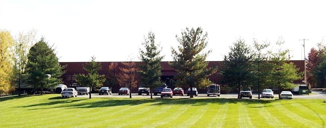
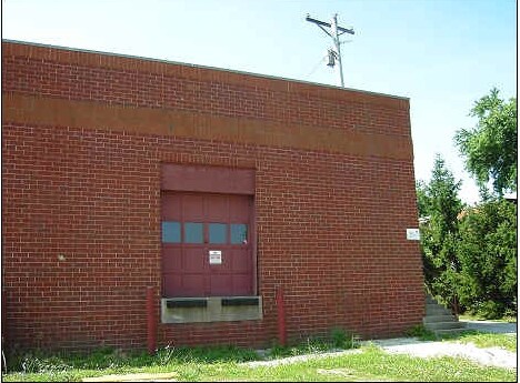
Warehouse
Saint Louis
93S-1
Missouri
B and X Area of moderate flood hazard, usually the area between the limits of the 100-year and 500-year floods.
5-9
2024
3.59 AC
2025
West County
217923
St. Louis
56,890 SF
St. Louis, MO-IL
NEARBY LISTINGS FOR SALE OR LEASE
-
-
View all Ballwin listings for sale on LoopNet.com
DEMOGRAPHICS near 203 Ramsey Ln
1 mile
3 mile
5 mile
2024 Total Population
11,406
78,046
152,705
2029 Population
11,261
76,783
150,461
Pop Growth 2024-2029
(1.27%)
(1.62%)
(1.47%)
Average Age
40
42
43
2024 Total Households
4,705
30,406
60,110
HH Growth 2024-2029
(1.25%)
(1.63%)
(1.47%)
Median Household Inc
$106,148
$123,244
$123,791
Avg Household Size
2.40
2.50
2.50
2024 Avg HH Vehicles
2.00
2.00
2.00
Median Home Value
$326,602
$371,434
$405,183
Median Year Built
1974
1977
1981
Nearby Places
Map Layers
Map Styles
 Street
 Aerial
Transit
 Traffic
 Biking
Places
Listings with unknown addresses are not visible on the map
- Restaurants
- Banks
- Shops
- Fitness
- Groceries
PUBLIC TRANSPORTATION
COMMUTER RAIL
Kirkwood Amtrak Station (Lincoln Service Missouri River Runner - Amtrak, Missouri River Runner - Amtrak)
Drive
Walk
Distance
Kirkwood Amtrak Station (Lincoln Service Missouri River Runner - Amtrak, Missouri River Runner - Amtrak)
19 min
9.5 mi
AIRPORT
St Louis Lambert International
Drive
Walk
Distance
St Louis Lambert International
36 min
23.1 mi
Freight Ports
Tulsa Port of Inola
Drive
Walk
Distance
Tulsa Port of Inola
407 min
365.5 mi
Nearby Properties
Address
Land Use
TOTAL SIZE
Lot Size
Zoning
Address
Land Use
TOTAL SIZE
Lot Size
Zoning
96.62 AC
R3
Address
Land Use
TOTAL SIZE
Lot Size
Zoning
633,127 SF
51.20 AC
NU
Address
Land Use
TOTAL SIZE
Lot Size
Zoning
156,253 SF
10.64 AC
87PC
Address
Land Use
TOTAL SIZE
Lot Size
Zoning
65.15 AC
105NU
Address
Land Use
TOTAL SIZE
Lot Size
Zoning
403,166 SF
23.17 AC
R4
Address
Land Use
TOTAL SIZE
Lot Size
Zoning
19.25 AC
55INSTU
Address
Land Use
TOTAL SIZE
Lot Size
Zoning
201,837 SF
27.89 AC
83C
Address
Land Use
TOTAL SIZE
Lot Size
Zoning
223,598 SF
13.95 AC
93C-1
Address
Land Use
TOTAL SIZE
Lot Size
Zoning
175,448 SF
6.95 AC
Address
Land Use
TOTAL SIZE
Lot Size
Zoning
111,719 SF
9.51 AC
19C-1
Address
Land Use
TOTAL SIZE
Lot Size
Zoning
137,873 SF
10.99 AC
PCD
Address
Land Use
TOTAL SIZE
Lot Size
Zoning
7.32 AC
83C
Address
Land Use
TOTAL SIZE
Lot Size
Zoning
153,489 SF
13.01 AC
93C-1
Address
Land Use
TOTAL SIZE
Lot Size
Zoning
247,992 SF
5.72 AC
C
Address
Land Use
TOTAL SIZE
Lot Size
Zoning
2,154 SF
13.19 AC
S
Address
Land Use
TOTAL SIZE
Lot Size
Zoning
7,900 SF
31.95 AC
87A
Address
Land Use
TOTAL SIZE
Lot Size
Zoning
212,328 SF
17.98 AC
94R-1
Address
Land Use
TOTAL SIZE
Lot Size
Zoning
23.18 AC
105NU
Address
Land Use
TOTAL SIZE
Lot Size
Zoning
220,288 SF
11.09 AC
93R-4
Address
Land Use
TOTAL SIZE
Lot Size
Zoning
191,316 SF
7.61 AC
R4
Address
Land Use
TOTAL SIZE
Lot Size
Zoning
181,790 SF
16.64 AC
R4
Address
Land Use
TOTAL SIZE
Lot Size
Zoning
177,250 SF
23.87 AC
M1
Address
Land Use
TOTAL SIZE
Lot Size
Zoning
128,358 SF
12.01 AC
19C-3
Address
Land Use
TOTAL SIZE
Lot Size
Zoning
158,700 SF
14.25 AC
R6A
Address
Land Use
TOTAL SIZE
Lot Size
Zoning
151,222 SF
11.50 AC
FPR6A
Address
Land Use
TOTAL SIZE
Lot Size
Zoning
115,050 SF
12.46 AC
87C
Address
Land Use
TOTAL SIZE
Lot Size
Zoning
174,250 SF
17.72 AC
R-6A
Address
Land Use
TOTAL SIZE
Lot Size
Zoning
247,511 SF
31.03 AC
19M-1
Address
Land Use
TOTAL SIZE
Lot Size
Zoning
29.26 AC
NU
Address
Land Use
TOTAL SIZE
Lot Size
Zoning
74,614 SF
8.05 AC
93C-1
The World's #1 Commercial Real Estate Marketplace
Connect with us
© 2026 CoStar Group
The information above has been obtained from sources believed reliable. While we do not doubt its accuracy we have not verified it and make no guarantee, warranty or representation about it. It is your responsibility to independently confirm its accuracy and completeness. Any projections, opinions, assumptions, or estimates used are for example only and do not represent the current or future performance of the property. The value of this transaction to you depends on tax and other factors which should be evaluated by your tax, financial, and legal advisors. You and your advisors should conduct a careful, independent investigation of the property to determine to your satisfaction the suitability of the property for your needs.