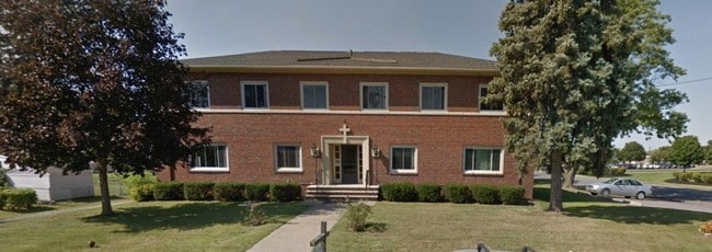
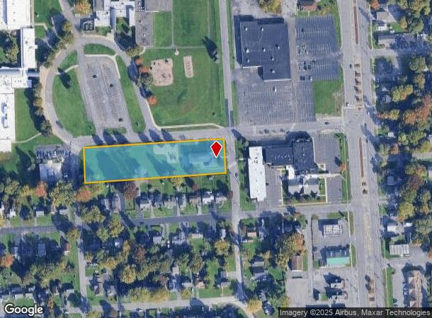
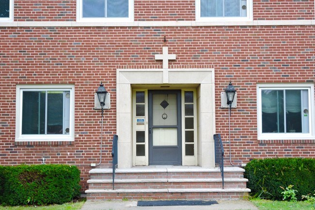
Property Record
203 Roxboro Rd, Syracuse, NY 13211

NEARBY LISTINGS FOR SALE OR LEASE
Property Detail
203 Roxboro Rd
314889-055-000-0002-012-000-0000
ST MARGARETS CHURCH KIRSCH TR 0550212 47000011010170
Religious
Onondaga
X
New York
36067C0207F
12.000
2025
1.84 AC
2024
NE Outer Onondaga County
014000
Syracuse
9,944 SF
Syracuse, NY
DEMOGRAPHICS near 203 Roxboro Rd
1 Mile
3 Mile
5 Mile
2024 Total Population
8,420
80,773
203,849
2029 Population
8,244
78,504
198,929
Pop Growth 2024-2029
(2.09%)
(2.81%)
(2.41%)
Average Age
41
40
39
2024 Total Households
3,531
35,020
86,267
HH Growth 2024-2029
(2.35%)
(2.92%)
(2.49%)
Median Household Inc
$63,399
$55,237
$53,403
Avg Household Size
2.30
2.20
2.20
2024 Avg HH Vehicles
2.00
1.00
1.00
Median Home Value
$112,234
$137,134
$143,204
Median Year Built
1954
1955
1956
Nearby Places
- Restaurants
- Banks
- Shops
- Fitness
- Groceries
PUBLIC TRANSPORTATION
COMMUTER RAIL
Syracuse Regional Transportation Center (Empire Service - Amtrak, Lake Shore Limited - Amtrak, Maple Leaf - Amtrak)
DRIVE
WALK
Distance
Syracuse Regional Transportation Center (Empire Service - Amtrak, Lake Shore Limited - Amtrak, Maple Leaf - Amtrak)
6 min
2.7 mi
Syracuse (Toronto - New York - VIA Rail)
DRIVE
WALK
Distance
Syracuse (Toronto - New York - VIA Rail)
7 min
2.7 mi
AIRPORT
Syracuse Hancock International
DRIVE
WALK
Distance
Syracuse Hancock International
7 min
2.8 mi
Freight Ports
Albany, NY Port
DRIVE
WALK
Distance
Albany, NY Port
171 min
143.7 mi
SALE & LEASE HISTORY
LISTING DATE
SALE/LEASE

Nov 27, 2017
For Sale
Nearby Properties
Address
Land Use
TOTAL SIZE
Lot Size
Zoning
Address
Land Use
TOTAL SIZE
Lot Size
Zoning
847,042 SF
42.78 AC
23
Address
Land Use
TOTAL SIZE
Lot Size
Zoning
848,000 SF
30.29 AC
Address
Land Use
TOTAL SIZE
Lot Size
Zoning
169,752 SF
12.81 AC
04 - FARM
Address
Land Use
TOTAL SIZE
Lot Size
Zoning
432,246 SF
37.21 AC
05 - COMME
Address
Land Use
TOTAL SIZE
Lot Size
Zoning
22.16 AC
06 - INDUS
Address
Land Use
TOTAL SIZE
Lot Size
Zoning
11,484 SF
16.36 AC
03 - MULTI
Address
Land Use
TOTAL SIZE
Lot Size
Zoning
285,000 SF
10.94 AC
23
Address
Land Use
TOTAL SIZE
Lot Size
Zoning
110,105 SF
26.68 AC
06 - INDUS
Address
Land Use
TOTAL SIZE
Lot Size
Zoning
218,439 SF
18.85 AC
Address
Land Use
TOTAL SIZE
Lot Size
Zoning
77,150 SF
159.25 AC
06 - INDUS
Address
Land Use
TOTAL SIZE
Lot Size
Zoning
35,848 SF
1.68 AC
05 - COMME
Address
Land Use
TOTAL SIZE
Lot Size
Zoning
2,025 SF
267.94 AC
06 - INDUS
Address
Land Use
TOTAL SIZE
Lot Size
Zoning
151,326 SF
9.23 AC
05 - COMME
Address
Land Use
TOTAL SIZE
Lot Size
Zoning
246,172 SF
16.65 AC
Address
Land Use
TOTAL SIZE
Lot Size
Zoning
3,968 SF
14.31 AC
03 - MULTI
Address
Land Use
TOTAL SIZE
Lot Size
Zoning
91,264 SF
1.59 AC
Address
Land Use
TOTAL SIZE
Lot Size
Zoning
11,952 SF
9.14 AC
03 - MULTI
Address
Land Use
TOTAL SIZE
Lot Size
Zoning
38,000 SF
9.90 AC
22
Address
Land Use
TOTAL SIZE
Lot Size
Zoning
128,998 SF
2.52 AC
02 - SINGL
Address
Land Use
TOTAL SIZE
Lot Size
Zoning
125,684 SF
25.61 AC
06 - INDUS
Address
Land Use
TOTAL SIZE
Lot Size
Zoning
3.59 AC
04 - FARM
Address
Land Use
TOTAL SIZE
Lot Size
Zoning
864 SF
3.07 AC
16
Address
Land Use
TOTAL SIZE
Lot Size
Zoning
71,074 SF
27.78 AC
02 - SINGL
Address
Land Use
TOTAL SIZE
Lot Size
Zoning
78,656 SF
9.14 AC
06 - INDUS
Address
Land Use
TOTAL SIZE
Lot Size
Zoning
296.49 AC
06 - INDUS
Address
Land Use
TOTAL SIZE
Lot Size
Zoning
112,608 SF
5.92 AC
02 - SINGL
Address
Land Use
TOTAL SIZE
Lot Size
Zoning
118,651 SF
12.27 AC
02 - SINGL
Address
Land Use
TOTAL SIZE
Lot Size
Zoning
17,240 SF
6.49 AC
03 - MULTI
Address
Land Use
TOTAL SIZE
Lot Size
Zoning
27,618 SF
24.05 AC
06 - INDUS
The World's #1 Commercial Real Estate Marketplace
Connect with us
© 2025 CoStar Group
The information above has been obtained from sources believed reliable. While we do not doubt its accuracy we have not verified it and make no guarantee, warranty or representation about it. It is your responsibility to independently confirm its accuracy and completeness. Any projections, opinions, assumptions, or estimates used are for example only and do not represent the current or future performance of the property. The value of this transaction to you depends on tax and other factors which should be evaluated by your tax, financial, and legal advisors. You and your advisors should conduct a careful, independent investigation of the property to determine to your satisfaction the suitability of the property for your needs.