Property Record
2030 Nw Progress Pky, Jackson, MS 39213


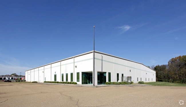
Property Detail
2030 Nw Progress Pky
0902-0010-003
BEG 654.5 FT W SE COR NE 1/4 SEC 6 N 259.9 FT NWLY 533.88 FT S 600 FT SELY 475.93 FT NELY 578.85 FT W 270 FT TO POB IN E 1/2 SEC 6 T6 R1E
Industrialgeneral
Hinds
AE The base floodplain where base flood elevations are provided. AE Zones are now used on new format FIRMs instead of A1-A30 Zones.
Mississippi
2024
8.27 AC
2025
North Jackson
010203
Jackson
50,716 SF
Jackson, MS
NEARBY LISTINGS FOR SALE OR LEASE
-
-
View all Jackson listings for sale on LoopNet.com
DEMOGRAPHICS near 2030 Nw Progress Pky
1 mile
3 mile
5 mile
2025 Total Population
32
9,792
54,843
2030 Population
32
9,207
53,352
Pop Growth 2025-2030
0.00%
(5.97%)
(2.72%)
Average Age
49
43
41
2025 Total Households
13
3,943
23,032
HH Growth 2025-2030
(7.69%)
(6.26%)
(2.96%)
Median Household Inc
$99,999
$51,172
$42,087
Avg Household Size
2.50
2.40
2.30
2025 Avg HH Vehicles
2.00
2.00
2.00
Median Home Value
$299,999
$143,786
$118,807
Median Year Built
1982
1973
1969
Nearby Places
Map Layers
Map Styles
 Street
 Aerial
Transit
 Traffic
 Biking
Places
Listings with unknown addresses are not visible on the map
- Restaurants
- Banks
- Shops
- Fitness
- Groceries
PUBLIC TRANSPORTATION
COMMUTER RAIL
Drive
Walk
Distance
20 min
8.6 mi
AIRPORT
Jackson-Medgar Wiley Evers International
Drive
Walk
Distance
Jackson-Medgar Wiley Evers International
34 min
17.7 mi
Nearby Properties
Address
Land Use
TOTAL SIZE
Lot Size
Zoning
Address
Land Use
TOTAL SIZE
Lot Size
Zoning
16,932 SF
41.60 AC
Address
Land Use
TOTAL SIZE
Lot Size
Zoning
105,600 SF
13 AC
Address
Land Use
TOTAL SIZE
Lot Size
Zoning
49,949 SF
10 AC
Address
Land Use
TOTAL SIZE
Lot Size
Zoning
57,234 SF
Address
Land Use
TOTAL SIZE
Lot Size
Zoning
310,650 SF
17 AC
Address
Land Use
TOTAL SIZE
Lot Size
Zoning
9,003 SF
1 AC
Address
Land Use
TOTAL SIZE
Lot Size
Zoning
139,497 SF
12 AC
Address
Land Use
TOTAL SIZE
Lot Size
Zoning
40,000 SF
63.11 AC
Address
Land Use
TOTAL SIZE
Lot Size
Zoning
562.15 AC
Address
Land Use
TOTAL SIZE
Lot Size
Zoning
38,142 SF
16.35 AC
Address
Land Use
TOTAL SIZE
Lot Size
Zoning
14,260 SF
3.05 AC
Address
Land Use
TOTAL SIZE
Lot Size
Zoning
89,064 SF
8.13 AC
Address
Land Use
TOTAL SIZE
Lot Size
Zoning
8,610 SF
2 AC
Address
Land Use
TOTAL SIZE
Lot Size
Zoning
61,865 SF
4 AC
Address
Land Use
TOTAL SIZE
Lot Size
Zoning
41 AC
Address
Land Use
TOTAL SIZE
Lot Size
Zoning
46,812 SF
Address
Land Use
TOTAL SIZE
Lot Size
Zoning
4,370 SF
70 AC
Address
Land Use
TOTAL SIZE
Lot Size
Zoning
96,367 SF
6.44 AC
Address
Land Use
TOTAL SIZE
Lot Size
Zoning
105,000 SF
10.80 AC
Address
Land Use
TOTAL SIZE
Lot Size
Zoning
4,495 SF
1 AC
Address
Land Use
TOTAL SIZE
Lot Size
Zoning
Address
Land Use
TOTAL SIZE
Lot Size
Zoning
8,090 SF
6.96 AC
Address
Land Use
TOTAL SIZE
Lot Size
Zoning
Address
Land Use
TOTAL SIZE
Lot Size
Zoning
141 AC
Address
Land Use
TOTAL SIZE
Lot Size
Zoning
23.89 AC
Address
Land Use
TOTAL SIZE
Lot Size
Zoning
13.02 AC
Address
Land Use
TOTAL SIZE
Lot Size
Zoning
74,955 SF
10.20 AC
Address
Land Use
TOTAL SIZE
Lot Size
Zoning
12,604 SF
0.50 AC
Address
Land Use
TOTAL SIZE
Lot Size
Zoning
86,391 SF
6.10 AC
Address
Land Use
TOTAL SIZE
Lot Size
Zoning
105,520 SF
11.74 AC
The World's #1 Commercial Real Estate Marketplace
Connect with us
© 2026 CoStar Group
The information above has been obtained from sources believed reliable. While we do not doubt its accuracy we have not verified it and make no guarantee, warranty or representation about it. It is your responsibility to independently confirm its accuracy and completeness. Any projections, opinions, assumptions, or estimates used are for example only and do not represent the current or future performance of the property. The value of this transaction to you depends on tax and other factors which should be evaluated by your tax, financial, and legal advisors. You and your advisors should conduct a careful, independent investigation of the property to determine to your satisfaction the suitability of the property for your needs.