Property Record
2030 Old Railroad Bed Rd, Harvest, AL 35749


NEARBY LISTINGS FOR SALE OR LEASE
Property Detail
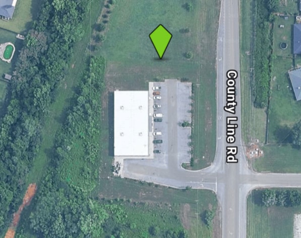
2030 Old Railroad Bed Rd
09-01-12-0-000-014.002
Heritage Estates Ph 3
Storebuilding
Limestone
X
Alabama
01083C0216G
tr 1
2025
2.23 AC
2024
Outlying Limestone County
010628
Huntsville
9,240 SF
Huntsville, AL
DEMOGRAPHICS near 2030 Old Railroad Bed Rd
1 Mile
3 Mile
5 Mile
2024 Total Population
5,848
30,264
80,279
2029 Population
6,402
33,123
87,227
Pop Growth 2024-2029
+ 9.47%
+ 9.45%
+ 8.65%
Average Age
40
40
40
2024 Total Households
2,161
11,434
29,211
HH Growth 2024-2029
+ 9.81%
+ 9.78%
+ 8.98%
Median Household Inc
$122,583
$107,934
$114,027
Avg Household Size
2.70
2.50
2.60
2024 Avg HH Vehicles
2.00
2.00
2.00
Median Home Value
$322,678
$319,439
$349,905
Median Year Built
2005
2004
2003
Nearby Places
Map Layers
Map Styles
 Street
 Aerial
- Restaurants
- Banks
- Shops
- Fitness
- Groceries
PUBLIC TRANSPORTATION
AIRPORT
Huntsville International-Carl T Jones Field
DRIVE
WALK
Distance
Huntsville International-Carl T Jones Field
27 min
12.8 mi
SALE & LEASE HISTORY
LISTING DATE
SALE/LEASE

Jan 12, 2017
For Lease
Nearby Properties
Address
Land Use
TOTAL SIZE
Lot Size
Zoning
Address
Land Use
TOTAL SIZE
Lot Size
Zoning
25,692 SF
11.77 AC
Address
Land Use
TOTAL SIZE
Lot Size
Zoning
7,055 SF
19 AC
Address
Land Use
TOTAL SIZE
Lot Size
Zoning
3,746 SF
22.08 AC
Address
Land Use
TOTAL SIZE
Lot Size
Zoning
8,868 SF
25 AC
Address
Land Use
TOTAL SIZE
Lot Size
Zoning
9,138 SF
27 AC
Address
Land Use
TOTAL SIZE
Lot Size
Zoning
8,468 SF
5.80 AC
Address
Land Use
TOTAL SIZE
Lot Size
Zoning
178,255 SF
19.39 AC
Address
Land Use
TOTAL SIZE
Lot Size
Zoning
28.40 AC
Address
Land Use
TOTAL SIZE
Lot Size
Zoning
57,905 SF
10.26 AC
Address
Land Use
TOTAL SIZE
Lot Size
Zoning
Address
Land Use
TOTAL SIZE
Lot Size
Zoning
48,200 SF
4.05 AC
Address
Land Use
TOTAL SIZE
Lot Size
Zoning
1,140 SF
11 AC
Address
Land Use
TOTAL SIZE
Lot Size
Zoning
1,554 SF
7.63 AC
Address
Land Use
TOTAL SIZE
Lot Size
Zoning
19,490 SF
2.98 AC
Address
Land Use
TOTAL SIZE
Lot Size
Zoning
1,680 SF
22 AC
Address
Land Use
TOTAL SIZE
Lot Size
Zoning
15.62 AC
Address
Land Use
TOTAL SIZE
Lot Size
Zoning
3.40 AC
Address
Land Use
TOTAL SIZE
Lot Size
Zoning
20,463 SF
4.50 AC
Address
Land Use
TOTAL SIZE
Lot Size
Zoning
15,030 SF
3.95 AC
Address
Land Use
TOTAL SIZE
Lot Size
Zoning
2,846 SF
Address
Land Use
TOTAL SIZE
Lot Size
Zoning
2,846 SF
Address
Land Use
TOTAL SIZE
Lot Size
Zoning
192 SF
6.95 AC
Address
Land Use
TOTAL SIZE
Lot Size
Zoning
24,015 SF
2.97 AC
Address
Land Use
TOTAL SIZE
Lot Size
Zoning
1,554 SF
6.73 AC
Address
Land Use
TOTAL SIZE
Lot Size
Zoning
Address
Land Use
TOTAL SIZE
Lot Size
Zoning
10,214 SF
1.21 AC
Address
Land Use
TOTAL SIZE
Lot Size
Zoning
17,475 SF
2.13 AC
Address
Land Use
TOTAL SIZE
Lot Size
Zoning
18,474 SF
3.51 AC
Address
Land Use
TOTAL SIZE
Lot Size
Zoning
27,258 SF
11.50 AC
Address
Land Use
TOTAL SIZE
Lot Size
Zoning
11,937 SF
2.20 AC
The World's #1 Commercial Real Estate Marketplace
Connect with us
© 2025 CoStar Group
The information above has been obtained from sources believed reliable. While we do not doubt its accuracy we have not verified it and make no guarantee, warranty or representation about it. It is your responsibility to independently confirm its accuracy and completeness. Any projections, opinions, assumptions, or estimates used are for example only and do not represent the current or future performance of the property. The value of this transaction to you depends on tax and other factors which should be evaluated by your tax, financial, and legal advisors. You and your advisors should conduct a careful, independent investigation of the property to determine to your satisfaction the suitability of the property for your needs.