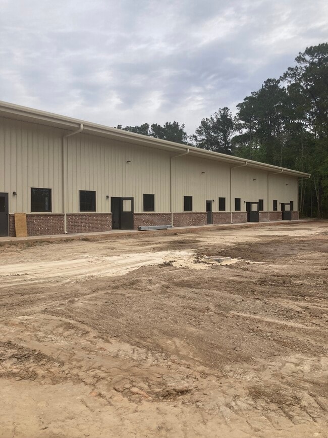
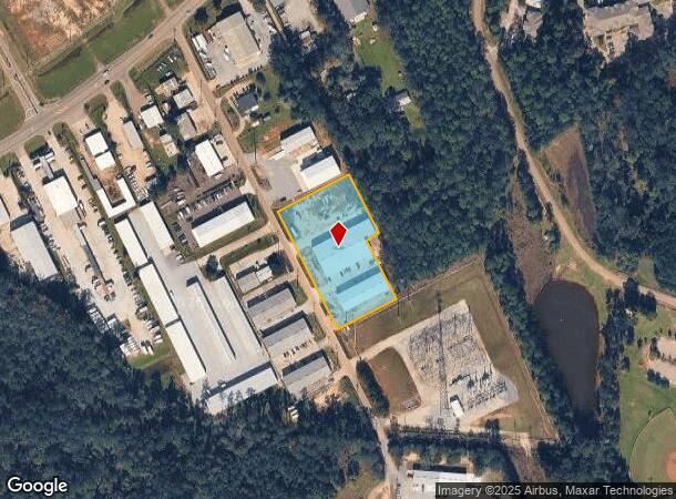
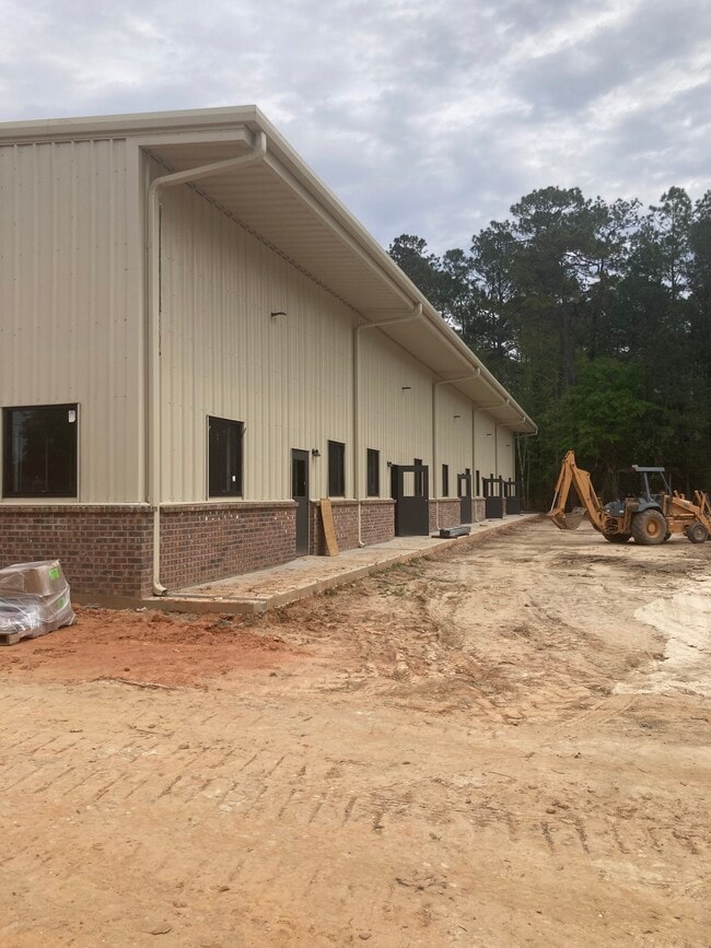
Property Record
2028 Phillip Dr, Covington, LA 70433
Current Lease Availabilities
Property Detail
2028 Phillip Dr
Slidell-Mandeville-Covington, LA
SWETT COMMERCIAL PARK BEING RESUB OF LOTS 4A 4B 5A 5B LT4A-1 PH1
21785
ST TAMMANY
Commercialnec
Louisiana
2025
4a
2025
2.03 AC
040501
Mandeville/Covington
16,445 SF
New Orleans/Metairie/Kenner
NEARBY LISTINGS FOR SALE OR LEASE
DEMOGRAPHICS near 2028 Phillip Dr
1 mile
3 mile
5 mile
2025 Total Population
5,167
23,039
58,987
2030 Population
5,357
24,010
61,220
Pop Growth 2025-2030
+ 3.68%
+ 4.21%
+ 3.79%
Average Age
38
41
41
2025 Total Households
1,926
9,150
23,567
HH Growth 2025-2030
+ 3.79%
+ 4.26%
+ 3.81%
Median Household Inc
$62,083
$75,013
$75,846
Avg Household Size
2.50
2.40
2.40
2025 Avg HH Vehicles
2.00
2.00
2.00
Median Home Value
$276,645
$332,187
$318,868
Median Year Built
1990
1997
2000
Nearby Places
Map Layers
Map Styles
 Street
 Aerial
Transit
 Traffic
 Biking
Places
Listings with unknown addresses are not visible on the map
- Restaurants
- Banks
- Shops
- Fitness
- Groceries
PUBLIC TRANSPORTATION
AIRPORT
Louis Armstrong New Orleans International
Drive
Walk
Distance
Louis Armstrong New Orleans International
60 min
44.3 mi
Freight Ports
Port of New Orleans
Drive
Walk
Distance
Port of New Orleans
65 min
45.3 mi
Nearby Properties
Address
Land Use
TOTAL SIZE
Lot Size
Zoning
Address
Land Use
TOTAL SIZE
Lot Size
Zoning
200,000 SF
0.28 AC
Address
Land Use
TOTAL SIZE
Lot Size
Zoning
Address
Land Use
TOTAL SIZE
Lot Size
Zoning
0.92 AC
Address
Land Use
TOTAL SIZE
Lot Size
Zoning
11.91 AC
Address
Land Use
TOTAL SIZE
Lot Size
Zoning
Address
Land Use
TOTAL SIZE
Lot Size
Zoning
246,559 SF
42.43 AC
Address
Land Use
TOTAL SIZE
Lot Size
Zoning
86,167 SF
0.71 AC
Address
Land Use
TOTAL SIZE
Lot Size
Zoning
99,157 SF
12 AC
Address
Land Use
TOTAL SIZE
Lot Size
Zoning
201,920 SF
1,056.50 AC
Address
Land Use
TOTAL SIZE
Lot Size
Zoning
171,138 SF
13.02 AC
Address
Land Use
TOTAL SIZE
Lot Size
Zoning
147,611 SF
22 AC
Address
Land Use
TOTAL SIZE
Lot Size
Zoning
38,976 SF
6.80 AC
Address
Land Use
TOTAL SIZE
Lot Size
Zoning
Address
Land Use
TOTAL SIZE
Lot Size
Zoning
62,800 SF
15 AC
Address
Land Use
TOTAL SIZE
Lot Size
Zoning
124,002 SF
20.55 AC
Address
Land Use
TOTAL SIZE
Lot Size
Zoning
50,819 SF
18.82 AC
Address
Land Use
TOTAL SIZE
Lot Size
Zoning
106,915 SF
20 AC
Address
Land Use
TOTAL SIZE
Lot Size
Zoning
Address
Land Use
TOTAL SIZE
Lot Size
Zoning
101,007 SF
6 AC
Address
Land Use
TOTAL SIZE
Lot Size
Zoning
97,331 SF
25.37 AC
Address
Land Use
TOTAL SIZE
Lot Size
Zoning
83,292 SF
6.27 AC
Address
Land Use
TOTAL SIZE
Lot Size
Zoning
Address
Land Use
TOTAL SIZE
Lot Size
Zoning
37,007 SF
0.06 AC
Address
Land Use
TOTAL SIZE
Lot Size
Zoning
46,823 SF
3.95 AC
Address
Land Use
TOTAL SIZE
Lot Size
Zoning
18,271 SF
1 AC
Address
Land Use
TOTAL SIZE
Lot Size
Zoning
88,560 SF
4.61 AC
Address
Land Use
TOTAL SIZE
Lot Size
Zoning
76,132 SF
10.92 AC
Address
Land Use
TOTAL SIZE
Lot Size
Zoning
41,762 SF
6.32 AC
Address
Land Use
TOTAL SIZE
Lot Size
Zoning
105,720 SF
6.49 AC
Address
Land Use
TOTAL SIZE
Lot Size
Zoning
58,141 SF
3.29 AC
The World's #1 Commercial Real Estate Marketplace
Connect with us
© 2026 CoStar Group
The information above has been obtained from sources believed reliable. While we do not doubt its accuracy we have not verified it and make no guarantee, warranty or representation about it. It is your responsibility to independently confirm its accuracy and completeness. Any projections, opinions, assumptions, or estimates used are for example only and do not represent the current or future performance of the property. The value of this transaction to you depends on tax and other factors which should be evaluated by your tax, financial, and legal advisors. You and your advisors should conduct a careful, independent investigation of the property to determine to your satisfaction the suitability of the property for your needs.