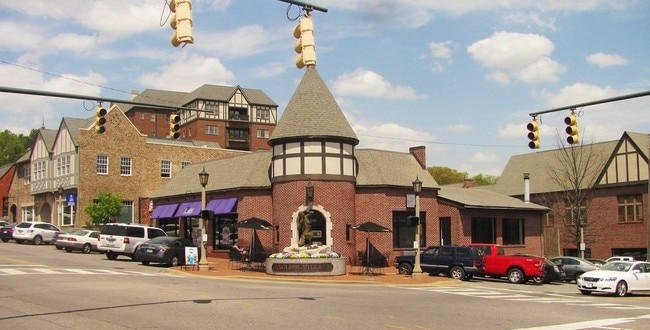
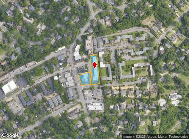
Property Record
2031 Cahaba Rd, Mountain Brk, AL 35223
NEARBY LISTINGS FOR SALE OR LEASE
Property Detail
2031 Cahaba Rd
Birmingham-Hoover, AL
Boulevard Rlty Co Res *
28-00-06-4-010-025.001
LOTS 1 2 & 7 BLK 1 THE ENGLISH VILLAGE EAST SECT 16/48 ALSO TRACT DESC AS: BEG SE COR LOT 7 TH N 310 FT TH E 25 FT TH S 310 FT TH SW 25 FT TO POB
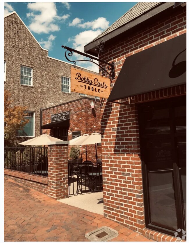
Restaurantbuilding
Jefferson
X
Alabama
01073C0557J
1
2023
0.32 AC
2024
Midtown
010801
Birmingham
21,318 SF
DEMOGRAPHICS near 2031 Cahaba Rd
1 Mile
3 Mile
5 Mile
2024 Total Population
11,896
76,230
178,472
2029 Population
11,731
75,405
177,084
Pop Growth 2024-2029
(1.39%)
(1.08%)
(0.78%)
Average Age
41
36
38
2024 Total Households
6,924
33,655
76,685
HH Growth 2024-2029
(1.37%)
(0.96%)
(0.69%)
Median Household Inc
$56,770
$59,344
$53,818
Avg Household Size
1.60
2.00
2.10
2024 Avg HH Vehicles
1.00
2.00
2.00
Median Home Value
$557,803
$452,316
$341,468
Median Year Built
1961
1966
1968
Nearby Places
Map Layers
Map Styles
 Street
 Aerial
- Restaurants
- Banks
- Shops
- Fitness
- Groceries
PUBLIC TRANSPORTATION
AIRPORT
Birmingham-Shuttlesworth International
DRIVE
WALK
Distance
Birmingham-Shuttlesworth International
12 min
8.0 mi
Freight Ports
Port of Mobile
DRIVE
WALK
Distance
Port of Mobile
1 min
207.0 mi
SALE & LEASE HISTORY
LISTING DATE
SALE/LEASE

Sep 25, 2016
For Lease
Nov 14, 2016
For Lease
Apr 30, 2019
For Lease
Nearby Properties
Address
Land Use
TOTAL SIZE
Lot Size
Zoning
Address
Land Use
TOTAL SIZE
Lot Size
Zoning
296,284 SF
12 AC
OI
Address
Land Use
TOTAL SIZE
Lot Size
Zoning
305,826 SF
3.68 AC
B4
Address
Land Use
TOTAL SIZE
Lot Size
Zoning
189,447 SF
3.67 AC
B4
Address
Land Use
TOTAL SIZE
Lot Size
Zoning
224,049 SF
4.33 AC
M1
Address
Land Use
TOTAL SIZE
Lot Size
Zoning
978,879 SF
43.50 AC
I3
Address
Land Use
TOTAL SIZE
Lot Size
Zoning
239,334 SF
4.42 AC
B6
Address
Land Use
TOTAL SIZE
Lot Size
Zoning
230,441 SF
10.22 AC
M1
Address
Land Use
TOTAL SIZE
Lot Size
Zoning
261,311 SF
20.85 AC
C1
Address
Land Use
TOTAL SIZE
Lot Size
Zoning
183,862 SF
9.66 AC
B4
Address
Land Use
TOTAL SIZE
Lot Size
Zoning
334,463 SF
1.92 AC
B4
Address
Land Use
TOTAL SIZE
Lot Size
Zoning
94,958 SF
4.47 AC
M1
Address
Land Use
TOTAL SIZE
Lot Size
Zoning
106,144 SF
1.09 AC
B4
Address
Land Use
TOTAL SIZE
Lot Size
Zoning
57,066 SF
0.80 AC
B4
Address
Land Use
TOTAL SIZE
Lot Size
Zoning
31,980 SF
99.92 AC
I3/P
Address
Land Use
TOTAL SIZE
Lot Size
Zoning
154,474 SF
12.50 AC
R-D
Address
Land Use
TOTAL SIZE
Lot Size
Zoning
79,458 SF
1.37 AC
B4
Address
Land Use
TOTAL SIZE
Lot Size
Zoning
46,161 SF
1.38 AC
M1-B
Address
Land Use
TOTAL SIZE
Lot Size
Zoning
95,993 SF
3.67 AC
M1
Address
Land Use
TOTAL SIZE
Lot Size
Zoning
229,669 SF
2.75 AC
B4
Address
Land Use
TOTAL SIZE
Lot Size
Zoning
200,927 SF
19 AC
PMUD
Address
Land Use
TOTAL SIZE
Lot Size
Zoning
81,807 SF
6.30 AC
C1
Address
Land Use
TOTAL SIZE
Lot Size
Zoning
109,411 SF
2.77 AC
B4
Address
Land Use
TOTAL SIZE
Lot Size
Zoning
1.66 AC
M1-B
Address
Land Use
TOTAL SIZE
Lot Size
Zoning
1,666 SF
1.69 AC
M1
Address
Land Use
TOTAL SIZE
Lot Size
Zoning
1.54 AC
B4
Address
Land Use
TOTAL SIZE
Lot Size
Zoning
29,136 SF
1.58 AC
B4
Address
Land Use
TOTAL SIZE
Lot Size
Zoning
37,733 SF
0.84 AC
B-4
Address
Land Use
TOTAL SIZE
Lot Size
Zoning
51,699 SF
1.31 AC
PCD-
Address
Land Use
TOTAL SIZE
Lot Size
Zoning
109,819 SF
2.91 AC
M2
Address
Land Use
TOTAL SIZE
Lot Size
Zoning
37,640 SF
1.76 AC
B4
The World's #1 Commercial Real Estate Marketplace
Connect with us
© 2025 CoStar Group
The information above has been obtained from sources believed reliable. While we do not doubt its accuracy we have not verified it and make no guarantee, warranty or representation about it. It is your responsibility to independently confirm its accuracy and completeness. Any projections, opinions, assumptions, or estimates used are for example only and do not represent the current or future performance of the property. The value of this transaction to you depends on tax and other factors which should be evaluated by your tax, financial, and legal advisors. You and your advisors should conduct a careful, independent investigation of the property to determine to your satisfaction the suitability of the property for your needs.