Property Record
2031 Cape Lacroix Rd, Cape Girardeau, MO 63701

NEARBY LISTINGS FOR SALE OR LEASE
Property Detail
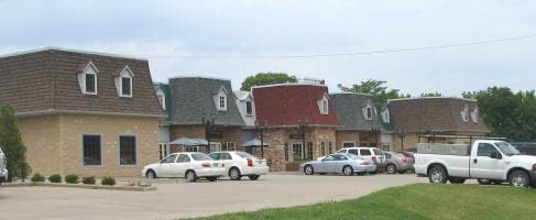
2031 Cape Lacroix Rd
Cape Girardeau, MO-IL
Commericaial Center Subdivsiion
15-617-00-02-00300-0000
LOTS 5-7 AMENDED ROUTE W COMMERCIAL CENTER 17/94
Commercialacreage
Cape Girardeau
AE
Missouri
29201C0025D
5-7
2025
2.67 AC
2025
Missouri South Area
881200
Other Market Areas
DEMOGRAPHICS near 2031 Cape Lacroix Rd
1 Mile
3 Mile
5 Mile
2024 Total Population
3,730
25,416
52,060
2029 Population
3,877
26,293
54,043
Pop Growth 2024-2029
+ 3.94%
+ 3.45%
+ 3.81%
Average Age
43
41
39
2024 Total Households
1,535
10,671
21,085
HH Growth 2024-2029
+ 4.17%
+ 3.55%
+ 4.00%
Median Household Inc
$80,788
$64,939
$55,546
Avg Household Size
2.30
2.30
2.30
2024 Avg HH Vehicles
2.00
2.00
2.00
Median Home Value
$203,226
$190,817
$182,360
Median Year Built
1986
1978
1977
Nearby Places
Map Layers
Map Styles
 Street
 Aerial
- Restaurants
- Banks
- Shops
- Fitness
- Groceries
SALE & LEASE HISTORY
LISTING DATE
SALE/LEASE

Jun 20, 2018
For Sale
Dec 09, 2019
For Sale
Aug 28, 2018
For Sale
Nearby Properties
Address
Land Use
TOTAL SIZE
Lot Size
Zoning
Address
Land Use
TOTAL SIZE
Lot Size
Zoning
31,076 SF
0.25 AC
Address
Land Use
TOTAL SIZE
Lot Size
Zoning
Address
Land Use
TOTAL SIZE
Lot Size
Zoning
2,037 SF
40.70 AC
Address
Land Use
TOTAL SIZE
Lot Size
Zoning
70.74 AC
Address
Land Use
TOTAL SIZE
Lot Size
Zoning
Address
Land Use
TOTAL SIZE
Lot Size
Zoning
22.60 AC
Address
Land Use
TOTAL SIZE
Lot Size
Zoning
10.77 AC
Address
Land Use
TOTAL SIZE
Lot Size
Zoning
Address
Land Use
TOTAL SIZE
Lot Size
Zoning
Address
Land Use
TOTAL SIZE
Lot Size
Zoning
Address
Land Use
TOTAL SIZE
Lot Size
Zoning
Address
Land Use
TOTAL SIZE
Lot Size
Zoning
5,544 SF
9.11 AC
Address
Land Use
TOTAL SIZE
Lot Size
Zoning
Address
Land Use
TOTAL SIZE
Lot Size
Zoning
6.43 AC
Address
Land Use
TOTAL SIZE
Lot Size
Zoning
Address
Land Use
TOTAL SIZE
Lot Size
Zoning
Address
Land Use
TOTAL SIZE
Lot Size
Zoning
Address
Land Use
TOTAL SIZE
Lot Size
Zoning
Address
Land Use
TOTAL SIZE
Lot Size
Zoning
Address
Land Use
TOTAL SIZE
Lot Size
Zoning
Address
Land Use
TOTAL SIZE
Lot Size
Zoning
Address
Land Use
TOTAL SIZE
Lot Size
Zoning
Address
Land Use
TOTAL SIZE
Lot Size
Zoning
Address
Land Use
TOTAL SIZE
Lot Size
Zoning
Address
Land Use
TOTAL SIZE
Lot Size
Zoning
Address
Land Use
TOTAL SIZE
Lot Size
Zoning
Address
Land Use
TOTAL SIZE
Lot Size
Zoning
14,112 SF
5.65 AC
Address
Land Use
TOTAL SIZE
Lot Size
Zoning
8,320 SF
12.70 AC
Address
Land Use
TOTAL SIZE
Lot Size
Zoning
Address
Land Use
TOTAL SIZE
Lot Size
Zoning
The World's #1 Commercial Real Estate Marketplace
Connect with us
© 2026 CoStar Group
The information above has been obtained from sources believed reliable. While we do not doubt its accuracy we have not verified it and make no guarantee, warranty or representation about it. It is your responsibility to independently confirm its accuracy and completeness. Any projections, opinions, assumptions, or estimates used are for example only and do not represent the current or future performance of the property. The value of this transaction to you depends on tax and other factors which should be evaluated by your tax, financial, and legal advisors. You and your advisors should conduct a careful, independent investigation of the property to determine to your satisfaction the suitability of the property for your needs.