Property Record
2031 Oglesby Pl, Macon, GA 31204

NEARBY LISTINGS FOR SALE OR LEASE
Property Detail
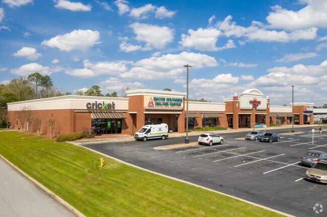
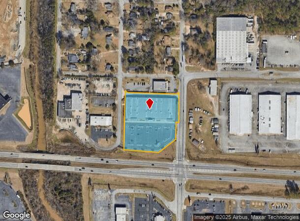
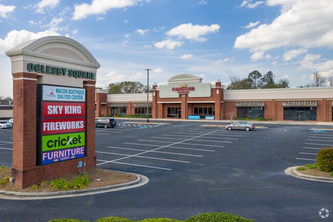
2031 Oglesby Pl
Macon-Bibb County, GA
Oglesby Place
N084-0141
OGLESBY PLACE
Stripcommercialcenter
Bibb
X
Georgia
13021C0133G
156
2025
3.04 AC
2025
Suburban Macon
014000
Atlanta
47,333 SF
DEMOGRAPHICS near 2031 Oglesby Pl
1 Mile
3 Mile
5 Mile
2024 Total Population
4,557
59,718
89,125
2029 Population
4,521
59,948
89,096
Pop Growth 2024-2029
(0.79%)
+ 0.39%
(0.03%)
Average Age
37
36
37
2024 Total Households
1,758
22,852
35,615
HH Growth 2024-2029
(0.63%)
+ 0.49%
(0.01%)
Median Household Inc
$35,221
$31,646
$38,841
Avg Household Size
2.40
2.40
2.30
2024 Avg HH Vehicles
1.00
1.00
1.00
Median Home Value
$82,671
$80,570
$124,260
Median Year Built
1966
1965
1967
Nearby Places
Map Layers
Map Styles
 Street
 Aerial
- Restaurants
- Banks
- Shops
- Fitness
- Groceries
SALE & LEASE HISTORY
LISTING DATE
SALE/LEASE

Sep 25, 2016
For Lease
Sep 24, 2016
For Sale
Oct 24, 2017
For Lease
Oct 19, 2017
For Lease
Oct 06, 2016
For Sale
Apr 12, 2017
For Sale
Nearby Properties
Address
Land Use
TOTAL SIZE
Lot Size
Zoning
Address
Land Use
TOTAL SIZE
Lot Size
Zoning
17,812 SF
161.34 AC
A/C-4
Address
Land Use
TOTAL SIZE
Lot Size
Zoning
63,394 SF
5.30 AC
M-1/R-3
Address
Land Use
TOTAL SIZE
Lot Size
Zoning
181,396 SF
44.77 AC
R-1A
Address
Land Use
TOTAL SIZE
Lot Size
Zoning
18,900 SF
25.25 AC
C-2
Address
Land Use
TOTAL SIZE
Lot Size
Zoning
199,096 SF
22.03 AC
R-2
Address
Land Use
TOTAL SIZE
Lot Size
Zoning
1,428 SF
64.46 AC
R-1A
Address
Land Use
TOTAL SIZE
Lot Size
Zoning
86,912 SF
5.39 AC
PDE
Address
Land Use
TOTAL SIZE
Lot Size
Zoning
89,814 SF
16.60 AC
R-1A
Address
Land Use
TOTAL SIZE
Lot Size
Zoning
98,928 SF
12.32 AC
R-3
Address
Land Use
TOTAL SIZE
Lot Size
Zoning
85,556 SF
10.50 AC
R-1A
Address
Land Use
TOTAL SIZE
Lot Size
Zoning
110,153 SF
22 AC
R-2
Address
Land Use
TOTAL SIZE
Lot Size
Zoning
46,288 SF
1.80 AC
PDE
Address
Land Use
TOTAL SIZE
Lot Size
Zoning
3,268 SF
9.29 AC
R-3
Address
Land Use
TOTAL SIZE
Lot Size
Zoning
33,248 SF
10.18 AC
R-3
Address
Land Use
TOTAL SIZE
Lot Size
Zoning
202,057 SF
33.05 AC
C-4
Address
Land Use
TOTAL SIZE
Lot Size
Zoning
40,560 SF
19.20 AC
R-2
Address
Land Use
TOTAL SIZE
Lot Size
Zoning
119,564 SF
3.89 AC
R-3
Address
Land Use
TOTAL SIZE
Lot Size
Zoning
96,512 SF
11.30 AC
PDE
Address
Land Use
TOTAL SIZE
Lot Size
Zoning
58,730 SF
3.42 AC
R-3
Address
Land Use
TOTAL SIZE
Lot Size
Zoning
3,860 SF
22 AC
PDE
Address
Land Use
TOTAL SIZE
Lot Size
Zoning
46,174 SF
9.67 AC
R-2
Address
Land Use
TOTAL SIZE
Lot Size
Zoning
6,560 SF
17 AC
PDE
Address
Land Use
TOTAL SIZE
Lot Size
Zoning
133,862 SF
25.44 AC
C-2
Address
Land Use
TOTAL SIZE
Lot Size
Zoning
69,184 SF
12.67 AC
C-2
Address
Land Use
TOTAL SIZE
Lot Size
Zoning
8,480 SF
7.92 AC
HPD-BH
Address
Land Use
TOTAL SIZE
Lot Size
Zoning
143,280 SF
5.06 AC
HR-3
Address
Land Use
TOTAL SIZE
Lot Size
Zoning
108,418 SF
24.45 AC
R-1A
Address
Land Use
TOTAL SIZE
Lot Size
Zoning
30,096 SF
6.63 AC
PDR
Address
Land Use
TOTAL SIZE
Lot Size
Zoning
105,247 SF
12.27 AC
C-2
Address
Land Use
TOTAL SIZE
Lot Size
Zoning
44,323 SF
2.76 AC
PDE
The World's #1 Commercial Real Estate Marketplace
Connect with us
© 2026 CoStar Group
The information above has been obtained from sources believed reliable. While we do not doubt its accuracy we have not verified it and make no guarantee, warranty or representation about it. It is your responsibility to independently confirm its accuracy and completeness. Any projections, opinions, assumptions, or estimates used are for example only and do not represent the current or future performance of the property. The value of this transaction to you depends on tax and other factors which should be evaluated by your tax, financial, and legal advisors. You and your advisors should conduct a careful, independent investigation of the property to determine to your satisfaction the suitability of the property for your needs.