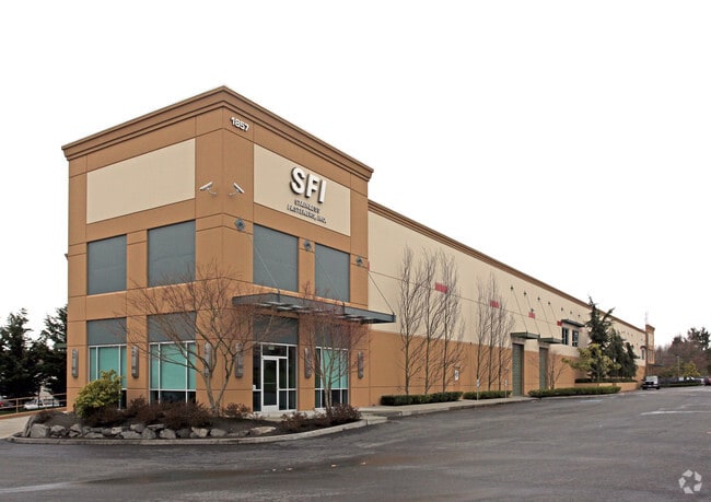
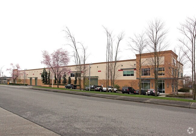
Property Record
2031 S 216Th St, Des Moines, WA 98198
NEARBY LISTINGS FOR SALE OR LEASE
Property Detail
2031 S 216Th St
Seattle-Tacoma-Bellevue, WA
ELY 198 FT OF NE QTR NW QTR SW QTR STR 09-22-04 EXC THAT PORTION ACQUIRED FOR SR-509 AS DESCRIBED IN RECORDING NO 7207200376; EXC N 30 FT FOR COUNTY ROAD (S 216TH ST); EXC N 20 FT THEREOF CONVEYED TO CITY OF DES MOINES BY DEED UNDER RECORDING NO 9807
092204-9077
King
Uspostalservice
Washington
X
92204
53033C0966G
2.67 AC
2025
SeaTac/Burien
2024
Seattle/Puget Sound
028901
DEMOGRAPHICS near 2031 S 216Th St
1 Mile
3 Mile
5 Mile
2024 Total Population
15,647
79,838
190,449
2029 Population
15,836
80,193
191,970
Pop Growth 2024-2029
+ 1.21%
+ 0.44%
+ 0.80%
Average Age
38
39
39
2024 Total Households
5,599
29,533
70,553
HH Growth 2024-2029
+ 0.95%
+ 0.22%
+ 0.66%
Median Household Inc
$59,182
$76,292
$76,068
Avg Household Size
2.60
2.60
2.60
2024 Avg HH Vehicles
2.00
2.00
2.00
Median Home Value
$481,045
$471,667
$503,038
Median Year Built
1976
1977
1979
Nearby Places
Map Layers
Map Styles
 Street
 Aerial
- Restaurants
- Banks
- Shops
- Fitness
- Groceries
PUBLIC TRANSPORTATION
COMMUTER RAIL
Kent Station (Sounder South Line - Central Puget Sound Regional Transit Authority Rail (Link Light Rail/Sounder))
DRIVE
WALK
Distance
Kent Station (Sounder South Line - Central Puget Sound Regional Transit Authority Rail (Link Light Rail/Sounder))
10 min
5.6 mi
Kent Station (Seattle - Tacoma/Lakewood - Sound Transit)
DRIVE
WALK
Distance
Kent Station (Seattle - Tacoma/Lakewood - Sound Transit)
10 min
5.6 mi
AIRPORT
Seattle-Tacoma International
DRIVE
WALK
Distance
Seattle-Tacoma International
11 min
4.4 mi
Freight Ports
Port of Tacoma
DRIVE
WALK
Distance
Port of Tacoma
24 min
17.3 mi
SALE & LEASE HISTORY
LISTING DATE
SALE/LEASE

Jul 08, 2024
For Lease
Nearby Properties
Address
Land Use
TOTAL SIZE
Lot Size
Zoning
Address
Land Use
TOTAL SIZE
Lot Size
Zoning
830,533 SF
43.51 AC
I1
Address
Land Use
TOTAL SIZE
Lot Size
Zoning
342,484 SF
58.76 AC
I2
Address
Land Use
TOTAL SIZE
Lot Size
Zoning
213,468 SF
23.67 AC
CB-C
Address
Land Use
TOTAL SIZE
Lot Size
Zoning
358,292 SF
18.98 AC
I-C
Address
Land Use
TOTAL SIZE
Lot Size
Zoning
298,150 SF
9.17 AC
CB-C
Address
Land Use
TOTAL SIZE
Lot Size
Zoning
435,187 SF
31.48 AC
I2
Address
Land Use
TOTAL SIZE
Lot Size
Zoning
297,018 SF
11.48 AC
MCR
Address
Land Use
TOTAL SIZE
Lot Size
Zoning
458,197 SF
23.83 AC
I2
Address
Land Use
TOTAL SIZE
Lot Size
Zoning
436,880 SF
25.62 AC
AVC
Address
Land Use
TOTAL SIZE
Lot Size
Zoning
313,384 SF
16.85 AC
MR-G
Address
Land Use
TOTAL SIZE
Lot Size
Zoning
324,480 SF
17.24 AC
MR-M
Address
Land Use
TOTAL SIZE
Lot Size
Zoning
130,200 SF
9.55 AC
CB-C
Address
Land Use
TOTAL SIZE
Lot Size
Zoning
245,078 SF
6.32 AC
MCR
Address
Land Use
TOTAL SIZE
Lot Size
Zoning
434,002 SF
19.74 AC
I2
Address
Land Use
TOTAL SIZE
Lot Size
Zoning
15,856 SF
19.64 AC
I1
Address
Land Use
TOTAL SIZE
Lot Size
Zoning
398,364 SF
19.83 AC
I2
Address
Land Use
TOTAL SIZE
Lot Size
Zoning
268,432 SF
17.93 AC
MR-G
Address
Land Use
TOTAL SIZE
Lot Size
Zoning
348,445 SF
14.93 AC
B-P
Address
Land Use
TOTAL SIZE
Lot Size
Zoning
341,900 SF
20.12 AC
I1
Address
Land Use
TOTAL SIZE
Lot Size
Zoning
250,500 SF
21.57 AC
MR-M
Address
Land Use
TOTAL SIZE
Lot Size
Zoning
324,839 SF
15.80 AC
HI
Address
Land Use
TOTAL SIZE
Lot Size
Zoning
156,248 SF
15.64 AC
R-SE
Address
Land Use
TOTAL SIZE
Lot Size
Zoning
59,300 SF
15.28 AC
I1
Address
Land Use
TOTAL SIZE
Lot Size
Zoning
79,120 SF
15.73 AC
I1
Address
Land Use
TOTAL SIZE
Lot Size
Zoning
318,150 SF
16.12 AC
I2
Address
Land Use
TOTAL SIZE
Lot Size
Zoning
299,975 SF
11.26 AC
PR-C
Address
Land Use
TOTAL SIZE
Lot Size
Zoning
252,222 SF
16.45 AC
MR-G
Address
Land Use
TOTAL SIZE
Lot Size
Zoning
226,771 SF
14.95 AC
CB-C
Address
Land Use
TOTAL SIZE
Lot Size
Zoning
178,400 SF
15.20 AC
I1
The World's #1 Commercial Real Estate Marketplace
Connect with us
© 2025 CoStar Group
The information above has been obtained from sources believed reliable. While we do not doubt its accuracy we have not verified it and make no guarantee, warranty or representation about it. It is your responsibility to independently confirm its accuracy and completeness. Any projections, opinions, assumptions, or estimates used are for example only and do not represent the current or future performance of the property. The value of this transaction to you depends on tax and other factors which should be evaluated by your tax, financial, and legal advisors. You and your advisors should conduct a careful, independent investigation of the property to determine to your satisfaction the suitability of the property for your needs.