Property Record
20310 State Highway 181, Fairhope, AL 36532


NEARBY LISTINGS FOR SALE OR LEASE
Property Detail
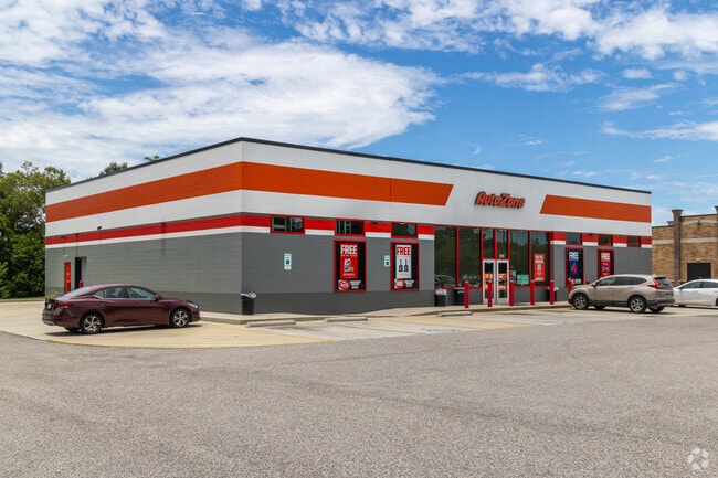
20310 State Highway 181
Daphne-Fairhope-Foley, AL
East Fairhope Plaza
46-06-14-0-000-001.982
411.2' X 248.9' IRR LOT 4 EAST FAIRHOPE PLAZA SUB SLIDE 2416 -F SEC 14-T6S-R2E (SP-WBOS) LEASE IN#1672027 AFF IN#1704165
Storebuilding
Baldwin
X
Alabama
01003C0663M
4
2024
2.53 AC
2024
Baldwin County
011104
Mobile
6,840 SF
DEMOGRAPHICS near 20310 State Highway 181
1 Mile
3 Mile
5 Mile
2024 Total Population
3,745
19,197
39,975
2029 Population
4,288
21,987
45,878
Pop Growth 2024-2029
+ 14.50%
+ 14.53%
+ 14.77%
Average Age
43
43
42
2024 Total Households
1,459
7,572
15,513
HH Growth 2024-2029
+ 14.05%
+ 14.13%
+ 14.42%
Median Household Inc
$85,639
$75,260
$78,339
Avg Household Size
2.50
2.40
2.50
2024 Avg HH Vehicles
2.00
2.00
2.00
Median Home Value
$276,152
$294,980
$317,536
Median Year Built
2003
2000
2000
Nearby Places
Map Layers
Map Styles
 Street
 Aerial
- Restaurants
- Banks
- Shops
- Fitness
- Groceries
PUBLIC TRANSPORTATION
AIRPORT
Mobile International
DRIVE
WALK
Distance
Mobile International
38 min
26.5 mi
Mobile Regional
DRIVE
WALK
Distance
Mobile Regional
60 min
40.1 mi
Freight Ports
Port of Mobile
DRIVE
WALK
Distance
Port of Mobile
32 min
23.1 mi
SALE & LEASE HISTORY
LISTING DATE
SALE/LEASE

Mar 05, 2024
For Sale
Nearby Properties
Address
Land Use
TOTAL SIZE
Lot Size
Zoning
Address
Land Use
TOTAL SIZE
Lot Size
Zoning
51,485 SF
7.90 AC
Address
Land Use
TOTAL SIZE
Lot Size
Zoning
1,273 SF
9.50 AC
Address
Land Use
TOTAL SIZE
Lot Size
Zoning
222,358 SF
51 AC
Address
Land Use
TOTAL SIZE
Lot Size
Zoning
74,683 SF
22 AC
Address
Land Use
TOTAL SIZE
Lot Size
Zoning
71,523 SF
20 AC
Address
Land Use
TOTAL SIZE
Lot Size
Zoning
53,038 SF
12 AC
Address
Land Use
TOTAL SIZE
Lot Size
Zoning
64,884 SF
22 AC
Address
Land Use
TOTAL SIZE
Lot Size
Zoning
5,762 SF
10 AC
Address
Land Use
TOTAL SIZE
Lot Size
Zoning
Address
Land Use
TOTAL SIZE
Lot Size
Zoning
2.76 AC
Address
Land Use
TOTAL SIZE
Lot Size
Zoning
8,196 SF
7.30 AC
Address
Land Use
TOTAL SIZE
Lot Size
Zoning
37,212 SF
5.10 AC
Address
Land Use
TOTAL SIZE
Lot Size
Zoning
34,370 SF
0.92 AC
Address
Land Use
TOTAL SIZE
Lot Size
Zoning
14,188 SF
5.20 AC
Address
Land Use
TOTAL SIZE
Lot Size
Zoning
473 SF
9.90 AC
Address
Land Use
TOTAL SIZE
Lot Size
Zoning
51,000 SF
14 AC
Address
Land Use
TOTAL SIZE
Lot Size
Zoning
90,403 SF
12 AC
Address
Land Use
TOTAL SIZE
Lot Size
Zoning
36 AC
Address
Land Use
TOTAL SIZE
Lot Size
Zoning
28,686 SF
0.30 AC
Address
Land Use
TOTAL SIZE
Lot Size
Zoning
9,123 SF
5.20 AC
Address
Land Use
TOTAL SIZE
Lot Size
Zoning
45,591 SF
4.30 AC
Address
Land Use
TOTAL SIZE
Lot Size
Zoning
7,539 SF
12 AC
Address
Land Use
TOTAL SIZE
Lot Size
Zoning
2.69 AC
Address
Land Use
TOTAL SIZE
Lot Size
Zoning
79,053 SF
4 AC
Address
Land Use
TOTAL SIZE
Lot Size
Zoning
22,806 SF
3.22 AC
Address
Land Use
TOTAL SIZE
Lot Size
Zoning
12,994 SF
1.45 AC
Address
Land Use
TOTAL SIZE
Lot Size
Zoning
9,840 SF
4.60 AC
Address
Land Use
TOTAL SIZE
Lot Size
Zoning
14,120 SF
Address
Land Use
TOTAL SIZE
Lot Size
Zoning
2,353 SF
61 AC
Address
Land Use
TOTAL SIZE
Lot Size
Zoning
11,000 SF
6.20 AC
The World's #1 Commercial Real Estate Marketplace
Connect with us
© 2026 CoStar Group
The information above has been obtained from sources believed reliable. While we do not doubt its accuracy we have not verified it and make no guarantee, warranty or representation about it. It is your responsibility to independently confirm its accuracy and completeness. Any projections, opinions, assumptions, or estimates used are for example only and do not represent the current or future performance of the property. The value of this transaction to you depends on tax and other factors which should be evaluated by your tax, financial, and legal advisors. You and your advisors should conduct a careful, independent investigation of the property to determine to your satisfaction the suitability of the property for your needs.