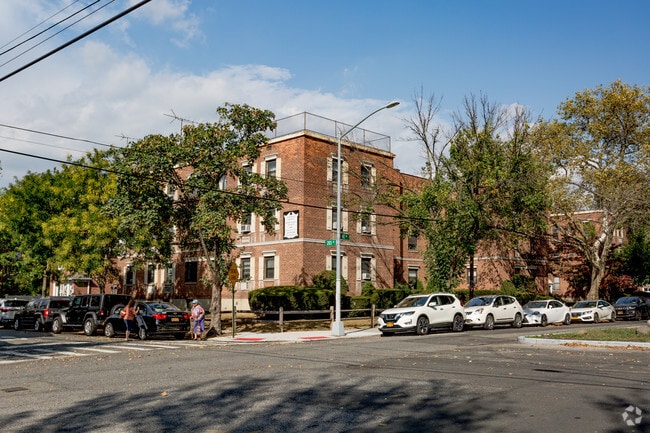
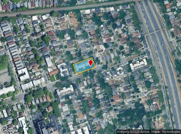
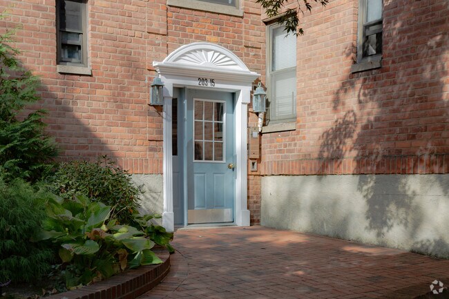
Property Record
20315 42Nd Ave, Bayside, NY 11361
NEARBY LISTINGS FOR SALE OR LEASE
Property Detail
20315 42Nd Ave
06206-0001
Bayside
Apartment
Queens
X
New York
3604970119F
1
2024
0.46 AC
2025
Auburndale
146300
Long Island (New York)
20,400 SF
New York-Jersey City-White Plains, NY-NJ
DEMOGRAPHICS near 20315 42Nd Ave
1 Mile
3 Mile
5 Mile
2024 Total Population
53,224
431,075
1,176,654
2029 Population
49,436
405,808
1,105,329
Pop Growth 2024-2029
(7.12%)
(5.86%)
(6.06%)
Average Age
44
44
42
2024 Total Households
18,870
154,954
405,238
HH Growth 2024-2029
(7.60%)
(6.23%)
(6.19%)
Median Household Inc
$86,634
$69,643
$75,173
Avg Household Size
2.70
2.70
2.80
2024 Avg HH Vehicles
1.00
1.00
1.00
Median Home Value
$818,610
$727,377
$694,112
Median Year Built
1951
1956
1954
Nearby Places
- Restaurants
- Banks
- Shops
- Fitness
- Groceries
PUBLIC TRANSPORTATION
COMMUTER RAIL
Auburndale Station (Port Washington Branch - Long Island Rail Road)
DRIVE
WALK
Distance
Auburndale Station (Port Washington Branch - Long Island Rail Road)
2 min
11 min
0.6 mi
Bayside Station (Port Washington Branch - Long Island Rail Road)
DRIVE
WALK
Distance
Bayside Station (Port Washington Branch - Long Island Rail Road)
3 min
16 min
0.8 mi
AIRPORT
LaGuardia
DRIVE
WALK
Distance
LaGuardia
14 min
6.1 mi
John F Kennedy International
DRIVE
WALK
Distance
John F Kennedy International
18 min
11.8 mi
Newark Liberty International
DRIVE
WALK
Distance
Newark Liberty International
40 min
32.6 mi
Freight Ports
NY - Red Hook Container Terminal
DRIVE
WALK
Distance
NY - Red Hook Container Terminal
26 min
16.4 mi
Nearby Properties
Address
Land Use
TOTAL SIZE
Lot Size
Zoning
Address
Land Use
TOTAL SIZE
Lot Size
Zoning
2,697,663 SF
3.46 AC
C5-3
Address
Land Use
TOTAL SIZE
Lot Size
Zoning
1,666,696 SF
1.87 AC
C52.5
Address
Land Use
TOTAL SIZE
Lot Size
Zoning
7,975 SF
133 AC
PARK
Address
Land Use
TOTAL SIZE
Lot Size
Zoning
4,528,000 SF
94.27 AC
R4
Address
Land Use
TOTAL SIZE
Lot Size
Zoning
2,078,606 SF
58.93 AC
R4
Address
Land Use
TOTAL SIZE
Lot Size
Zoning
878,386 SF
20.55 AC
R4
Address
Land Use
TOTAL SIZE
Lot Size
Zoning
800 SF
104.61 AC
PARK
Address
Land Use
TOTAL SIZE
Lot Size
Zoning
13,500 SF
104 AC
PARK
Address
Land Use
TOTAL SIZE
Lot Size
Zoning
421,996 SF
136.05 AC
R3-1
Address
Land Use
TOTAL SIZE
Lot Size
Zoning
4,050 SF
113.40 AC
PARK
Address
Land Use
TOTAL SIZE
Lot Size
Zoning
947 SF
101.82 AC
PARK
Address
Land Use
TOTAL SIZE
Lot Size
Zoning
4,800 SF
80.10 AC
PARK
Address
Land Use
TOTAL SIZE
Lot Size
Zoning
1,186,778 SF
31.45 AC
R4
Address
Land Use
TOTAL SIZE
Lot Size
Zoning
448,500 SF
22.59 AC
R3-2
Address
Land Use
TOTAL SIZE
Lot Size
Zoning
577,654 SF
5.38 AC
R6
Address
Land Use
TOTAL SIZE
Lot Size
Zoning
636,219 SF
11.39 AC
R3-2
Address
Land Use
TOTAL SIZE
Lot Size
Zoning
82.92 AC
PARK
Address
Land Use
TOTAL SIZE
Lot Size
Zoning
900 SF
86.35 AC
PARK
Address
Land Use
TOTAL SIZE
Lot Size
Zoning
521,944 SF
16.68 AC
R4
Address
Land Use
TOTAL SIZE
Lot Size
Zoning
511,684 SF
13.09 AC
R4
Address
Land Use
TOTAL SIZE
Lot Size
Zoning
377,896 SF
11.36 AC
R3-2
Address
Land Use
TOTAL SIZE
Lot Size
Zoning
198,298 SF
13.93 AC
C4-1
Address
Land Use
TOTAL SIZE
Lot Size
Zoning
186,843 SF
5.37 AC
R2A
Address
Land Use
TOTAL SIZE
Lot Size
Zoning
1,800 SF
54.60 AC
PARK
Address
Land Use
TOTAL SIZE
Lot Size
Zoning
281,416 SF
2.57 AC
C4-2
Address
Land Use
TOTAL SIZE
Lot Size
Zoning
201,770 SF
7.09 AC
R3-2
Address
Land Use
TOTAL SIZE
Lot Size
Zoning
268,500 SF
27.50 AC
R4
Address
Land Use
TOTAL SIZE
Lot Size
Zoning
382,302 SF
6.23 AC
R2A
Address
Land Use
TOTAL SIZE
Lot Size
Zoning
614,916 SF
28.10 AC
R4
Address
Land Use
TOTAL SIZE
Lot Size
Zoning
32,000 SF
50 AC
PARK
The World's #1 Commercial Real Estate Marketplace
Connect with us
© 2025 CoStar Group
The information above has been obtained from sources believed reliable. While we do not doubt its accuracy we have not verified it and make no guarantee, warranty or representation about it. It is your responsibility to independently confirm its accuracy and completeness. Any projections, opinions, assumptions, or estimates used are for example only and do not represent the current or future performance of the property. The value of this transaction to you depends on tax and other factors which should be evaluated by your tax, financial, and legal advisors. You and your advisors should conduct a careful, independent investigation of the property to determine to your satisfaction the suitability of the property for your needs.