Property Record
2032 Highland Ave E, Twin Falls, ID 83301

Property Detail
2032 Highland Ave E
RPT2481001004BA
TWIN FALLS HIGHLAND VIEW TRACT LOT 4, EXC N 337 OF W 104 BLOCK 1 (22-10-17 NE)
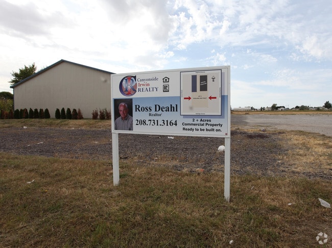
Warehouse
Twin Falls
M-2
Idaho
B and X Area of moderate flood hazard, usually the area between the limits of the 100-year and 500-year floods.
4
2025
4.05 AC
2025
Idaho South Area
001002
Other Market Areas
21,100 SF
Twin Falls, ID
NEARBY LISTINGS FOR SALE OR LEASE
DEMOGRAPHICS near 2032 Highland Ave E
1 mile
3 mile
5 mile
2025 Total Population
4,462
45,736
70,512
2030 Population
4,662
48,126
74,468
Pop Growth 2025-2030
+ 4.48%
+ 5.23%
+ 5.61%
Average Age
35
38
38
2025 Total Households
1,753
17,250
25,760
HH Growth 2025-2030
+ 4.56%
+ 5.32%
+ 5.70%
Median Household Inc
$58,146
$63,453
$67,268
Avg Household Size
2.50
2.60
2.60
2025 Avg HH Vehicles
2.00
2.00
2.00
Median Home Value
$283,443
$317,362
$332,092
Median Year Built
1978
1979
1987
Nearby Places
Map Layers
Map Styles
 Street
 Aerial
Transit
 Traffic
 Biking
Places
Listings with unknown addresses are not visible on the map
- Restaurants
- Banks
- Shops
- Fitness
- Groceries
SALE & LEASE HISTORY
LISTING DATE
SALE/LEASE

Jul 23, 2018
For Lease
Nearby Properties
Address
Land Use
TOTAL SIZE
Lot Size
Zoning
Address
Land Use
TOTAL SIZE
Lot Size
Zoning
917,616 SF
143.88 AC
M-2
Address
Land Use
TOTAL SIZE
Lot Size
Zoning
259,424 SF
89.44 AC
M-2
Address
Land Use
TOTAL SIZE
Lot Size
Zoning
6,384 SF
5.89 AC
M-2
Address
Land Use
TOTAL SIZE
Lot Size
Zoning
382,261 SF
11.44 AC
M-2
Address
Land Use
TOTAL SIZE
Lot Size
Zoning
57,683 SF
36.64 AC
Address
Land Use
TOTAL SIZE
Lot Size
Zoning
167,708 SF
14.90 AC
C-1
Address
Land Use
TOTAL SIZE
Lot Size
Zoning
137,048 SF
12.66 AC
C-1
Address
Land Use
TOTAL SIZE
Lot Size
Zoning
240,740 SF
6.74 AC
M-2
Address
Land Use
TOTAL SIZE
Lot Size
Zoning
9,440 SF
7.05 AC
R-6
Address
Land Use
TOTAL SIZE
Lot Size
Zoning
127,520 SF
16.82 AC
M-2
Address
Land Use
TOTAL SIZE
Lot Size
Zoning
40,730 SF
0.36 AC
O-T
Address
Land Use
TOTAL SIZE
Lot Size
Zoning
78,849 SF
18.66 AC
M-2
Address
Land Use
TOTAL SIZE
Lot Size
Zoning
29,988 SF
3.80 AC
Address
Land Use
TOTAL SIZE
Lot Size
Zoning
233,304 SF
6.01 AC
M-2
Address
Land Use
TOTAL SIZE
Lot Size
Zoning
94,366 SF
9.85 AC
M-2
Address
Land Use
TOTAL SIZE
Lot Size
Zoning
52,095 SF
0.22 AC
C-B
Address
Land Use
TOTAL SIZE
Lot Size
Zoning
88,314 SF
8.15 AC
C-1
Address
Land Use
TOTAL SIZE
Lot Size
Zoning
53,953 SF
3.98 AC
R-6
Address
Land Use
TOTAL SIZE
Lot Size
Zoning
46,122 SF
6.37 AC
R-6
Address
Land Use
TOTAL SIZE
Lot Size
Zoning
10,536 SF
3.07 AC
C-1
Address
Land Use
TOTAL SIZE
Lot Size
Zoning
74,375 SF
3.02 AC
M-2
Address
Land Use
TOTAL SIZE
Lot Size
Zoning
36,192 SF
0.34 AC
C-B
Address
Land Use
TOTAL SIZE
Lot Size
Zoning
157,403 SF
14.69 AC
M-1
Address
Land Use
TOTAL SIZE
Lot Size
Zoning
24,612 SF
4.70 AC
C-1
Address
Land Use
TOTAL SIZE
Lot Size
Zoning
52,068 SF
0.86 AC
R-4
Address
Land Use
TOTAL SIZE
Lot Size
Zoning
14,913 SF
104.49 AC
M-2
Address
Land Use
TOTAL SIZE
Lot Size
Zoning
45,252 SF
2.30 AC
C-1
Address
Land Use
TOTAL SIZE
Lot Size
Zoning
7,062 SF
3.62 AC
R-4
Address
Land Use
TOTAL SIZE
Lot Size
Zoning
19,286 SF
10.10 AC
C-1
The World's #1 Commercial Real Estate Marketplace
Connect with us
© 2026 CoStar Group
The information above has been obtained from sources believed reliable. While we do not doubt its accuracy we have not verified it and make no guarantee, warranty or representation about it. It is your responsibility to independently confirm its accuracy and completeness. Any projections, opinions, assumptions, or estimates used are for example only and do not represent the current or future performance of the property. The value of this transaction to you depends on tax and other factors which should be evaluated by your tax, financial, and legal advisors. You and your advisors should conduct a careful, independent investigation of the property to determine to your satisfaction the suitability of the property for your needs.