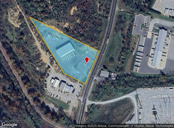
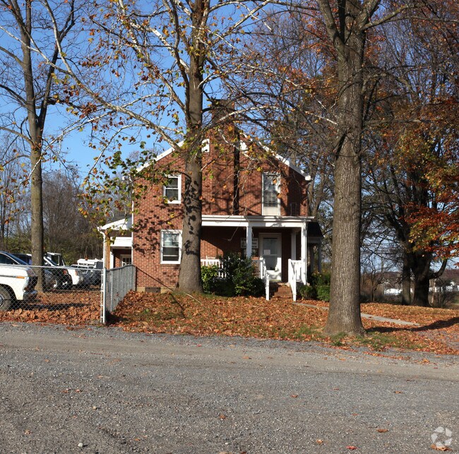
Property Record
2033 Lee Hwy, Cloverdale, VA 24077

NEARBY LISTINGS FOR SALE OR LEASE
Property Detail
2033 Lee Hwy
101-147
CLOVERDALE
Commercialnec
Botetourt
X
Virginia
51023C0369C
4.89 AC
2024
Botetourt County
2025
Roanoke
040402
Roanoke, VA
DEMOGRAPHICS near 2033 Lee Hwy
1 Mile
3 Mile
5 Mile
2024 Total Population
906
12,467
46,204
2029 Population
934
12,854
46,775
Pop Growth 2024-2029
+ 3.09%
+ 3.10%
+ 1.24%
Average Age
41
44
44
2024 Total Households
358
4,902
18,823
HH Growth 2024-2029
+ 2.79%
+ 3.14%
+ 1.18%
Median Household Inc
$56,477
$83,498
$73,259
Avg Household Size
2.30
2.40
2.30
2024 Avg HH Vehicles
2.00
2.00
2.00
Median Home Value
$203,261
$293,538
$243,031
Median Year Built
1973
1989
1979
Nearby Places
Map Layers
Map Styles
 Street
 Aerial
- Restaurants
- Banks
- Shops
- Fitness
- Groceries
PUBLIC TRANSPORTATION
COMMUTER RAIL
Roanoke (Northeast Regional - Amtrak)
DRIVE
WALK
Distance
Roanoke (Northeast Regional - Amtrak)
16 min
9.7 mi
AIRPORT
Roanoke/Blacksburg Regional (Woodrum Field)
DRIVE
WALK
Distance
Roanoke/Blacksburg Regional (Woodrum Field)
13 min
6.7 mi
Freight Ports
Virginia Port Authority - Richmond
DRIVE
WALK
Distance
Virginia Port Authority - Richmond
206 min
182.9 mi
Nearby Properties
Address
Land Use
TOTAL SIZE
Lot Size
Zoning
Address
Land Use
TOTAL SIZE
Lot Size
Zoning
5,957.14 AC
FC
Address
Land Use
TOTAL SIZE
Lot Size
Zoning
4,284 SF
17.86 AC
R3
Address
Land Use
TOTAL SIZE
Lot Size
Zoning
26 AC
R-1
Address
Land Use
TOTAL SIZE
Lot Size
Zoning
9.31 AC
B-1
Address
Land Use
TOTAL SIZE
Lot Size
Zoning
40.12 AC
M-1
Address
Land Use
TOTAL SIZE
Lot Size
Zoning
4.24 AC
Address
Land Use
TOTAL SIZE
Lot Size
Zoning
40.04 AC
M-2
Address
Land Use
TOTAL SIZE
Lot Size
Zoning
22.52 AC
R-1
Address
Land Use
TOTAL SIZE
Lot Size
Zoning
36.98 AC
M-1
Address
Land Use
TOTAL SIZE
Lot Size
Zoning
6.47 AC
A1
Address
Land Use
TOTAL SIZE
Lot Size
Zoning
2.56 AC
Address
Land Use
TOTAL SIZE
Lot Size
Zoning
51,532 SF
4.01 AC
Address
Land Use
TOTAL SIZE
Lot Size
Zoning
35,004 SF
5.07 AC
SCD
Address
Land Use
TOTAL SIZE
Lot Size
Zoning
9.98 AC
A1
Address
Land Use
TOTAL SIZE
Lot Size
Zoning
9.14 AC
M-2
Address
Land Use
TOTAL SIZE
Lot Size
Zoning
Address
Land Use
TOTAL SIZE
Lot Size
Zoning
14.27 AC
SCD
Address
Land Use
TOTAL SIZE
Lot Size
Zoning
6 AC
SCD
Address
Land Use
TOTAL SIZE
Lot Size
Zoning
4 AC
B-2
Address
Land Use
TOTAL SIZE
Lot Size
Zoning
275,553 SF
23.30 AC
I1
Address
Land Use
TOTAL SIZE
Lot Size
Zoning
8.24 AC
SCD
Address
Land Use
TOTAL SIZE
Lot Size
Zoning
12.20 AC
4
Address
Land Use
TOTAL SIZE
Lot Size
Zoning
Address
Land Use
TOTAL SIZE
Lot Size
Zoning
2.90 AC
A1
Address
Land Use
TOTAL SIZE
Lot Size
Zoning
16.94 AC
M-1
Address
Land Use
TOTAL SIZE
Lot Size
Zoning
10 AC
R-1
Address
Land Use
TOTAL SIZE
Lot Size
Zoning
4.57 AC
SCD
Address
Land Use
TOTAL SIZE
Lot Size
Zoning
18.97 AC
M-2
Address
Land Use
TOTAL SIZE
Lot Size
Zoning
4.43 AC
M-2
Address
Land Use
TOTAL SIZE
Lot Size
Zoning
20 AC
M-3
The World's #1 Commercial Real Estate Marketplace
Connect with us
© 2025 CoStar Group
The information above has been obtained from sources believed reliable. While we do not doubt its accuracy we have not verified it and make no guarantee, warranty or representation about it. It is your responsibility to independently confirm its accuracy and completeness. Any projections, opinions, assumptions, or estimates used are for example only and do not represent the current or future performance of the property. The value of this transaction to you depends on tax and other factors which should be evaluated by your tax, financial, and legal advisors. You and your advisors should conduct a careful, independent investigation of the property to determine to your satisfaction the suitability of the property for your needs.