Property Record
2035 W Northwest Blvd, Spokane, WA 99205


Save to a Folder
{{folder.Name}}
{{folder.ListingIds.length}} Properties
{{folder.ListingIds.length}} Property
Create a New Folder
Property Detail
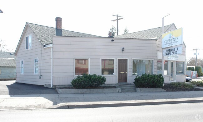
2035 W Northwest Blvd
25121.3607
PORTION OF LOT 9
Storebuilding
Spokane
CB
Washington
B and X Area of moderate flood hazard, usually the area between the limits of the 100-year and 500-year floods.
9
2026
0.08 AC
2026
SW North Metro
002100
Spokane
2,256 SF
Spokane-Spokane Valley, WA
NEARBY LISTINGS FOR SALE OR LEASE
DEMOGRAPHICS near 2035 W Northwest Blvd
1 mile
3 mile
5 mile
2025 Total Population
15,132
111,736
221,205
2030 Population
15,236
113,364
224,837
Pop Growth 2025-2030
+ 0.69%
+ 1.46%
+ 1.64%
Average Age
39
39
39
2025 Total Households
6,171
47,571
91,561
HH Growth 2025-2030
+ 0.70%
+ 1.75%
+ 1.81%
Median Household Inc
$65,390
$60,432
$65,730
Avg Household Size
2.40
2.20
2.30
2025 Avg HH Vehicles
2.00
2.00
2.00
Median Home Value
$350,732
$334,571
$369,486
Median Year Built
1947
1953
1961
Nearby Places
Map Layers
Map Styles
 Street
 Aerial
Layers
 Traffic
 Biking
Places
Listings with unknown addresses are not visible on the map
- Restaurants
- Banks
- Shops
- Fitness
- Groceries
PUBLIC TRANSPORTATION
COMMUTER RAIL
Spokane (Empire Builder - Amtrak)
Drive
Walk
Distance
Spokane (Empire Builder - Amtrak)
7 min
2.9 mi
AIRPORT
Spokane International
Drive
Walk
Distance
Spokane International
14 min
7.5 mi
Freight Ports
Port of Everett
Drive
Walk
Distance
Port of Everett
342 min
303.1 mi
Nearby Properties
Address
Land Use
TOTAL SIZE
Lot Size
Zoning
Address
Land Use
TOTAL SIZE
Lot Size
Zoning
763,627 SF
12.44 AC
OR
Address
Land Use
TOTAL SIZE
Lot Size
Zoning
851,943 SF
119.79 AC
Address
Land Use
TOTAL SIZE
Lot Size
Zoning
481,348 SF
17.09 AC
DTU
Address
Land Use
TOTAL SIZE
Lot Size
Zoning
624,552 SF
26.28 AC
RHD
Address
Land Use
TOTAL SIZE
Lot Size
Zoning
241,106 SF
3.92 AC
CB
Address
Land Use
TOTAL SIZE
Lot Size
Zoning
157,882 SF
42.70 AC
DTG
Address
Land Use
TOTAL SIZE
Lot Size
Zoning
123,047 SF
3.95 AC
DTG
Address
Land Use
TOTAL SIZE
Lot Size
Zoning
536,438 SF
1.70 AC
DTC
Address
Land Use
TOTAL SIZE
Lot Size
Zoning
530,527 SF
17.11 AC
CC2
Address
Land Use
TOTAL SIZE
Lot Size
Zoning
171,479 SF
67.30 AC
RSF
Address
Land Use
TOTAL SIZE
Lot Size
Zoning
468,006 SF
22.81 AC
RSF
Address
Land Use
TOTAL SIZE
Lot Size
Zoning
154,800 SF
20.06 AC
DTG
Address
Land Use
TOTAL SIZE
Lot Size
Zoning
180,822 SF
16.11 AC
CC1
Address
Land Use
TOTAL SIZE
Lot Size
Zoning
151,667 SF
7.45 AC
DTG
Address
Land Use
TOTAL SIZE
Lot Size
Zoning
141,264 SF
16.74 AC
RSF
Address
Land Use
TOTAL SIZE
Lot Size
Zoning
107,800 SF
3.20 AC
CB
Address
Land Use
TOTAL SIZE
Lot Size
Zoning
379,678 SF
20.64 AC
LI
Address
Land Use
TOTAL SIZE
Lot Size
Zoning
91,882 SF
2.07 AC
OR
Address
Land Use
TOTAL SIZE
Lot Size
Zoning
46,255 SF
2.06 AC
DTG
Address
Land Use
TOTAL SIZE
Lot Size
Zoning
112,634 SF
3.87 AC
OR
Address
Land Use
TOTAL SIZE
Lot Size
Zoning
289,705 SF
3.36 AC
OR
Address
Land Use
TOTAL SIZE
Lot Size
Zoning
50,869 SF
0.61 AC
DTC
Address
Land Use
TOTAL SIZE
Lot Size
Zoning
229,541 SF
5.32 AC
RHD
Address
Land Use
TOTAL SIZE
Lot Size
Zoning
290,380 SF
2.11 AC
CA3
Address
Land Use
TOTAL SIZE
Lot Size
Zoning
107,240 SF
1.54 AC
CC1
Address
Land Use
TOTAL SIZE
Lot Size
Zoning
295,569 SF
15.45 AC
RHD
Address
Land Use
TOTAL SIZE
Lot Size
Zoning
135,640 SF
17.31 AC
GC
Address
Land Use
TOTAL SIZE
Lot Size
Zoning
182,088 SF
0.37 AC
DTC
Address
Land Use
TOTAL SIZE
Lot Size
Zoning
1,572,216 SF
23.12 AC
GC
Address
Land Use
TOTAL SIZE
Lot Size
Zoning
159,508 SF
18.52 AC
RSF
The World's #1 Commercial Real Estate Marketplace
Connect with us
© 2026 CoStar Group
The information above has been obtained from sources believed reliable. While we do not doubt its accuracy we have not verified it and make no guarantee, warranty or representation about it. It is your responsibility to independently confirm its accuracy and completeness. Any projections, opinions, assumptions, or estimates used are for example only and do not represent the current or future performance of the property. The value of this transaction to you depends on tax and other factors which should be evaluated by your tax, financial, and legal advisors. You and your advisors should conduct a careful, independent investigation of the property to determine to your satisfaction the suitability of the property for your needs.