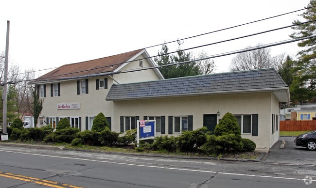
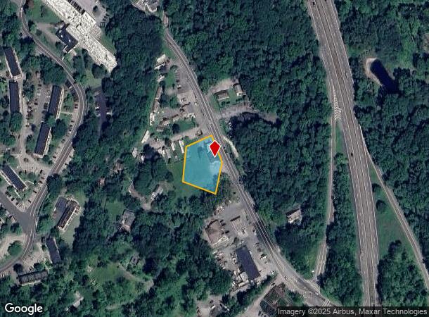
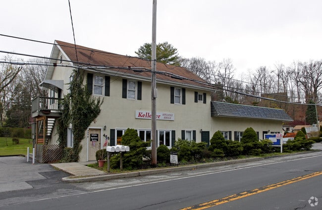
Property Record
2036 Albany Post Rd, Croton On Hudson, NY 10520
NEARBY LISTINGS FOR SALE OR LEASE
Property Detail
2036 Albany Post Rd
New York-Jersey City-White Plains, NY-NJ
17.06A-000-004 ADDNL 27X138 468
2289-055-018-00001-000-0011
Westchester
Commercialbuilding
New York
X
11.000
36119C0106F
0.65 AC
2025
Northwest
2024
Westchester/So Connecticut
014605
DEMOGRAPHICS near 2036 Albany Post Rd
1 Mile
3 Mile
5 Mile
2024 Total Population
5,253
22,631
97,279
2029 Population
5,142
22,106
95,240
Pop Growth 2024-2029
(2.11%)
(2.32%)
(2.10%)
Average Age
51
45
42
2024 Total Households
2,086
8,409
34,768
HH Growth 2024-2029
(3.12%)
(2.72%)
(2.29%)
Median Household Inc
$85,388
$131,781
$101,060
Avg Household Size
2.00
2.50
2.70
2024 Avg HH Vehicles
2.00
2.00
2.00
Median Home Value
$579,749
$586,352
$439,225
Median Year Built
1970
1963
1965
Nearby Places
- Restaurants
- Banks
- Shops
- Fitness
- Groceries
PUBLIC TRANSPORTATION
COMMUTER RAIL
Cortlandt Station (Hudson Line - Metro-North Commuter Railroad Company (Metro-North))
DRIVE
WALK
Distance
Cortlandt Station (Hudson Line - Metro-North Commuter Railroad Company (Metro-North))
3 min
1.3 mi
Croton-Harmon Station (Hudson Line - Metro-North Commuter Railroad Company (Metro-North))
DRIVE
WALK
Distance
Croton-Harmon Station (Hudson Line - Metro-North Commuter Railroad Company (Metro-North))
6 min
3.8 mi
AIRPORT
Westchester County
DRIVE
WALK
Distance
Westchester County
36 min
22.4 mi
New York Stewart International
DRIVE
WALK
Distance
New York Stewart International
48 min
28.5 mi
Freight Ports
NY - Red Hook Container Terminal
DRIVE
WALK
Distance
NY - Red Hook Container Terminal
73 min
49.3 mi
Nearby Properties
Address
Land Use
TOTAL SIZE
Lot Size
Zoning
Address
Land Use
TOTAL SIZE
Lot Size
Zoning
188.01 AC
Address
Land Use
TOTAL SIZE
Lot Size
Zoning
Address
Land Use
TOTAL SIZE
Lot Size
Zoning
74.84 AC
Address
Land Use
TOTAL SIZE
Lot Size
Zoning
49.60 AC
963
Address
Land Use
TOTAL SIZE
Lot Size
Zoning
28,357 SF
0.01 AC
963
Address
Land Use
TOTAL SIZE
Lot Size
Zoning
4.80 AC
RW
Address
Land Use
TOTAL SIZE
Lot Size
Zoning
13.80 AC
Address
Land Use
TOTAL SIZE
Lot Size
Zoning
Address
Land Use
TOTAL SIZE
Lot Size
Zoning
Address
Land Use
TOTAL SIZE
Lot Size
Zoning
Address
Land Use
TOTAL SIZE
Lot Size
Zoning
Address
Land Use
TOTAL SIZE
Lot Size
Zoning
410,221 SF
33.49 AC
LI
Address
Land Use
TOTAL SIZE
Lot Size
Zoning
26.80 AC
Address
Land Use
TOTAL SIZE
Lot Size
Zoning
655.36 AC
Address
Land Use
TOTAL SIZE
Lot Size
Zoning
8.75 AC
Address
Land Use
TOTAL SIZE
Lot Size
Zoning
143.43 AC
Address
Land Use
TOTAL SIZE
Lot Size
Zoning
9.90 AC
963
Address
Land Use
TOTAL SIZE
Lot Size
Zoning
16.91 AC
Address
Land Use
TOTAL SIZE
Lot Size
Zoning
5.90 AC
Address
Land Use
TOTAL SIZE
Lot Size
Zoning
4,312 SF
1.53 AC
R-2A
Address
Land Use
TOTAL SIZE
Lot Size
Zoning
Address
Land Use
TOTAL SIZE
Lot Size
Zoning
22.50 AC
Address
Land Use
TOTAL SIZE
Lot Size
Zoning
Address
Land Use
TOTAL SIZE
Lot Size
Zoning
Address
Land Use
TOTAL SIZE
Lot Size
Zoning
5.39 AC
Address
Land Use
TOTAL SIZE
Lot Size
Zoning
Address
Land Use
TOTAL SIZE
Lot Size
Zoning
12.81 AC
Address
Land Use
TOTAL SIZE
Lot Size
Zoning
7,920 SF
2.90 AC
WP
Address
Land Use
TOTAL SIZE
Lot Size
Zoning
12.50 AC
Address
Land Use
TOTAL SIZE
Lot Size
Zoning
The World's #1 Commercial Real Estate Marketplace
Connect with us
© 2025 CoStar Group
The information above has been obtained from sources believed reliable. While we do not doubt its accuracy we have not verified it and make no guarantee, warranty or representation about it. It is your responsibility to independently confirm its accuracy and completeness. Any projections, opinions, assumptions, or estimates used are for example only and do not represent the current or future performance of the property. The value of this transaction to you depends on tax and other factors which should be evaluated by your tax, financial, and legal advisors. You and your advisors should conduct a careful, independent investigation of the property to determine to your satisfaction the suitability of the property for your needs.