Property Record
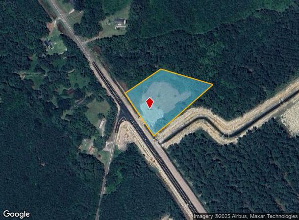
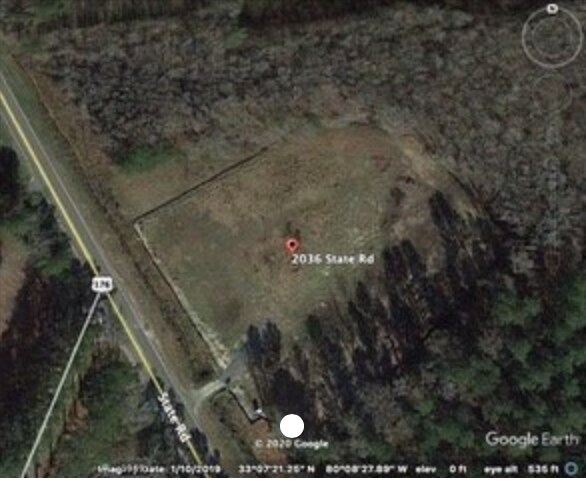
2036 State Rd, Summerville, SC 29486
NEARBY LISTINGS FOR SALE OR LEASE
Property Detail
2036 State Rd
Charleston-North Charleston, SC
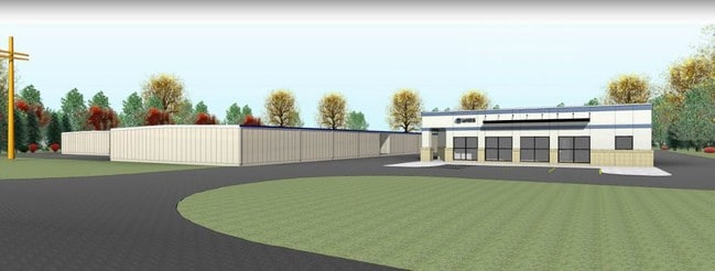
Commercial On 176
178-00-01-048
LOT 2
Vacantlandnec
Berkeley
X
South Carolina
45015C0560E
2
2025
2.97 AC
2025
Outlying Berkeley County
020711
Charleston/N Charleston
DEMOGRAPHICS near 2036 State Rd
1 Mile
3 Mile
5 Mile
2024 Total Population
1,986
22,445
41,387
2029 Population
2,418
27,084
49,833
Pop Growth 2024-2029
+ 21.75%
+ 20.67%
+ 20.41%
Average Age
37
39
39
2024 Total Households
679
7,797
14,770
HH Growth 2024-2029
+ 21.65%
+ 20.52%
+ 20.37%
Median Household Inc
$93,465
$92,065
$87,172
Avg Household Size
2.90
2.80
2.80
2024 Avg HH Vehicles
2.00
2.00
2.00
Median Home Value
$346,902
$336,500
$325,697
Median Year Built
2011
2011
2010
Nearby Places
Map Layers
Map Styles
 Street
 Aerial
- Restaurants
- Banks
- Shops
- Fitness
- Groceries
PUBLIC TRANSPORTATION
AIRPORT
Charleston AFB/International
DRIVE
WALK
Distance
Charleston AFB/International
34 min
21.3 mi
Freight Ports
North Charleston Terminal
DRIVE
WALK
Distance
North Charleston Terminal
28 min
19.6 mi
SALE & LEASE HISTORY
LISTING DATE
SALE/LEASE

Jan 09, 2020
For Sale
Apr 06, 2020
For Sale
Nearby Properties
Address
Land Use
TOTAL SIZE
Lot Size
Zoning
Address
Land Use
TOTAL SIZE
Lot Size
Zoning
22,554 SF
25.20 AC
BERKELEY C
Address
Land Use
TOTAL SIZE
Lot Size
Zoning
5,027 SF
18.19 AC
BERKELEY C
Address
Land Use
TOTAL SIZE
Lot Size
Zoning
45,600 SF
13 AC
BERKELEY C
Address
Land Use
TOTAL SIZE
Lot Size
Zoning
44.90 AC
BERKELEY C
Address
Land Use
TOTAL SIZE
Lot Size
Zoning
40.07 AC
BERKELEY C
Address
Land Use
TOTAL SIZE
Lot Size
Zoning
54,009 SF
6.67 AC
BERKELEY C
Address
Land Use
TOTAL SIZE
Lot Size
Zoning
7,536 SF
3.16 AC
BERKELEY C
Address
Land Use
TOTAL SIZE
Lot Size
Zoning
10,979 SF
4.88 AC
BERKELEY C
Address
Land Use
TOTAL SIZE
Lot Size
Zoning
47,342 SF
13.42 AC
BERKELEY C
Address
Land Use
TOTAL SIZE
Lot Size
Zoning
47,744 SF
36.40 AC
BERKELEY C
Address
Land Use
TOTAL SIZE
Lot Size
Zoning
7.05 AC
BERKELEY C
Address
Land Use
TOTAL SIZE
Lot Size
Zoning
15.62 AC
BERKELEY C
Address
Land Use
TOTAL SIZE
Lot Size
Zoning
21.03 AC
BERKELEY C
Address
Land Use
TOTAL SIZE
Lot Size
Zoning
18.31 AC
BERKELEY C
Address
Land Use
TOTAL SIZE
Lot Size
Zoning
1,484 SF
25.33 AC
BERKELEY C
Address
Land Use
TOTAL SIZE
Lot Size
Zoning
46.59 AC
BERKELEY C
Address
Land Use
TOTAL SIZE
Lot Size
Zoning
31.06 AC
BERKELEY C
Address
Land Use
TOTAL SIZE
Lot Size
Zoning
15.58 AC
BERKELEY C
Address
Land Use
TOTAL SIZE
Lot Size
Zoning
6,240 SF
1.02 AC
BERKELEY C
Address
Land Use
TOTAL SIZE
Lot Size
Zoning
5,391 SF
1.62 AC
BERKELEY C
Address
Land Use
TOTAL SIZE
Lot Size
Zoning
12.06 AC
BERKELEY C
Address
Land Use
TOTAL SIZE
Lot Size
Zoning
11,597 SF
1.98 AC
BERKELEY C
Address
Land Use
TOTAL SIZE
Lot Size
Zoning
17,046 SF
1.97 AC
BERKELEY C
Address
Land Use
TOTAL SIZE
Lot Size
Zoning
4,545 SF
1.31 AC
BERKELEY C
Address
Land Use
TOTAL SIZE
Lot Size
Zoning
4,606 SF
1.47 AC
BERKELEY C
Address
Land Use
TOTAL SIZE
Lot Size
Zoning
5,114 SF
1.35 AC
BERKELEY C
Address
Land Use
TOTAL SIZE
Lot Size
Zoning
7,225 SF
1.25 AC
BERKELEY C
Address
Land Use
TOTAL SIZE
Lot Size
Zoning
10,640 SF
1.42 AC
BERKELEY C
Address
Land Use
TOTAL SIZE
Lot Size
Zoning
7,587 SF
3.64 AC
BERKELEY C
The World's #1 Commercial Real Estate Marketplace
Connect with us
© 2026 CoStar Group
The information above has been obtained from sources believed reliable. While we do not doubt its accuracy we have not verified it and make no guarantee, warranty or representation about it. It is your responsibility to independently confirm its accuracy and completeness. Any projections, opinions, assumptions, or estimates used are for example only and do not represent the current or future performance of the property. The value of this transaction to you depends on tax and other factors which should be evaluated by your tax, financial, and legal advisors. You and your advisors should conduct a careful, independent investigation of the property to determine to your satisfaction the suitability of the property for your needs.