Property Record
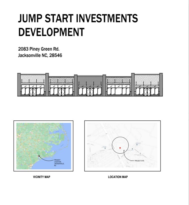
2038 Piney Green Rd, Jacksonville, NC 28546


NEARBY LISTINGS FOR SALE OR LEASE
Property Detail
2038 Piney Green Rd
Jacksonville, NC
Pla
017423
L1 JE THOMAS DIV
Communitycenter
Onslow
X
North Carolina
3720530600J
1
2025
0.98 AC
2025
North Carolina Southeast Area
002100
Other Market Areas
6,572 SF
DEMOGRAPHICS near 2038 Piney Green Rd
1 Mile
3 Mile
5 Mile
2024 Total Population
4,918
31,547
54,036
2029 Population
5,228
33,544
57,240
Pop Growth 2024-2029
+ 6.30%
+ 6.33%
+ 5.93%
Average Age
31
31
31
2024 Total Households
1,848
11,897
19,089
HH Growth 2024-2029
+ 6.44%
+ 6.40%
+ 6.24%
Median Household Inc
$59,207
$51,486
$51,816
Avg Household Size
2.60
2.60
2.60
2024 Avg HH Vehicles
2.00
2.00
2.00
Median Home Value
$170,165
$168,542
$168,441
Median Year Built
1993
1994
1993
Nearby Places
Map Layers
Map Styles
 Street
 Aerial
- Restaurants
- Banks
- Shops
- Fitness
- Groceries
PUBLIC TRANSPORTATION
AIRPORT
Albert J Ellis
DRIVE
WALK
Distance
Albert J Ellis
41 min
23.1 mi
Coastal Carolina Regional
DRIVE
WALK
Distance
Coastal Carolina Regional
63 min
43.9 mi
SALE & LEASE HISTORY
LISTING DATE
SALE/LEASE

May 15, 2024
For Lease
Nearby Properties
Address
Land Use
TOTAL SIZE
Lot Size
Zoning
Address
Land Use
TOTAL SIZE
Lot Size
Zoning
40,838 SF
48.30 AC
O-I
Address
Land Use
TOTAL SIZE
Lot Size
Zoning
10,631 SF
8.77 AC
RMF-HD
Address
Land Use
TOTAL SIZE
Lot Size
Zoning
3,369 SF
79.40 AC
RMF-LD
Address
Land Use
TOTAL SIZE
Lot Size
Zoning
78,855 SF
40.49 AC
R-5
Address
Land Use
TOTAL SIZE
Lot Size
Zoning
7,740 SF
16.50 AC
RMF-LD
Address
Land Use
TOTAL SIZE
Lot Size
Zoning
12,745 SF
30 AC
R-5
Address
Land Use
TOTAL SIZE
Lot Size
Zoning
1,584 SF
61.32 AC
PDR
Address
Land Use
TOTAL SIZE
Lot Size
Zoning
30,942 SF
9.15 AC
RMF-HD
Address
Land Use
TOTAL SIZE
Lot Size
Zoning
42,180 SF
4.23 AC
CC
Address
Land Use
TOTAL SIZE
Lot Size
Zoning
46,502 SF
11.03 AC
CC
Address
Land Use
TOTAL SIZE
Lot Size
Zoning
85,530 SF
4.43 AC
CC
Address
Land Use
TOTAL SIZE
Lot Size
Zoning
4,200 SF
19.96 AC
R-10
Address
Land Use
TOTAL SIZE
Lot Size
Zoning
24,232 SF
8.06 AC
CC
Address
Land Use
TOTAL SIZE
Lot Size
Zoning
12,348 SF
3.57 AC
OI
Address
Land Use
TOTAL SIZE
Lot Size
Zoning
51,105 SF
7.86 AC
OI
Address
Land Use
TOTAL SIZE
Lot Size
Zoning
4,040 SF
13.48 AC
HB
Address
Land Use
TOTAL SIZE
Lot Size
Zoning
5,598 SF
4 AC
RMF-HD
Address
Land Use
TOTAL SIZE
Lot Size
Zoning
4,448 SF
7.98 AC
RMF-LD
Address
Land Use
TOTAL SIZE
Lot Size
Zoning
37,144 SF
7.27 AC
CC
Address
Land Use
TOTAL SIZE
Lot Size
Zoning
7,312 SF
8.13 AC
RMF-HD
Address
Land Use
TOTAL SIZE
Lot Size
Zoning
5,040 SF
12.08 AC
RSF-7
Address
Land Use
TOTAL SIZE
Lot Size
Zoning
43,884 SF
4.91 AC
RMF-HD
Address
Land Use
TOTAL SIZE
Lot Size
Zoning
17,732 SF
2.85 AC
CC
Address
Land Use
TOTAL SIZE
Lot Size
Zoning
2,968 SF
3.95 AC
RMF-HD
Address
Land Use
TOTAL SIZE
Lot Size
Zoning
1,856 SF
5 AC
CC
Address
Land Use
TOTAL SIZE
Lot Size
Zoning
23,872 SF
4.20 AC
OI
Address
Land Use
TOTAL SIZE
Lot Size
Zoning
44,346 SF
1.87 AC
CC
Address
Land Use
TOTAL SIZE
Lot Size
Zoning
10,500 SF
12 AC
HB
Address
Land Use
TOTAL SIZE
Lot Size
Zoning
536 SF
3.99 AC
RMF-HD
Address
Land Use
TOTAL SIZE
Lot Size
Zoning
2,560 SF
3.91 AC
RMF-HD
The World's #1 Commercial Real Estate Marketplace
Connect with us
© 2025 CoStar Group
The information above has been obtained from sources believed reliable. While we do not doubt its accuracy we have not verified it and make no guarantee, warranty or representation about it. It is your responsibility to independently confirm its accuracy and completeness. Any projections, opinions, assumptions, or estimates used are for example only and do not represent the current or future performance of the property. The value of this transaction to you depends on tax and other factors which should be evaluated by your tax, financial, and legal advisors. You and your advisors should conduct a careful, independent investigation of the property to determine to your satisfaction the suitability of the property for your needs.