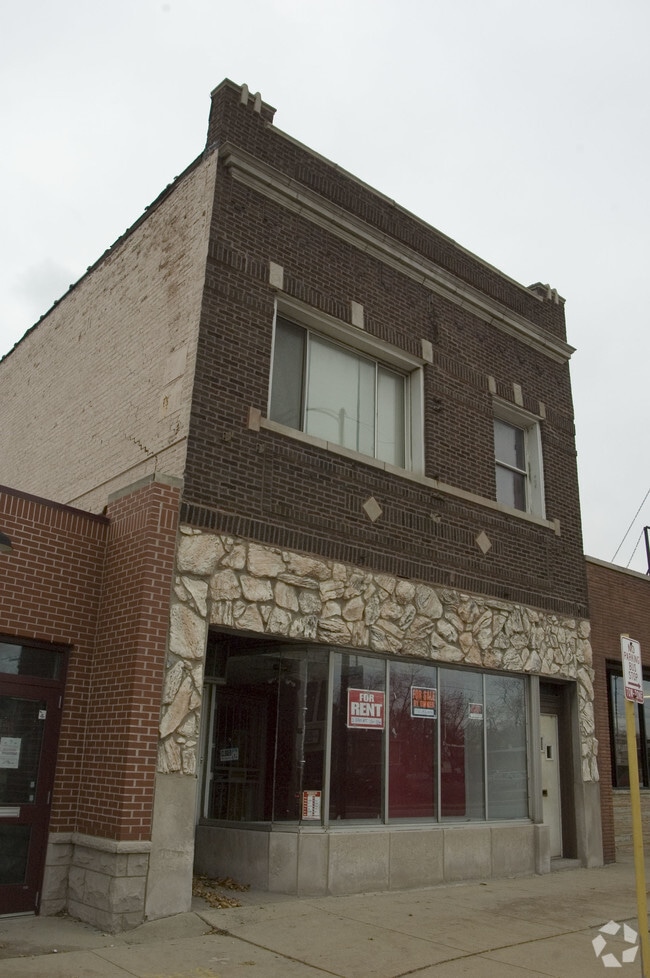
Property Record
2039 W 95Th St, Chicago, IL 60643


NEARBY LISTINGS FOR SALE OR LEASE
Property Detail
2039 W 95Th St
Chicago-Naperville-Elgin, IL-IN-WI
Hilliard & Dobbins 1St Add To Washington
25-07-106-007-0000
HILLIARD & DOBBINS 1ST ADD TO WASHINGTON HTS
Miscresidentialimprovement
Cook
X
Illinois
17031C0635J
2
2023
0.07 AC
2024
South Chicago
720300
Chicago
3,397 SF
DEMOGRAPHICS near 2039 W 95Th St
1 Mile
3 Mile
5 Mile
2024 Total Population
19,227
212,492
573,157
2029 Population
18,528
205,261
552,320
Pop Growth 2024-2029
(3.64%)
(3.40%)
(3.64%)
Average Age
43
41
40
2024 Total Households
7,338
79,306
210,513
HH Growth 2024-2029
(4.03%)
(3.79%)
(3.93%)
Median Household Inc
$87,828
$62,638
$51,770
Avg Household Size
2.60
2.60
2.60
2024 Avg HH Vehicles
2.00
1.00
1.00
Median Home Value
$307,201
$208,115
$194,139
Median Year Built
1947
1952
1953
Nearby Places
Map Layers
Map Styles
 Street
 Aerial
- Restaurants
- Banks
- Shops
- Fitness
- Groceries
PUBLIC TRANSPORTATION
TRANSIT/SUBWAY
95th Street Station (Rock Island District Line - Northeast Illinois Regional Commuter Railroad (Metra))
DRIVE
WALK
Distance
95th Street Station (Rock Island District Line - Northeast Illinois Regional Commuter Railroad (Metra))
1 min
7 min
0.4 mi
Beverly-91st Street Station (Rock Island District Line - Northeast Illinois Regional Commuter Railroad (Metra))
DRIVE
WALK
Distance
Beverly-91st Street Station (Rock Island District Line - Northeast Illinois Regional Commuter Railroad (Metra))
3 min
16 min
0.8 mi
99th Street Station (Rock Island District Line - Northeast Illinois Regional Commuter Railroad (Metra))
DRIVE
WALK
Distance
99th Street Station (Rock Island District Line - Northeast Illinois Regional Commuter Railroad (Metra))
3 min
16 min
0.8 mi
COMMUTER RAIL
95th Street Station (Rock Island District Line - Northeast Illinois Regional Commuter Railroad (Metra))
DRIVE
WALK
Distance
95th Street Station (Rock Island District Line - Northeast Illinois Regional Commuter Railroad (Metra))
1 min
7 min
0.4 mi
Beverly-91st Street Station (Rock Island District Line - Northeast Illinois Regional Commuter Railroad (Metra))
DRIVE
WALK
Distance
Beverly-91st Street Station (Rock Island District Line - Northeast Illinois Regional Commuter Railroad (Metra))
3 min
16 min
0.8 mi
AIRPORT
Chicago Midway International
DRIVE
WALK
Distance
Chicago Midway International
16 min
9.2 mi
Chicago O'Hare International
DRIVE
WALK
Distance
Chicago O'Hare International
47 min
32.7 mi
SALE & LEASE HISTORY
LISTING DATE
SALE/LEASE

Jun 22, 2020
For Sale
Aug 28, 2019
For Sale
Nearby Properties
Address
Land Use
TOTAL SIZE
Lot Size
Zoning
Address
Land Use
TOTAL SIZE
Lot Size
Zoning
10.73 AC
PD 1243
Address
Land Use
TOTAL SIZE
Lot Size
Zoning
159,300 SF
13.36 AC
PD 425
Address
Land Use
TOTAL SIZE
Lot Size
Zoning
307,335 SF
24.17 AC
PD 770
Address
Land Use
TOTAL SIZE
Lot Size
Zoning
87,830 SF
0.76 AC
B1-1
Address
Land Use
TOTAL SIZE
Lot Size
Zoning
240,300 SF
3.72 AC
Address
Land Use
TOTAL SIZE
Lot Size
Zoning
63,930 SF
3.49 AC
PD 181
Address
Land Use
TOTAL SIZE
Lot Size
Zoning
157,787 SF
12.23 AC
Address
Land Use
TOTAL SIZE
Lot Size
Zoning
Address
Land Use
TOTAL SIZE
Lot Size
Zoning
223,310 SF
15.67 AC
Address
Land Use
TOTAL SIZE
Lot Size
Zoning
129,837 SF
10.44 AC
PD 770
Address
Land Use
TOTAL SIZE
Lot Size
Zoning
224,089 SF
Address
Land Use
TOTAL SIZE
Lot Size
Zoning
82,000 SF
Address
Land Use
TOTAL SIZE
Lot Size
Zoning
99,900 SF
12.45 AC
PD 1172
Address
Land Use
TOTAL SIZE
Lot Size
Zoning
166,292 SF
5.95 AC
PMD13
Address
Land Use
TOTAL SIZE
Lot Size
Zoning
98,506 SF
7.66 AC
Address
Land Use
TOTAL SIZE
Lot Size
Zoning
48,192 SF
2.01 AC
Address
Land Use
TOTAL SIZE
Lot Size
Zoning
141,165 SF
7.82 AC
PD 966
Address
Land Use
TOTAL SIZE
Lot Size
Zoning
1 AC
RS-3
Address
Land Use
TOTAL SIZE
Lot Size
Zoning
285,672 SF
13.14 AC
Address
Land Use
TOTAL SIZE
Lot Size
Zoning
101,294 SF
8.10 AC
B3-1
Address
Land Use
TOTAL SIZE
Lot Size
Zoning
111,198 SF
10.60 AC
PD 566
Address
Land Use
TOTAL SIZE
Lot Size
Zoning
0.54 AC
RS-3
Address
Land Use
TOTAL SIZE
Lot Size
Zoning
65,882 SF
1.23 AC
Address
Land Use
TOTAL SIZE
Lot Size
Zoning
451,400 SF
26.59 AC
M3-3
Address
Land Use
TOTAL SIZE
Lot Size
Zoning
38,358 SF
2.52 AC
Address
Land Use
TOTAL SIZE
Lot Size
Zoning
100,224 SF
9.49 AC
Address
Land Use
TOTAL SIZE
Lot Size
Zoning
65,186 SF
10.47 AC
PD 566
Address
Land Use
TOTAL SIZE
Lot Size
Zoning
91,200 SF
3.41 AC
PMD13
Address
Land Use
TOTAL SIZE
Lot Size
Zoning
63,700 SF
0.74 AC
C1-1
Address
Land Use
TOTAL SIZE
Lot Size
Zoning
66,152 SF
5.47 AC
PD 430
The World's #1 Commercial Real Estate Marketplace
Connect with us
© 2025 CoStar Group
The information above has been obtained from sources believed reliable. While we do not doubt its accuracy we have not verified it and make no guarantee, warranty or representation about it. It is your responsibility to independently confirm its accuracy and completeness. Any projections, opinions, assumptions, or estimates used are for example only and do not represent the current or future performance of the property. The value of this transaction to you depends on tax and other factors which should be evaluated by your tax, financial, and legal advisors. You and your advisors should conduct a careful, independent investigation of the property to determine to your satisfaction the suitability of the property for your needs.