Property Record
204 Durand Ave, High Point, NC 27263

NEARBY LISTINGS FOR SALE OR LEASE
Property Detail
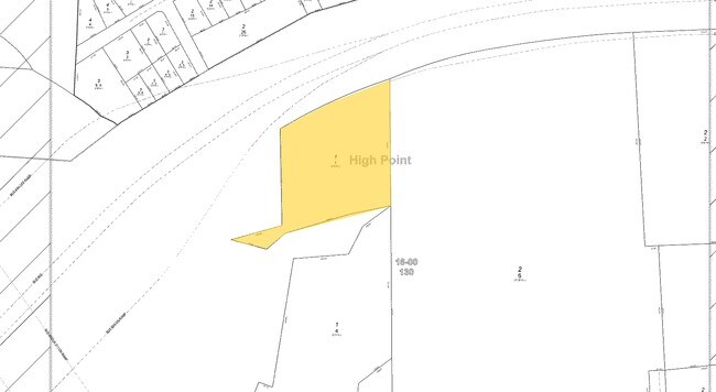
204 Durand Ave
0180699
4.67 AC 1915-D BRENTW
Industrialgeneral
Guilford
AE
North Carolina
3710781000J
1
2024
4.67 AC
2025
High Point/SW Guilford Cty
014502
Greensboro/Winston-Salem
2,553 SF
Greensboro-High Point, NC
DEMOGRAPHICS near 204 Durand Ave
1 Mile
3 Mile
5 Mile
2024 Total Population
3,638
51,159
99,356
2029 Population
3,637
51,662
100,172
Pop Growth 2024-2029
(0.03%)
+ 0.98%
+ 0.82%
Average Age
38
37
39
2024 Total Households
1,368
18,627
38,610
HH Growth 2024-2029
(0.07%)
+ 1.11%
+ 0.84%
Median Household Inc
$37,297
$40,299
$49,379
Avg Household Size
2.60
2.40
2.40
2024 Avg HH Vehicles
2.00
2.00
2.00
Median Home Value
$81,058
$113,638
$158,933
Median Year Built
1968
1970
1974
Nearby Places
Map Layers
Map Styles
 Street
 Aerial
- Restaurants
- Banks
- Shops
- Fitness
- Groceries
PUBLIC TRANSPORTATION
COMMUTER RAIL
High Point Station (Piedmont - North Carolina by Train (NC Train))
DRIVE
WALK
Distance
High Point Station (Piedmont - North Carolina by Train (NC Train))
8 min
4.2 mi
AIRPORT
Piedmont Triad International
DRIVE
WALK
Distance
Piedmont Triad International
28 min
17.3 mi
Nearby Properties
Address
Land Use
TOTAL SIZE
Lot Size
Zoning
Address
Land Use
TOTAL SIZE
Lot Size
Zoning
264,860 SF
62.75 AC
PI
Address
Land Use
TOTAL SIZE
Lot Size
Zoning
418,654 SF
17.20 AC
PI
Address
Land Use
TOTAL SIZE
Lot Size
Zoning
1,277,656 SF
2.47 AC
CB
Address
Land Use
TOTAL SIZE
Lot Size
Zoning
464,134 SF
11.28 AC
PI
Address
Land Use
TOTAL SIZE
Lot Size
Zoning
236,597 SF
13.83 AC
CU-PI
Address
Land Use
TOTAL SIZE
Lot Size
Zoning
484,289 SF
6.41 AC
CB
Address
Land Use
TOTAL SIZE
Lot Size
Zoning
139,254 SF
0.01 AC
PI
Address
Land Use
TOTAL SIZE
Lot Size
Zoning
796,121 SF
9.36 AC
CB
Address
Land Use
TOTAL SIZE
Lot Size
Zoning
802,214 SF
0.01 AC
CB
Address
Land Use
TOTAL SIZE
Lot Size
Zoning
805,958 SF
61.42 AC
LI
Address
Land Use
TOTAL SIZE
Lot Size
Zoning
1,259,149 SF
46.12 AC
HB
Address
Land Use
TOTAL SIZE
Lot Size
Zoning
136,202 SF
30.02 AC
CZ-I
Address
Land Use
TOTAL SIZE
Lot Size
Zoning
457,534 SF
2.13 AC
CB
Address
Land Use
TOTAL SIZE
Lot Size
Zoning
142,800 SF
1.04 AC
CB
Address
Land Use
TOTAL SIZE
Lot Size
Zoning
285,094 SF
3.23 AC
CB
Address
Land Use
TOTAL SIZE
Lot Size
Zoning
100,121 SF
0.01 AC
PI
Address
Land Use
TOTAL SIZE
Lot Size
Zoning
299,349 SF
21.76 AC
RM-16
Address
Land Use
TOTAL SIZE
Lot Size
Zoning
355,633 SF
63.42 AC
HI
Address
Land Use
TOTAL SIZE
Lot Size
Zoning
322,779 SF
0.88 AC
CB
Address
Land Use
TOTAL SIZE
Lot Size
Zoning
90,060 SF
3.15 AC
CZ-I
Address
Land Use
TOTAL SIZE
Lot Size
Zoning
297,676 SF
0.48 AC
CB
Address
Land Use
TOTAL SIZE
Lot Size
Zoning
319,603 SF
1.34 AC
CB
Address
Land Use
TOTAL SIZE
Lot Size
Zoning
196,353 SF
13.76 AC
RC
Address
Land Use
TOTAL SIZE
Lot Size
Zoning
250,573 SF
48.53 AC
R-5
Address
Land Use
TOTAL SIZE
Lot Size
Zoning
369,312 SF
0.75 AC
CB
Address
Land Use
TOTAL SIZE
Lot Size
Zoning
156,010 SF
36.21 AC
M-1
Address
Land Use
TOTAL SIZE
Lot Size
Zoning
87,488 SF
0.01 AC
PI
Address
Land Use
TOTAL SIZE
Lot Size
Zoning
324,986 SF
24.19 AC
LI
Address
Land Use
TOTAL SIZE
Lot Size
Zoning
473,040 SF
63.60 AC
AG
Address
Land Use
TOTAL SIZE
Lot Size
Zoning
174,529 SF
2.87 AC
CB
The World's #1 Commercial Real Estate Marketplace
Connect with us
© 2026 CoStar Group
The information above has been obtained from sources believed reliable. While we do not doubt its accuracy we have not verified it and make no guarantee, warranty or representation about it. It is your responsibility to independently confirm its accuracy and completeness. Any projections, opinions, assumptions, or estimates used are for example only and do not represent the current or future performance of the property. The value of this transaction to you depends on tax and other factors which should be evaluated by your tax, financial, and legal advisors. You and your advisors should conduct a careful, independent investigation of the property to determine to your satisfaction the suitability of the property for your needs.