Property Record
E Trade St, , NC
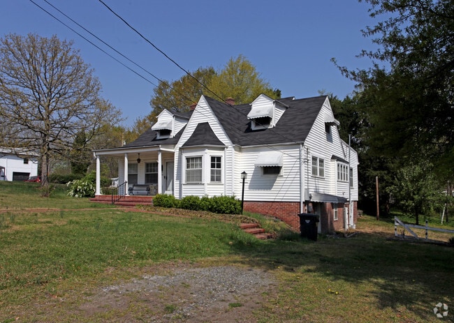
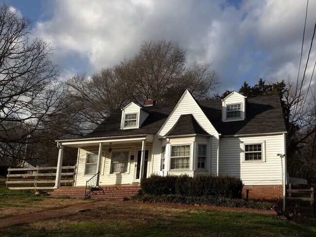

This Property Is For Sale
NEARBY LISTINGS FOR SALE OR LEASE
Property Detail
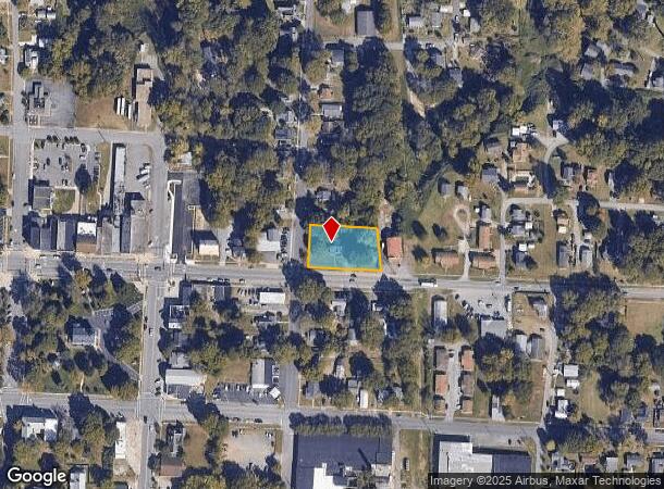
E Trade St
Charlotte-Concord-Gastonia, NC-SC
Holland Subdivision
305399
Gaston
Sfr
North Carolina
X
0.59 AC
3710355700J
Gaston County
1,981 SF
Charlotte
DEMOGRAPHICS near E Trade St
1 Mile
3 Mile
5 Mile
2024 Total Population
4,448
21,774
63,947
2029 Population
4,765
23,206
68,301
Pop Growth 2024-2029
+ 7.13%
+ 6.58%
+ 6.81%
Average Age
38
39
39
2024 Total Households
1,806
8,464
25,339
HH Growth 2024-2029
+ 7.25%
+ 6.76%
+ 6.96%
Median Household Inc
$40,890
$50,559
$45,670
Avg Household Size
2.40
2.50
2.40
2024 Avg HH Vehicles
2.00
2.00
2.00
Median Home Value
$181,093
$179,189
$172,621
Median Year Built
1971
1977
1972
Nearby Places
- Restaurants
- Banks
- Shops
- Fitness
- Groceries
PUBLIC TRANSPORTATION
COMMUTER RAIL
Gastonia Amtrak Station (Crescent - Amtrak)
DRIVE
WALK
Distance
Gastonia Amtrak Station (Crescent - Amtrak)
9 min
5.0 mi
AIRPORT
Charlotte/Douglas International
DRIVE
WALK
Distance
Charlotte/Douglas International
33 min
19.2 mi
Concord-Padgett Regional
DRIVE
WALK
Distance
Concord-Padgett Regional
47 min
35.5 mi
Freight Ports
North Charleston Terminal
DRIVE
WALK
Distance
North Charleston Terminal
247 min
215.2 mi
Nearby Properties
Address
Land Use
TOTAL SIZE
Lot Size
Zoning
Address
Land Use
TOTAL SIZE
Lot Size
Zoning
11,696 SF
159.68 AC
Address
Land Use
TOTAL SIZE
Lot Size
Zoning
312,465 SF
35.23 AC
Address
Land Use
TOTAL SIZE
Lot Size
Zoning
192,315 SF
44.12 AC
INDS1
Address
Land Use
TOTAL SIZE
Lot Size
Zoning
2,688 SF
22.48 AC
OFF01
Address
Land Use
TOTAL SIZE
Lot Size
Zoning
411,076 SF
67.01 AC
INDS2
Address
Land Use
TOTAL SIZE
Lot Size
Zoning
176,657 SF
16.19 AC
Address
Land Use
TOTAL SIZE
Lot Size
Zoning
154,681 SF
63.07 AC
INDS1
Address
Land Use
TOTAL SIZE
Lot Size
Zoning
163,100 SF
41.60 AC
INDS1
Address
Land Use
TOTAL SIZE
Lot Size
Zoning
16,776 SF
49.87 AC
PUB01
Address
Land Use
TOTAL SIZE
Lot Size
Zoning
148,300 SF
12.59 AC
INDS2
Address
Land Use
TOTAL SIZE
Lot Size
Zoning
1,914 SF
15.78 AC
MRKT1
Address
Land Use
TOTAL SIZE
Lot Size
Zoning
3,328 SF
10.16 AC
APT02
Address
Land Use
TOTAL SIZE
Lot Size
Zoning
20,160 SF
18.47 AC
PUB01
Address
Land Use
TOTAL SIZE
Lot Size
Zoning
44,224 SF
3.32 AC
Address
Land Use
TOTAL SIZE
Lot Size
Zoning
4,228 SF
11.39 AC
APT02
Address
Land Use
TOTAL SIZE
Lot Size
Zoning
2,776 SF
57.41 AC
R1
Address
Land Use
TOTAL SIZE
Lot Size
Zoning
3,832 SF
36.55 AC
Address
Land Use
TOTAL SIZE
Lot Size
Zoning
61,043 SF
30.34 AC
PUB01
Address
Land Use
TOTAL SIZE
Lot Size
Zoning
44,132 SF
1.90 AC
MOTL2
Address
Land Use
TOTAL SIZE
Lot Size
Zoning
2,053 SF
15.34 AC
OFF01
Address
Land Use
TOTAL SIZE
Lot Size
Zoning
115,534 SF
50.10 AC
PUB01
Address
Land Use
TOTAL SIZE
Lot Size
Zoning
70,288 SF
13.42 AC
INDS1
Address
Land Use
TOTAL SIZE
Lot Size
Zoning
36,300 SF
15.83 AC
Address
Land Use
TOTAL SIZE
Lot Size
Zoning
13,602 SF
8.74 AC
Address
Land Use
TOTAL SIZE
Lot Size
Zoning
2,145 SF
10.19 AC
Address
Land Use
TOTAL SIZE
Lot Size
Zoning
1,620 SF
6.73 AC
OFF01
Address
Land Use
TOTAL SIZE
Lot Size
Zoning
77,568 SF
1.65 AC
REST2
Address
Land Use
TOTAL SIZE
Lot Size
Zoning
43,164 SF
11.52 AC
SHOP1
Address
Land Use
TOTAL SIZE
Lot Size
Zoning
15,744 SF
4.10 AC
MOTL1
Address
Land Use
TOTAL SIZE
Lot Size
Zoning
69,540 SF
19.40 AC
PUB01
The World's #1 Commercial Real Estate Marketplace
Connect with us
© 2025 CoStar Group
The information above has been obtained from sources believed reliable. While we do not doubt its accuracy we have not verified it and make no guarantee, warranty or representation about it. It is your responsibility to independently confirm its accuracy and completeness. Any projections, opinions, assumptions, or estimates used are for example only and do not represent the current or future performance of the property. The value of this transaction to you depends on tax and other factors which should be evaluated by your tax, financial, and legal advisors. You and your advisors should conduct a careful, independent investigation of the property to determine to your satisfaction the suitability of the property for your needs.