Property Record
204 Easy St, Lafayette, LA 70506
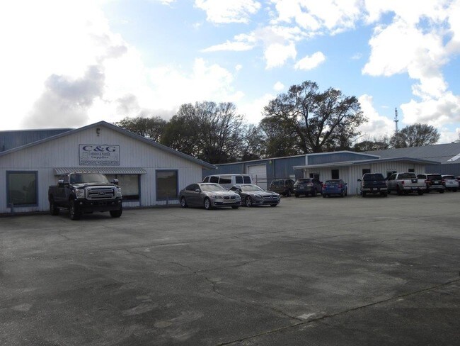


Property Detail
204 Easy St
Lafayette, LA
LOT 15A & NW 20FT LOT16A VAN WAY COMMERCIAL INDUSTRIAL CENTER
6066317
Lafayette
Warehouse
Louisiana
B and X Area of moderate flood hazard, usually the area between the limits of the 100-year and 500-year floods.
15a,16a
2025
1.10 AC
2025
Greater Lafayette
000603
Lafayette
11,839 SF
NEARBY LISTINGS FOR SALE OR LEASE
-
-
No Photo
-
-
View all Lafayette listings for lease on LoopNet.com
DEMOGRAPHICS near 204 Easy St
1 mile
3 mile
5 mile
2025 Total Population
9,951
66,815
136,780
2030 Population
10,303
69,687
143,044
Pop Growth 2025-2030
+ 3.54%
+ 4.30%
+ 4.58%
Average Age
38
39
40
2025 Total Households
4,715
29,033
58,667
HH Growth 2025-2030
+ 3.54%
+ 4.36%
+ 4.65%
Median Household Inc
$49,776
$52,934
$55,540
Avg Household Size
2.00
2.20
2.20
2025 Avg HH Vehicles
1.00
2.00
2.00
Median Home Value
$220,357
$231,768
$234,558
Median Year Built
1978
1976
1981
Nearby Places
Map Layers
Map Styles
 Street
 Aerial
Layers
 Traffic
 Biking
Places
Listings with unknown addresses are not visible on the map
- Restaurants
- Banks
- Shops
- Fitness
- Groceries
PUBLIC TRANSPORTATION
COMMUTER RAIL
Lafayette Amtrak Station (Sunset Limited - Amtrak)
Drive
Walk
Distance
Lafayette Amtrak Station (Sunset Limited - Amtrak)
8 min
4.1 mi
AIRPORT
Lafayette Regional/Paul Fournet Field
Drive
Walk
Distance
Lafayette Regional/Paul Fournet Field
13 min
6.5 mi
Freight Ports
Port of Iberia
Drive
Walk
Distance
Port of Iberia
38 min
27.2 mi
SALE & LEASE HISTORY
LISTING DATE
SALE/LEASE

Mar 01, 2017
For Sale
Feb 22, 2018
For Lease
Nearby Properties
Address
Land Use
TOTAL SIZE
Lot Size
Zoning
Address
Land Use
TOTAL SIZE
Lot Size
Zoning
800,608 SF
6.64 AC
Address
Land Use
TOTAL SIZE
Lot Size
Zoning
51,132 SF
11.07 AC
Address
Land Use
TOTAL SIZE
Lot Size
Zoning
272,945 SF
21.64 AC
Address
Land Use
TOTAL SIZE
Lot Size
Zoning
141,706 SF
3.44 AC
Address
Land Use
TOTAL SIZE
Lot Size
Zoning
231,380 SF
4.20 AC
Address
Land Use
TOTAL SIZE
Lot Size
Zoning
140,051 SF
26.21 AC
Address
Land Use
TOTAL SIZE
Lot Size
Zoning
141,295 SF
28.09 AC
Address
Land Use
TOTAL SIZE
Lot Size
Zoning
443,758 SF
19.73 AC
Address
Land Use
TOTAL SIZE
Lot Size
Zoning
10.80 AC
Address
Land Use
TOTAL SIZE
Lot Size
Zoning
249,875 SF
29.76 AC
Address
Land Use
TOTAL SIZE
Lot Size
Zoning
90,725 SF
17.17 AC
Address
Land Use
TOTAL SIZE
Lot Size
Zoning
96.54 AC
Address
Land Use
TOTAL SIZE
Lot Size
Zoning
221,760 SF
0.67 AC
Address
Land Use
TOTAL SIZE
Lot Size
Zoning
67,949 SF
0.92 AC
Address
Land Use
TOTAL SIZE
Lot Size
Zoning
Address
Land Use
TOTAL SIZE
Lot Size
Zoning
12.42 AC
Address
Land Use
TOTAL SIZE
Lot Size
Zoning
32.14 AC
Address
Land Use
TOTAL SIZE
Lot Size
Zoning
29.99 AC
Address
Land Use
TOTAL SIZE
Lot Size
Zoning
92,556 SF
10.75 AC
Address
Land Use
TOTAL SIZE
Lot Size
Zoning
15,386 SF
13.17 AC
Address
Land Use
TOTAL SIZE
Lot Size
Zoning
47,249 SF
22.17 AC
Address
Land Use
TOTAL SIZE
Lot Size
Zoning
106,686 SF
7.03 AC
Address
Land Use
TOTAL SIZE
Lot Size
Zoning
226,513 SF
0.02 AC
Address
Land Use
TOTAL SIZE
Lot Size
Zoning
151,863 SF
1.43 AC
Address
Land Use
TOTAL SIZE
Lot Size
Zoning
123,164 SF
2.11 AC
Address
Land Use
TOTAL SIZE
Lot Size
Zoning
180,132 SF
18.18 AC
Address
Land Use
TOTAL SIZE
Lot Size
Zoning
250,211 SF
7.77 AC
Address
Land Use
TOTAL SIZE
Lot Size
Zoning
87,868 SF
3.02 AC
Address
Land Use
TOTAL SIZE
Lot Size
Zoning
67,672 SF
10.18 AC
Address
Land Use
TOTAL SIZE
Lot Size
Zoning
66,678 SF
0.01 AC
The World's #1 Commercial Real Estate Marketplace
Connect with us
© 2026 CoStar Group
The information above has been obtained from sources believed reliable. While we do not doubt its accuracy we have not verified it and make no guarantee, warranty or representation about it. It is your responsibility to independently confirm its accuracy and completeness. Any projections, opinions, assumptions, or estimates used are for example only and do not represent the current or future performance of the property. The value of this transaction to you depends on tax and other factors which should be evaluated by your tax, financial, and legal advisors. You and your advisors should conduct a careful, independent investigation of the property to determine to your satisfaction the suitability of the property for your needs.