Property Record
204 Flightline Rd, Austin, TX 78719


Property Detail
204 Flightline Rd
184758
ABS 2540 SUR 92 FAUBION F F ACR .224
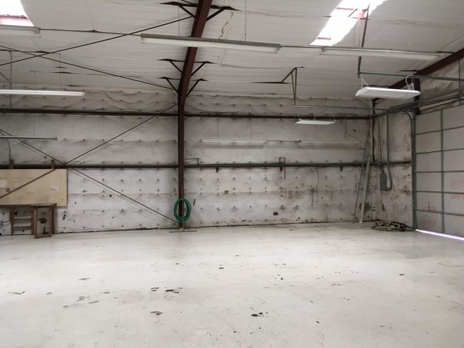
Warehouse
TRAVIS
B and X Area of moderate flood hazard, usually the area between the limits of the 100-year and 500-year floods.
Texas
2025
0.22 AC
2025
Far Northwest
002436
Austin
6,732 SF
Austin-Round Rock-San Marcos, TX
NEARBY LISTINGS FOR SALE OR LEASE
DEMOGRAPHICS near 204 Flightline Rd
1 mile
3 mile
5 mile
2025 Total Population
380
7,188
20,477
2030 Population
404
7,703
22,129
Pop Growth 2025-2030
+ 6.32%
+ 7.16%
+ 8.07%
Average Age
48
47
46
2025 Total Households
168
2,937
8,107
HH Growth 2025-2030
+ 7.14%
+ 7.83%
+ 8.66%
Median Household Inc
$105,500
$99,588
$126,691
Avg Household Size
2.30
2.40
2.50
2025 Avg HH Vehicles
3.00
2.00
2.00
Median Home Value
$309,375
$526,075
$616,459
Median Year Built
2001
2001
2006
Nearby Places
Map Layers
Map Styles
 Street
 Aerial
Transit
 Traffic
 Biking
Places
Listings with unknown addresses are not visible on the map
- Restaurants
- Banks
- Shops
- Fitness
- Groceries
PUBLIC TRANSPORTATION
AIRPORT
Austin-Bergstrom International
Drive
Walk
Distance
Austin-Bergstrom International
70 min
46.0 mi
Freight Ports
Calhoun Port
Drive
Walk
Distance
Calhoun Port
235 min
189.4 mi
SALE & LEASE HISTORY
LISTING DATE
SALE/LEASE

Jul 23, 2018
For Sale
Jul 20, 2018
For Lease
Jan 10, 2019
For Sale
Nearby Properties
Address
Land Use
TOTAL SIZE
Lot Size
Zoning
Address
Land Use
TOTAL SIZE
Lot Size
Zoning
1 SF
834.04 AC
Address
Land Use
TOTAL SIZE
Lot Size
Zoning
596 AC
Address
Land Use
TOTAL SIZE
Lot Size
Zoning
358.17 AC
Address
Land Use
TOTAL SIZE
Lot Size
Zoning
323.39 AC
Address
Land Use
TOTAL SIZE
Lot Size
Zoning
22.34 AC
Address
Land Use
TOTAL SIZE
Lot Size
Zoning
2,861 SF
264.59 AC
Address
Land Use
TOTAL SIZE
Lot Size
Zoning
241.54 AC
Address
Land Use
TOTAL SIZE
Lot Size
Zoning
69,163 SF
4.42 AC
Address
Land Use
TOTAL SIZE
Lot Size
Zoning
207.03 AC
Address
Land Use
TOTAL SIZE
Lot Size
Zoning
14,351 SF
2.74 AC
Address
Land Use
TOTAL SIZE
Lot Size
Zoning
2,744 SF
299.90 AC
Address
Land Use
TOTAL SIZE
Lot Size
Zoning
17,596 SF
2.15 AC
Address
Land Use
TOTAL SIZE
Lot Size
Zoning
584.77 AC
Address
Land Use
TOTAL SIZE
Lot Size
Zoning
46,955 SF
3.09 AC
Address
Land Use
TOTAL SIZE
Lot Size
Zoning
22,198 SF
8.56 AC
Address
Land Use
TOTAL SIZE
Lot Size
Zoning
26.88 AC
Address
Land Use
TOTAL SIZE
Lot Size
Zoning
7.71 AC
Address
Land Use
TOTAL SIZE
Lot Size
Zoning
21,739 SF
7.45 AC
Address
Land Use
TOTAL SIZE
Lot Size
Zoning
76.82 AC
Address
Land Use
TOTAL SIZE
Lot Size
Zoning
22,576 SF
2.48 AC
Address
Land Use
TOTAL SIZE
Lot Size
Zoning
107.31 AC
Address
Land Use
TOTAL SIZE
Lot Size
Zoning
7,045 SF
1.19 AC
Address
Land Use
TOTAL SIZE
Lot Size
Zoning
68.53 AC
Address
Land Use
TOTAL SIZE
Lot Size
Zoning
13,000 SF
1.60 AC
Address
Land Use
TOTAL SIZE
Lot Size
Zoning
10,852 SF
1.22 AC
Address
Land Use
TOTAL SIZE
Lot Size
Zoning
28,213 SF
5.39 AC
Address
Land Use
TOTAL SIZE
Lot Size
Zoning
10,000 SF
1.87 AC
Address
Land Use
TOTAL SIZE
Lot Size
Zoning
1,078 SF
64.92 AC
Address
Land Use
TOTAL SIZE
Lot Size
Zoning
30,502 SF
4.95 AC
Address
Land Use
TOTAL SIZE
Lot Size
Zoning
143.60 AC
The World's #1 Commercial Real Estate Marketplace
Connect with us
© 2026 CoStar Group
The information above has been obtained from sources believed reliable. While we do not doubt its accuracy we have not verified it and make no guarantee, warranty or representation about it. It is your responsibility to independently confirm its accuracy and completeness. Any projections, opinions, assumptions, or estimates used are for example only and do not represent the current or future performance of the property. The value of this transaction to you depends on tax and other factors which should be evaluated by your tax, financial, and legal advisors. You and your advisors should conduct a careful, independent investigation of the property to determine to your satisfaction the suitability of the property for your needs.