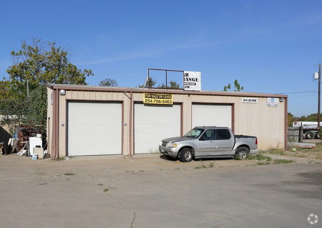
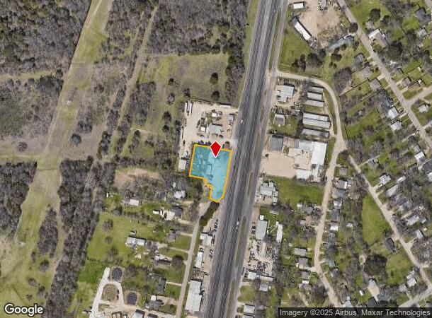
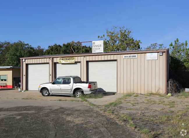
Property Record
204 N Lacy Dr, Waco, TX 76705
NEARBY LISTINGS FOR SALE OR LEASE
Property Detail
204 N Lacy Dr
Waco, TX
Coastal Transport Co
20-023300-000100-7
COASTAL TRANSPORT CO LOT 1 BLOCK 1 ACRES 1.5684
Commercialnec
Mclennan
X
Texas
48309C0215D
1
2024
1.57 AC
2025
Waco & Killeen
003200
Other Market Areas
2,147 SF
DEMOGRAPHICS near 204 N Lacy Dr
1 Mile
3 Mile
5 Mile
2024 Total Population
6,155
26,416
49,893
2029 Population
6,631
28,310
53,432
Pop Growth 2024-2029
+ 7.73%
+ 7.17%
+ 7.09%
Average Age
36
36
36
2024 Total Households
2,432
9,565
18,406
HH Growth 2024-2029
+ 7.89%
+ 7.36%
+ 7.30%
Median Household Inc
$42,544
$45,969
$42,104
Avg Household Size
2.40
2.60
2.50
2024 Avg HH Vehicles
2.00
2.00
2.00
Median Home Value
$148,969
$131,757
$139,123
Median Year Built
1980
1980
1977
Nearby Places
Map Layers
Map Styles
 Street
 Aerial
- Restaurants
- Banks
- Shops
- Fitness
- Groceries
PUBLIC TRANSPORTATION
AIRPORT
Waco Regional
DRIVE
WALK
Distance
Waco Regional
20 min
10.1 mi
Freight Ports
Port of Houston
DRIVE
WALK
Distance
Port of Houston
217 min
188.2 mi
SALE & LEASE HISTORY
LISTING DATE
SALE/LEASE

Nov 04, 2016
For Lease
Nearby Properties
Address
Land Use
TOTAL SIZE
Lot Size
Zoning
Address
Land Use
TOTAL SIZE
Lot Size
Zoning
821,607 SF
48.98 AC
Address
Land Use
TOTAL SIZE
Lot Size
Zoning
193,246 SF
144.87 AC
R
Address
Land Use
TOTAL SIZE
Lot Size
Zoning
215,433 SF
33.17 AC
R
Address
Land Use
TOTAL SIZE
Lot Size
Zoning
Address
Land Use
TOTAL SIZE
Lot Size
Zoning
Address
Land Use
TOTAL SIZE
Lot Size
Zoning
Address
Land Use
TOTAL SIZE
Lot Size
Zoning
30.89 AC
R1
Address
Land Use
TOTAL SIZE
Lot Size
Zoning
33,442 SF
2.80 AC
Address
Land Use
TOTAL SIZE
Lot Size
Zoning
127,979 SF
5.72 AC
R
Address
Land Use
TOTAL SIZE
Lot Size
Zoning
186,588 SF
10.28 AC
C1
Address
Land Use
TOTAL SIZE
Lot Size
Zoning
21.76 AC
R
Address
Land Use
TOTAL SIZE
Lot Size
Zoning
13.72 AC
R1
Address
Land Use
TOTAL SIZE
Lot Size
Zoning
8.86 AC
R1
Address
Land Use
TOTAL SIZE
Lot Size
Zoning
87,206 SF
2.80 AC
Address
Land Use
TOTAL SIZE
Lot Size
Zoning
202,787 SF
22.33 AC
B2
Address
Land Use
TOTAL SIZE
Lot Size
Zoning
Address
Land Use
TOTAL SIZE
Lot Size
Zoning
229,166 SF
14.18 AC
C
Address
Land Use
TOTAL SIZE
Lot Size
Zoning
Address
Land Use
TOTAL SIZE
Lot Size
Zoning
132,772 SF
27.36 AC
C
Address
Land Use
TOTAL SIZE
Lot Size
Zoning
125,412 SF
8.37 AC
R
Address
Land Use
TOTAL SIZE
Lot Size
Zoning
99,796 SF
11.13 AC
R
Address
Land Use
TOTAL SIZE
Lot Size
Zoning
102,480 SF
9.36 AC
R4
Address
Land Use
TOTAL SIZE
Lot Size
Zoning
Address
Land Use
TOTAL SIZE
Lot Size
Zoning
68,942 SF
2.13 AC
C1
Address
Land Use
TOTAL SIZE
Lot Size
Zoning
69,642 SF
27.76 AC
R1B
Address
Land Use
TOTAL SIZE
Lot Size
Zoning
99,124 SF
5 AC
B2
Address
Land Use
TOTAL SIZE
Lot Size
Zoning
Address
Land Use
TOTAL SIZE
Lot Size
Zoning
47.44 AC
Address
Land Use
TOTAL SIZE
Lot Size
Zoning
55,756 SF
7.72 AC
R
Address
Land Use
TOTAL SIZE
Lot Size
Zoning
67,229 SF
3.22 AC
R
The World's #1 Commercial Real Estate Marketplace
Connect with us
© 2025 CoStar Group
The information above has been obtained from sources believed reliable. While we do not doubt its accuracy we have not verified it and make no guarantee, warranty or representation about it. It is your responsibility to independently confirm its accuracy and completeness. Any projections, opinions, assumptions, or estimates used are for example only and do not represent the current or future performance of the property. The value of this transaction to you depends on tax and other factors which should be evaluated by your tax, financial, and legal advisors. You and your advisors should conduct a careful, independent investigation of the property to determine to your satisfaction the suitability of the property for your needs.