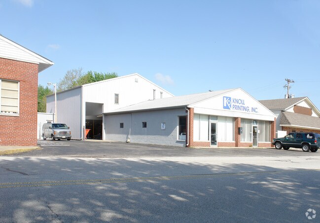
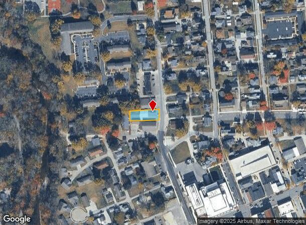
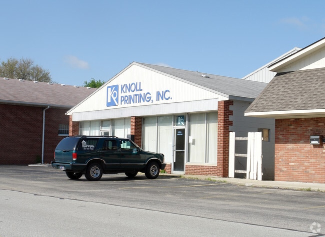
Property Record
204 N Mill St, Plainfield, IN 46168
NEARBY LISTINGS FOR SALE OR LEASE
Property Detail
204 N Mill St
32-10-27-470-018.000-012
PT SW SE 27-15-1E .22AC DBA: FOR LEASE 7/26/21
Commercialnec
Hendricks
X
Indiana
18109C0025E
0.22 AC
2024
Plainfield
2024
Indianapolis
210900
Indianapolis-Carmel-Anderson, IN
7,340 SF
DEMOGRAPHICS near 204 N Mill St
1 Mile
3 Mile
5 Mile
2024 Total Population
7,142
45,380
74,612
2029 Population
8,017
50,782
83,229
Pop Growth 2024-2029
+ 12.25%
+ 11.90%
+ 11.55%
Average Age
40
40
40
2024 Total Households
3,082
16,602
27,368
HH Growth 2024-2029
+ 12.46%
+ 12.06%
+ 11.68%
Median Household Inc
$57,387
$83,771
$86,724
Avg Household Size
2.30
2.50
2.60
2024 Avg HH Vehicles
2.00
2.00
2.00
Median Home Value
$197,131
$242,272
$241,044
Median Year Built
1975
1995
1997
Nearby Places
Map Layers
Map Styles
 Street
 Aerial
- Restaurants
- Banks
- Shops
- Fitness
- Groceries
PUBLIC TRANSPORTATION
AIRPORT
Indianapolis International
DRIVE
WALK
Distance
Indianapolis International
17 min
7.5 mi
Freight Ports
Port of Toledo
DRIVE
WALK
Distance
Port of Toledo
293 min
239.4 mi
Nearby Properties
Address
Land Use
TOTAL SIZE
Lot Size
Zoning
Address
Land Use
TOTAL SIZE
Lot Size
Zoning
923,980 SF
60.08 AC
Address
Land Use
TOTAL SIZE
Lot Size
Zoning
9,728 SF
23.10 AC
Address
Land Use
TOTAL SIZE
Lot Size
Zoning
5,064 SF
25.50 AC
Address
Land Use
TOTAL SIZE
Lot Size
Zoning
750,820 SF
64.15 AC
Address
Land Use
TOTAL SIZE
Lot Size
Zoning
51,884 SF
14.73 AC
Address
Land Use
TOTAL SIZE
Lot Size
Zoning
651,610 SF
63.52 AC
Address
Land Use
TOTAL SIZE
Lot Size
Zoning
635,585 SF
28.37 AC
Address
Land Use
TOTAL SIZE
Lot Size
Zoning
10,953 SF
18.52 AC
Address
Land Use
TOTAL SIZE
Lot Size
Zoning
518,536 SF
25.66 AC
Address
Land Use
TOTAL SIZE
Lot Size
Zoning
37.04 AC
Address
Land Use
TOTAL SIZE
Lot Size
Zoning
551,424 SF
31.39 AC
Address
Land Use
TOTAL SIZE
Lot Size
Zoning
599,744 SF
34.65 AC
Address
Land Use
TOTAL SIZE
Lot Size
Zoning
4,514 SF
18.08 AC
Address
Land Use
TOTAL SIZE
Lot Size
Zoning
3,443 SF
15.82 AC
Address
Land Use
TOTAL SIZE
Lot Size
Zoning
500,000 SF
28.58 AC
Address
Land Use
TOTAL SIZE
Lot Size
Zoning
357,000 SF
27.34 AC
Address
Land Use
TOTAL SIZE
Lot Size
Zoning
476,720 SF
28.97 AC
Address
Land Use
TOTAL SIZE
Lot Size
Zoning
475,277 SF
29.61 AC
Address
Land Use
TOTAL SIZE
Lot Size
Zoning
Address
Land Use
TOTAL SIZE
Lot Size
Zoning
448,625 SF
23.82 AC
Address
Land Use
TOTAL SIZE
Lot Size
Zoning
454,260 SF
29.55 AC
Address
Land Use
TOTAL SIZE
Lot Size
Zoning
426,088 SF
23.11 AC
Address
Land Use
TOTAL SIZE
Lot Size
Zoning
445,166 SF
24 AC
Address
Land Use
TOTAL SIZE
Lot Size
Zoning
401,751 SF
24.05 AC
Address
Land Use
TOTAL SIZE
Lot Size
Zoning
400,860 SF
32.58 AC
Address
Land Use
TOTAL SIZE
Lot Size
Zoning
Address
Land Use
TOTAL SIZE
Lot Size
Zoning
4,933 SF
20.70 AC
Address
Land Use
TOTAL SIZE
Lot Size
Zoning
168,574 SF
8.30 AC
Address
Land Use
TOTAL SIZE
Lot Size
Zoning
725,390 SF
36.56 AC
Address
Land Use
TOTAL SIZE
Lot Size
Zoning
2.31 AC
The World's #1 Commercial Real Estate Marketplace
Connect with us
© 2025 CoStar Group
The information above has been obtained from sources believed reliable. While we do not doubt its accuracy we have not verified it and make no guarantee, warranty or representation about it. It is your responsibility to independently confirm its accuracy and completeness. Any projections, opinions, assumptions, or estimates used are for example only and do not represent the current or future performance of the property. The value of this transaction to you depends on tax and other factors which should be evaluated by your tax, financial, and legal advisors. You and your advisors should conduct a careful, independent investigation of the property to determine to your satisfaction the suitability of the property for your needs.