Property Record
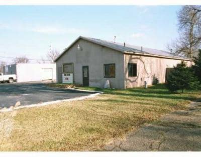
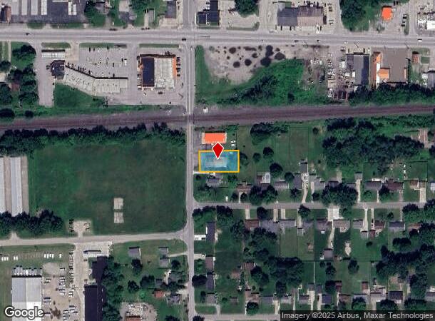
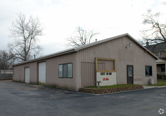
204 S Beech Rd, Osceola, IN 46561
NEARBY LISTINGS FOR SALE OR LEASE
Property Detail
204 S Beech Rd
South Bend-Mishawaka, IN-MI
Plat Of Moran Add
71-10-16-152-002.000-030
LOT 46 MORAN ADD EX 120 X 160.5 SW COR & EX PTS SOLD
Publicstorage
St Joseph
X
Indiana
18141C0237E
46
2023
0.31 AC
2024
Outlying St Joseph County
011602
South Bend/Mishawaka
3,200 SF
DEMOGRAPHICS near 204 S Beech Rd
1 Mile
3 Mile
5 Mile
2024 Total Population
3,924
26,771
65,212
2029 Population
3,872
26,455
64,723
Pop Growth 2024-2029
(1.33%)
(1.18%)
(0.75%)
Average Age
40
40
39
2024 Total Households
1,522
9,983
25,052
HH Growth 2024-2029
(1.45%)
(1.26%)
(0.81%)
Median Household Inc
$63,156
$76,767
$64,813
Avg Household Size
2.50
2.60
2.50
2024 Avg HH Vehicles
2.00
2.00
2.00
Median Home Value
$172,056
$181,624
$167,409
Median Year Built
1964
1975
1975
Nearby Places
Map Layers
Map Styles
 Street
 Aerial
- Restaurants
- Banks
- Shops
- Fitness
- Groceries
PUBLIC TRANSPORTATION
COMMUTER RAIL
Elkhart Amtrak Station (Capitol Limited - Amtrak, Lake Shore Limited - Amtrak)
DRIVE
WALK
Distance
Elkhart Amtrak Station (Capitol Limited - Amtrak, Lake Shore Limited - Amtrak)
10 min
6.1 mi
AIRPORT
South Bend International
DRIVE
WALK
Distance
South Bend International
33 min
15.8 mi
Freight Ports
Port Milwaukee
DRIVE
WALK
Distance
Port Milwaukee
229 min
191.7 mi
Nearby Properties
Address
Land Use
TOTAL SIZE
Lot Size
Zoning
Address
Land Use
TOTAL SIZE
Lot Size
Zoning
2,584,820 SF
32.18 AC
Address
Land Use
TOTAL SIZE
Lot Size
Zoning
377,169 SF
23.85 AC
ZO01
Address
Land Use
TOTAL SIZE
Lot Size
Zoning
184,212 SF
23.71 AC
ZO01
Address
Land Use
TOTAL SIZE
Lot Size
Zoning
36,851 SF
22.72 AC
Address
Land Use
TOTAL SIZE
Lot Size
Zoning
3,692,640 SF
0.01 AC
Address
Land Use
TOTAL SIZE
Lot Size
Zoning
316,658 SF
27.46 AC
Address
Land Use
TOTAL SIZE
Lot Size
Zoning
144,550 SF
30.99 AC
ZO01
Address
Land Use
TOTAL SIZE
Lot Size
Zoning
123,595 SF
7.92 AC
Address
Land Use
TOTAL SIZE
Lot Size
Zoning
115,990 SF
11.91 AC
Address
Land Use
TOTAL SIZE
Lot Size
Zoning
81,185 SF
23.42 AC
Address
Land Use
TOTAL SIZE
Lot Size
Zoning
279,230 SF
27.20 AC
Address
Land Use
TOTAL SIZE
Lot Size
Zoning
225,200 SF
25.73 AC
Address
Land Use
TOTAL SIZE
Lot Size
Zoning
49,293 SF
87 SF
Address
Land Use
TOTAL SIZE
Lot Size
Zoning
50,250 SF
16.70 AC
ZO01
Address
Land Use
TOTAL SIZE
Lot Size
Zoning
30,470 SF
20 AC
Address
Land Use
TOTAL SIZE
Lot Size
Zoning
47,240 SF
6.66 AC
Address
Land Use
TOTAL SIZE
Lot Size
Zoning
281,499 SF
21.32 AC
Address
Land Use
TOTAL SIZE
Lot Size
Zoning
42,500 SF
1.93 AC
Address
Land Use
TOTAL SIZE
Lot Size
Zoning
69,518 SF
33.38 AC
ZO01
Address
Land Use
TOTAL SIZE
Lot Size
Zoning
109,536 SF
106 AC
Address
Land Use
TOTAL SIZE
Lot Size
Zoning
55,428 SF
44 SF
Address
Land Use
TOTAL SIZE
Lot Size
Zoning
50,057 SF
10 AC
ZO01
Address
Land Use
TOTAL SIZE
Lot Size
Zoning
59,438 SF
10.73 AC
Address
Land Use
TOTAL SIZE
Lot Size
Zoning
30,344 SF
7.94 AC
Address
Land Use
TOTAL SIZE
Lot Size
Zoning
113,890 SF
22 AC
ZO01
Address
Land Use
TOTAL SIZE
Lot Size
Zoning
69,264 SF
10 AC
Address
Land Use
TOTAL SIZE
Lot Size
Zoning
40,480 SF
3.62 AC
Address
Land Use
TOTAL SIZE
Lot Size
Zoning
61,384 SF
5.59 AC
Address
Land Use
TOTAL SIZE
Lot Size
Zoning
31,156 SF
4.93 AC
Address
Land Use
TOTAL SIZE
Lot Size
Zoning
25,588 SF
12 AC
The World's #1 Commercial Real Estate Marketplace
Connect with us
© 2025 CoStar Group
The information above has been obtained from sources believed reliable. While we do not doubt its accuracy we have not verified it and make no guarantee, warranty or representation about it. It is your responsibility to independently confirm its accuracy and completeness. Any projections, opinions, assumptions, or estimates used are for example only and do not represent the current or future performance of the property. The value of this transaction to you depends on tax and other factors which should be evaluated by your tax, financial, and legal advisors. You and your advisors should conduct a careful, independent investigation of the property to determine to your satisfaction the suitability of the property for your needs.