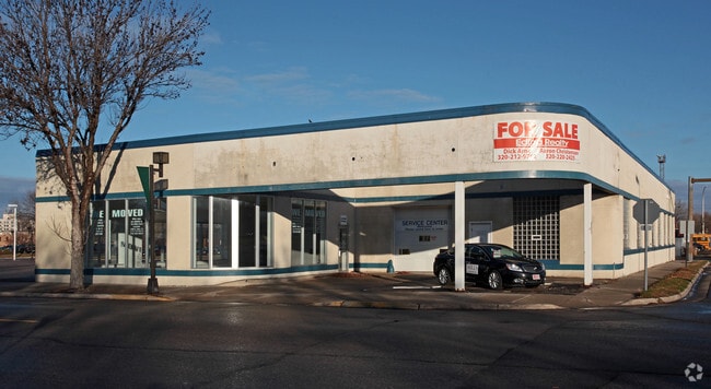
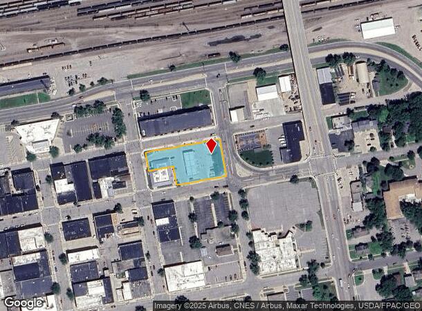
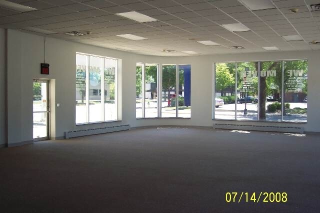
Property Record
212 2Nd St Sw, Willmar, MN 56201
NEARBY LISTINGS FOR SALE OR LEASE
Property Detail
212 2Nd St Sw
Willmar, MN
Willmar, Town Of (Original)
95-003-2940
WILLMAR, TOWN OF (ORIGINAL) LOTS 1-12, EXC THAT PART OF LOTS 9-12 DESC AS FLWS COMM AT SW'LY COR OF SD BLK 28, TH E'LY ALONG
Commercialnec
Kandiyohi
X
Minnesota
27067C0425D
1-12,9
2025
0.78 AC
2025
Minnesota Central Area
780800
Other Market Areas
DEMOGRAPHICS near 212 2Nd St Sw
1 Mile
3 Mile
5 Mile
2024 Total Population
8,526
21,924
23,696
2029 Population
8,493
22,035
23,781
Pop Growth 2024-2029
(0.39%)
+ 0.51%
+ 0.36%
Average Age
37
37
38
2024 Total Households
3,139
8,193
8,862
HH Growth 2024-2029
(0.48%)
+ 0.40%
+ 0.27%
Median Household Inc
$46,988
$56,399
$59,122
Avg Household Size
2.50
2.50
2.50
2024 Avg HH Vehicles
2.00
2.00
2.00
Median Home Value
$130,505
$169,145
$178,911
Median Year Built
1956
1974
1974
Nearby Places
Map Layers
Map Styles
 Street
 Aerial
- Restaurants
- Banks
- Shops
- Fitness
- Groceries
SALE & LEASE HISTORY
LISTING DATE
SALE/LEASE

Sep 24, 2016
For Sale
Nearby Properties
Address
Land Use
TOTAL SIZE
Lot Size
Zoning
Address
Land Use
TOTAL SIZE
Lot Size
Zoning
52.87 AC
Address
Land Use
TOTAL SIZE
Lot Size
Zoning
4.69 AC
Address
Land Use
TOTAL SIZE
Lot Size
Zoning
Address
Land Use
TOTAL SIZE
Lot Size
Zoning
9.75 AC
Address
Land Use
TOTAL SIZE
Lot Size
Zoning
18.80 AC
Address
Land Use
TOTAL SIZE
Lot Size
Zoning
18.17 AC
Address
Land Use
TOTAL SIZE
Lot Size
Zoning
19.83 AC
Address
Land Use
TOTAL SIZE
Lot Size
Zoning
25.40 AC
Address
Land Use
TOTAL SIZE
Lot Size
Zoning
24.92 AC
Address
Land Use
TOTAL SIZE
Lot Size
Zoning
35.03 AC
Address
Land Use
TOTAL SIZE
Lot Size
Zoning
39.63 AC
Address
Land Use
TOTAL SIZE
Lot Size
Zoning
2.65 AC
Address
Land Use
TOTAL SIZE
Lot Size
Zoning
Address
Land Use
TOTAL SIZE
Lot Size
Zoning
10.87 AC
Address
Land Use
TOTAL SIZE
Lot Size
Zoning
11.83 AC
Address
Land Use
TOTAL SIZE
Lot Size
Zoning
23.74 AC
Address
Land Use
TOTAL SIZE
Lot Size
Zoning
Address
Land Use
TOTAL SIZE
Lot Size
Zoning
10.36 AC
Address
Land Use
TOTAL SIZE
Lot Size
Zoning
2.96 AC
Address
Land Use
TOTAL SIZE
Lot Size
Zoning
8.90 AC
Address
Land Use
TOTAL SIZE
Lot Size
Zoning
23.52 AC
Address
Land Use
TOTAL SIZE
Lot Size
Zoning
4.23 AC
Address
Land Use
TOTAL SIZE
Lot Size
Zoning
56.71 AC
Address
Land Use
TOTAL SIZE
Lot Size
Zoning
2.04 AC
Address
Land Use
TOTAL SIZE
Lot Size
Zoning
2.12 AC
Address
Land Use
TOTAL SIZE
Lot Size
Zoning
2.75 AC
Address
Land Use
TOTAL SIZE
Lot Size
Zoning
2.75 AC
Address
Land Use
TOTAL SIZE
Lot Size
Zoning
1.90 AC
Address
Land Use
TOTAL SIZE
Lot Size
Zoning
2.44 AC
Address
Land Use
TOTAL SIZE
Lot Size
Zoning
17.02 AC
The World's #1 Commercial Real Estate Marketplace
Connect with us
© 2025 CoStar Group
The information above has been obtained from sources believed reliable. While we do not doubt its accuracy we have not verified it and make no guarantee, warranty or representation about it. It is your responsibility to independently confirm its accuracy and completeness. Any projections, opinions, assumptions, or estimates used are for example only and do not represent the current or future performance of the property. The value of this transaction to you depends on tax and other factors which should be evaluated by your tax, financial, and legal advisors. You and your advisors should conduct a careful, independent investigation of the property to determine to your satisfaction the suitability of the property for your needs.