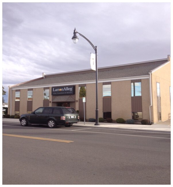
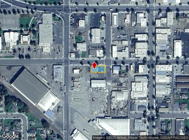
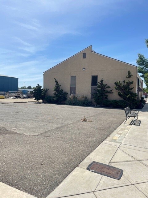
Property Record
204 W 2Nd St, Grandview, WA 98930
NEARBY LISTINGS FOR SALE OR LEASE
Property Detail
204 W 2Nd St
Yakima, WA
Grandview Washington
230923-13457
GRANDVIEW: N 5 FT LOT 9 & ALL LOT 10 BLK 29
Commercialnec
Yakima
X
Washington
53077C1925D
9,10
2025
0.16 AC
2025
Grandview/Sunnyside
001901
Yakima
2,684 SF
DEMOGRAPHICS near 204 W 2Nd St
1 Mile
3 Mile
5 Mile
2024 Total Population
9,407
14,613
18,523
2029 Population
9,468
14,726
18,649
Pop Growth 2024-2029
+ 0.65%
+ 0.77%
+ 0.68%
Average Age
32
33
34
2024 Total Households
2,678
4,214
5,389
HH Growth 2024-2029
+ 0.52%
+ 0.66%
+ 0.65%
Median Household Inc
$57,823
$60,292
$60,443
Avg Household Size
3.40
3.40
3.30
2024 Avg HH Vehicles
2.00
3.00
3.00
Median Home Value
$187,375
$216,346
$229,788
Median Year Built
1975
1976
1975
Nearby Places
Map Layers
Map Styles
 Street
 Aerial
- Restaurants
- Banks
- Shops
- Fitness
- Groceries
SALE & LEASE HISTORY
LISTING DATE
SALE/LEASE

Oct 17, 2019
For Sale
Nearby Properties
Address
Land Use
TOTAL SIZE
Lot Size
Zoning
Address
Land Use
TOTAL SIZE
Lot Size
Zoning
869,722 SF
113.32 AC
M1
Address
Land Use
TOTAL SIZE
Lot Size
Zoning
202,775 SF
37.51 AC
PF
Address
Land Use
TOTAL SIZE
Lot Size
Zoning
111,288 SF
25.53 AC
M1
Address
Land Use
TOTAL SIZE
Lot Size
Zoning
59,459 SF
5.62 AC
PF
Address
Land Use
TOTAL SIZE
Lot Size
Zoning
60,877 SF
3.53 AC
PF
Address
Land Use
TOTAL SIZE
Lot Size
Zoning
61,288 SF
10.06 AC
PF
Address
Land Use
TOTAL SIZE
Lot Size
Zoning
100,678 SF
11.97 AC
PF
Address
Land Use
TOTAL SIZE
Lot Size
Zoning
51,740 SF
10.91 AC
M1
Address
Land Use
TOTAL SIZE
Lot Size
Zoning
48,738 SF
4.86 AC
PF
Address
Land Use
TOTAL SIZE
Lot Size
Zoning
40,537 SF
4.95 AC
M1
Address
Land Use
TOTAL SIZE
Lot Size
Zoning
46,069 SF
4.48 AC
C2
Address
Land Use
TOTAL SIZE
Lot Size
Zoning
47,507 SF
3.85 AC
R3
Address
Land Use
TOTAL SIZE
Lot Size
Zoning
131,850 SF
5.39 AC
M1
Address
Land Use
TOTAL SIZE
Lot Size
Zoning
36,616 SF
2.99 AC
M1
Address
Land Use
TOTAL SIZE
Lot Size
Zoning
167,662 SF
11.75 AC
M1
Address
Land Use
TOTAL SIZE
Lot Size
Zoning
124,489 SF
11.34 AC
M2
Address
Land Use
TOTAL SIZE
Lot Size
Zoning
135,110 SF
5.77 AC
M1
Address
Land Use
TOTAL SIZE
Lot Size
Zoning
25,904 SF
9.38 AC
M1
Address
Land Use
TOTAL SIZE
Lot Size
Zoning
39,570 SF
22.24 AC
PF
Address
Land Use
TOTAL SIZE
Lot Size
Zoning
29,520 SF
4.45 AC
C2
Address
Land Use
TOTAL SIZE
Lot Size
Zoning
42,119 SF
9.89 AC
AG
Address
Land Use
TOTAL SIZE
Lot Size
Zoning
72,759 SF
3.19 AC
M1
Address
Land Use
TOTAL SIZE
Lot Size
Zoning
50,435 SF
18.09 AC
AG
Address
Land Use
TOTAL SIZE
Lot Size
Zoning
4,004 SF
1.20 AC
C2
Address
Land Use
TOTAL SIZE
Lot Size
Zoning
33,490 SF
3.02 AC
R3
Address
Land Use
TOTAL SIZE
Lot Size
Zoning
32,520 SF
6.94 AC
C2
Address
Land Use
TOTAL SIZE
Lot Size
Zoning
21,888 SF
5.10 AC
R3
Address
Land Use
TOTAL SIZE
Lot Size
Zoning
108,171 SF
3.17 AC
M1
Address
Land Use
TOTAL SIZE
Lot Size
Zoning
23,694 SF
5.41 AC
M1
Address
Land Use
TOTAL SIZE
Lot Size
Zoning
10,640 SF
1.06 AC
M1
The World's #1 Commercial Real Estate Marketplace
Connect with us
© 2025 CoStar Group
The information above has been obtained from sources believed reliable. While we do not doubt its accuracy we have not verified it and make no guarantee, warranty or representation about it. It is your responsibility to independently confirm its accuracy and completeness. Any projections, opinions, assumptions, or estimates used are for example only and do not represent the current or future performance of the property. The value of this transaction to you depends on tax and other factors which should be evaluated by your tax, financial, and legal advisors. You and your advisors should conduct a careful, independent investigation of the property to determine to your satisfaction the suitability of the property for your needs.