Property Record
204 Yellow Elder, Punta Gorda, FL 33955

Property Detail
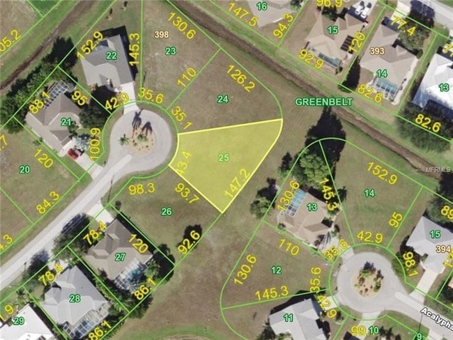
204 Yellow Elder
Punta Gorda, FL
PUNTA GORDA ISLES SEC18 BLK398 LT25 931/1298 2469/2194 2823/1980 4658/1718
412333232004
CHARLOTTE
Residentialacreage
Florida
GS-3.5
25
B and X Area of moderate flood hazard, usually the area between the limits of the 100-year and 500-year floods.
0.23 AC
2024
Charlotte County
2025
Southwest Florida
010505
NEARBY LISTINGS FOR SALE OR LEASE
DEMOGRAPHICS near 204 Yellow Elder
1 mile
3 mile
5 mile
2025 Total Population
3,460
12,391
30,576
2030 Population
3,786
13,661
33,787
Pop Growth 2025-2030
+ 9.42%
+ 10.25%
+ 10.50%
Average Age
58
56
58
2025 Total Households
1,748
5,783
14,808
HH Growth 2025-2030
+ 9.27%
+ 10.19%
+ 10.40%
Median Household Inc
$65,058
$80,591
$76,948
Avg Household Size
2.00
2.10
2.00
2025 Avg HH Vehicles
2.00
2.00
2.00
Median Home Value
$354,699
$377,985
$434,466
Median Year Built
1998
1999
1998
Nearby Places
Map Layers
Map Styles
 Street
 Aerial
Layers
 Traffic
 Biking
Places
Listings with unknown addresses are not visible on the map
- Restaurants
- Banks
- Shops
- Fitness
- Groceries
PUBLIC TRANSPORTATION
AIRPORT
Punta Gorda
Drive
Walk
Distance
Punta Gorda
14 min
5.0 mi
Southwest Florida International
Drive
Walk
Distance
Southwest Florida International
45 min
33.5 mi
SALE & LEASE HISTORY
LISTING DATE
SALE/LEASE

Feb 23, 2018
For Sale
Nearby Properties
Address
Land Use
TOTAL SIZE
Lot Size
Zoning
Address
Land Use
TOTAL SIZE
Lot Size
Zoning
265,949 SF
22.80 AC
PD-CC
Address
Land Use
TOTAL SIZE
Lot Size
Zoning
253,440 SF
30.47 AC
ECAP
Address
Land Use
TOTAL SIZE
Lot Size
Zoning
378,000 SF
29.24 AC
ECAP
Address
Land Use
TOTAL SIZE
Lot Size
Zoning
345,043 SF
33.12 AC
ECAP
Address
Land Use
TOTAL SIZE
Lot Size
Zoning
198,916 SF
25.79 AC
HC
Address
Land Use
TOTAL SIZE
Lot Size
Zoning
142,812 SF
7.89 AC
HC
Address
Land Use
TOTAL SIZE
Lot Size
Zoning
96,845 SF
17.62 AC
HC
Address
Land Use
TOTAL SIZE
Lot Size
Zoning
8,406 SF
31.48 AC
ECAP
Address
Land Use
TOTAL SIZE
Lot Size
Zoning
104,398 SF
12.97 AC
HC
Address
Land Use
TOTAL SIZE
Lot Size
Zoning
13,260 SF
2.27 AC
CG
Address
Land Use
TOTAL SIZE
Lot Size
Zoning
65,396 SF
5.13 AC
HC
Address
Land Use
TOTAL SIZE
Lot Size
Zoning
65,141 SF
9.56 AC
HC
Address
Land Use
TOTAL SIZE
Lot Size
Zoning
15,134 SF
2.03 AC
CG
Address
Land Use
TOTAL SIZE
Lot Size
Zoning
40,000 SF
20 AC
ECAP
Address
Land Use
TOTAL SIZE
Lot Size
Zoning
18.93 AC
HC
Address
Land Use
TOTAL SIZE
Lot Size
Zoning
68,773 SF
8.05 AC
ECAP
Address
Land Use
TOTAL SIZE
Lot Size
Zoning
43,500 SF
9.84 AC
CG
Address
Land Use
TOTAL SIZE
Lot Size
Zoning
17.81 AC
HC
Address
Land Use
TOTAL SIZE
Lot Size
Zoning
21,583 SF
590.79 AC
ES
Address
Land Use
TOTAL SIZE
Lot Size
Zoning
Address
Land Use
TOTAL SIZE
Lot Size
Zoning
12,408 SF
1.92 AC
CG
Address
Land Use
TOTAL SIZE
Lot Size
Zoning
21,936 SF
175.75 AC
GS-3.5
Address
Land Use
TOTAL SIZE
Lot Size
Zoning
22,597 SF
3.43 AC
HC
Address
Land Use
TOTAL SIZE
Lot Size
Zoning
636 AC
ES
Address
Land Use
TOTAL SIZE
Lot Size
Zoning
20,271 SF
6.26 AC
CG
Address
Land Use
TOTAL SIZE
Lot Size
Zoning
28,730 SF
11.64 AC
NC
Address
Land Use
TOTAL SIZE
Lot Size
Zoning
0.86 AC
RE1
Address
Land Use
TOTAL SIZE
Lot Size
Zoning
Address
Land Use
TOTAL SIZE
Lot Size
Zoning
515.16 AC
ES
Address
Land Use
TOTAL SIZE
Lot Size
Zoning
24,672 SF
4.47 AC
CG
The World's #1 Commercial Real Estate Marketplace
Connect with us
© 2026 CoStar Group
The information above has been obtained from sources believed reliable. While we do not doubt its accuracy we have not verified it and make no guarantee, warranty or representation about it. It is your responsibility to independently confirm its accuracy and completeness. Any projections, opinions, assumptions, or estimates used are for example only and do not represent the current or future performance of the property. The value of this transaction to you depends on tax and other factors which should be evaluated by your tax, financial, and legal advisors. You and your advisors should conduct a careful, independent investigation of the property to determine to your satisfaction the suitability of the property for your needs.