Property Record
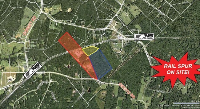
2040 Genito Rd, Moseley, VA 23120

Property Detail
2040 Genito Rd
Richmond, VA
PT MOSELEY
053-101B
POWHATAN
Ruralimprovednonresidential
Virginia
A-10
101b
B and X Area of moderate flood hazard, usually the area between the limits of the 100-year and 500-year floods.
63.64 AC
2026
Powhatan
2026
Richmond VA
101003
NEARBY LISTINGS FOR SALE OR LEASE
-
-
View all Moseley listings for sale on LoopNet.com
DEMOGRAPHICS near 2040 Genito Rd
1 mile
3 mile
5 mile
2025 Total Population
423
4,021
17,399
2030 Population
446
4,200
18,527
Pop Growth 2025-2030
+ 5.44%
+ 4.45%
+ 6.48%
Average Age
41
41
39
2025 Total Households
153
1,489
5,851
HH Growth 2025-2030
+ 5.23%
+ 4.43%
+ 6.29%
Median Household Inc
$94,711
$105,638
$140,225
Avg Household Size
2.70
2.70
2.90
2025 Avg HH Vehicles
2.00
3.00
3.00
Median Home Value
$444,444
$418,813
$518,660
Median Year Built
1995
1992
2004
Nearby Places
Map Layers
Map Styles
 Street
 Aerial
Transit
 Traffic
 Biking
Places
Listings with unknown addresses are not visible on the map
- Restaurants
- Banks
- Shops
- Fitness
- Groceries
PUBLIC TRANSPORTATION
AIRPORT
Richmond International
Drive
Walk
Distance
Richmond International
55 min
35.1 mi
Freight Ports
Virginia Port Authority - Richmond
Drive
Walk
Distance
Virginia Port Authority - Richmond
46 min
24.2 mi
Nearby Properties
Address
Land Use
TOTAL SIZE
Lot Size
Zoning
Address
Land Use
TOTAL SIZE
Lot Size
Zoning
1,800 SF
5.25 AC
CC
Address
Land Use
TOTAL SIZE
Lot Size
Zoning
15,690 SF
3.71 AC
CC
Address
Land Use
TOTAL SIZE
Lot Size
Zoning
128.39 AC
R12 - SING
Address
Land Use
TOTAL SIZE
Lot Size
Zoning
12,000 SF
5.08 AC
CC
Address
Land Use
TOTAL SIZE
Lot Size
Zoning
15,620 SF
2.48 AC
CC
Address
Land Use
TOTAL SIZE
Lot Size
Zoning
14,267 SF
2.84 AC
A - AGRICU
Address
Land Use
TOTAL SIZE
Lot Size
Zoning
17,000 SF
15.42 AC
A-10
Address
Land Use
TOTAL SIZE
Lot Size
Zoning
10,086 SF
1.58 AC
CC
Address
Land Use
TOTAL SIZE
Lot Size
Zoning
3,500 SF
2.08 AC
CC
Address
Land Use
TOTAL SIZE
Lot Size
Zoning
6,544 SF
1.31 AC
CC
Address
Land Use
TOTAL SIZE
Lot Size
Zoning
7,921 SF
1.56 AC
CC
Address
Land Use
TOTAL SIZE
Lot Size
Zoning
280 AC
A-10
Address
Land Use
TOTAL SIZE
Lot Size
Zoning
3,588 SF
1.34 AC
CC
Address
Land Use
TOTAL SIZE
Lot Size
Zoning
3,028 SF
1.09 AC
CC-PD
Address
Land Use
TOTAL SIZE
Lot Size
Zoning
1,215 SF
1.35 AC
CC
Address
Land Use
TOTAL SIZE
Lot Size
Zoning
7,540 SF
1.09 AC
CC
Address
Land Use
TOTAL SIZE
Lot Size
Zoning
5,872 SF
2.11 AC
R-U
Address
Land Use
TOTAL SIZE
Lot Size
Zoning
10,000 SF
28.31 AC
A - AGRICU
Address
Land Use
TOTAL SIZE
Lot Size
Zoning
2,578 SF
1.84 AC
CC
Address
Land Use
TOTAL SIZE
Lot Size
Zoning
3,288 SF
1.19 AC
CC
Address
Land Use
TOTAL SIZE
Lot Size
Zoning
10,500 SF
1.80 AC
CC
Address
Land Use
TOTAL SIZE
Lot Size
Zoning
4,800 SF
1.83 AC
C
Address
Land Use
TOTAL SIZE
Lot Size
Zoning
13,600 SF
3 AC
CC
Address
Land Use
TOTAL SIZE
Lot Size
Zoning
4,620 SF
5.17 AC
A-10
Address
Land Use
TOTAL SIZE
Lot Size
Zoning
50 AC
R12 - SING
Address
Land Use
TOTAL SIZE
Lot Size
Zoning
40.69 AC
R12 - SING
Address
Land Use
TOTAL SIZE
Lot Size
Zoning
19.66 AC
A-10
Address
Land Use
TOTAL SIZE
Lot Size
Zoning
1.58 AC
CC
Address
Land Use
TOTAL SIZE
Lot Size
Zoning
222.76 AC
A-10
The World's #1 Commercial Real Estate Marketplace
Connect with us
© 2026 CoStar Group
The information above has been obtained from sources believed reliable. While we do not doubt its accuracy we have not verified it and make no guarantee, warranty or representation about it. It is your responsibility to independently confirm its accuracy and completeness. Any projections, opinions, assumptions, or estimates used are for example only and do not represent the current or future performance of the property. The value of this transaction to you depends on tax and other factors which should be evaluated by your tax, financial, and legal advisors. You and your advisors should conduct a careful, independent investigation of the property to determine to your satisfaction the suitability of the property for your needs.