Property Record
2040 Nys Rte 26 S, Vestal, NY 13850

NEARBY LISTINGS FOR SALE OR LEASE
-
-
View all Vestal listings for sale on LoopNet.com
Property Detail
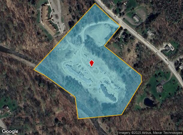
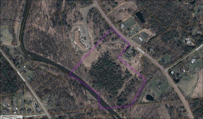
2040 Nys Rte 26 S
Binghamton, NY
Alta Nsps Land Title Survey For Vestal C
034800-206-001-0001-032-000-0000
Broome
Apartment
New York
2025
32.000
2024
13.99 AC
014400
Broome County
25,550 SF
Syracuse
DEMOGRAPHICS near 2040 Nys Rte 26 S
1 Mile
3 Mile
5 Mile
2024 Total Population
1,591
5,705
46,750
2029 Population
1,568
5,611
45,849
Pop Growth 2024-2029
(1.45%)
(1.65%)
(1.93%)
Average Age
47
45
39
2024 Total Households
584
2,207
16,451
HH Growth 2024-2029
(1.71%)
(1.86%)
(2.32%)
Median Household Inc
$84,534
$100,907
$63,815
Avg Household Size
2.40
2.40
2.30
2024 Avg HH Vehicles
2.00
2.00
2.00
Median Home Value
$161,784
$176,247
$153,199
Median Year Built
1970
1967
1959
Nearby Places
- Restaurants
- Banks
- Shops
- Fitness
- Groceries
SALE & LEASE HISTORY
LISTING DATE
SALE/LEASE

Sep 24, 2016
For Sale
May 17, 2017
For Sale
Nearby Properties
Address
Land Use
TOTAL SIZE
Lot Size
Zoning
Address
Land Use
TOTAL SIZE
Lot Size
Zoning
Address
Land Use
TOTAL SIZE
Lot Size
Zoning
148,400 SF
14.51 AC
PDD
Address
Land Use
TOTAL SIZE
Lot Size
Zoning
Address
Land Use
TOTAL SIZE
Lot Size
Zoning
29,750 SF
14.38 AC
RA-2
Address
Land Use
TOTAL SIZE
Lot Size
Zoning
51,861 SF
13.44 AC
RA-2
Address
Land Use
TOTAL SIZE
Lot Size
Zoning
31,846 SF
5.41 AC
RA-2
Address
Land Use
TOTAL SIZE
Lot Size
Zoning
15,440 SF
14.53 AC
RR
Address
Land Use
TOTAL SIZE
Lot Size
Zoning
1,536 SF
97.49 AC
RR
Address
Land Use
TOTAL SIZE
Lot Size
Zoning
0.77 AC
RA-2
Address
Land Use
TOTAL SIZE
Lot Size
Zoning
22,040 SF
21.58 AC
RA-1
Address
Land Use
TOTAL SIZE
Lot Size
Zoning
Address
Land Use
TOTAL SIZE
Lot Size
Zoning
1,620 SF
46.77 AC
RR
Address
Land Use
TOTAL SIZE
Lot Size
Zoning
11,250 SF
8.50 AC
Address
Land Use
TOTAL SIZE
Lot Size
Zoning
4,484 SF
38.84 AC
RR
Address
Land Use
TOTAL SIZE
Lot Size
Zoning
305.24 AC
RR
Address
Land Use
TOTAL SIZE
Lot Size
Zoning
6,852 SF
3.63 AC
RR
Address
Land Use
TOTAL SIZE
Lot Size
Zoning
30,416 SF
20.71 AC
C-2
Address
Land Use
TOTAL SIZE
Lot Size
Zoning
22,198 SF
2.91 AC
C-1
Address
Land Use
TOTAL SIZE
Lot Size
Zoning
Address
Land Use
TOTAL SIZE
Lot Size
Zoning
3,259 SF
24.18 AC
RR
Address
Land Use
TOTAL SIZE
Lot Size
Zoning
5,425 SF
3.07 AC
RA-1
Address
Land Use
TOTAL SIZE
Lot Size
Zoning
240 SF
2.80 AC
RR
Address
Land Use
TOTAL SIZE
Lot Size
Zoning
800 SF
107.37 AC
RR
Address
Land Use
TOTAL SIZE
Lot Size
Zoning
88.92 AC
Address
Land Use
TOTAL SIZE
Lot Size
Zoning
0.94 AC
RR
Address
Land Use
TOTAL SIZE
Lot Size
Zoning
6,878 SF
3.45 AC
RR
Address
Land Use
TOTAL SIZE
Lot Size
Zoning
1,209 SF
92.47 AC
RA-1
Address
Land Use
TOTAL SIZE
Lot Size
Zoning
3,212 SF
2.51 AC
RR
Address
Land Use
TOTAL SIZE
Lot Size
Zoning
1,620 SF
0.79 AC
C-2
The World's #1 Commercial Real Estate Marketplace
Connect with us
© 2025 CoStar Group
The information above has been obtained from sources believed reliable. While we do not doubt its accuracy we have not verified it and make no guarantee, warranty or representation about it. It is your responsibility to independently confirm its accuracy and completeness. Any projections, opinions, assumptions, or estimates used are for example only and do not represent the current or future performance of the property. The value of this transaction to you depends on tax and other factors which should be evaluated by your tax, financial, and legal advisors. You and your advisors should conduct a careful, independent investigation of the property to determine to your satisfaction the suitability of the property for your needs.