Property Record
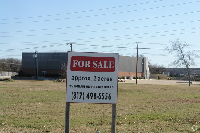
2040 Precinct Line Rd, Hurst, TX 76054

Property Detail
2040 Precinct Line Rd
Dallas-Fort Worth-Arlington, TX
LOREAN CREEK ADDITION BLOCK 1 LOT 4A
07681429
TARRANT
Commercialnec
Texas
AE The base floodplain where base flood elevations are provided. AE Zones are now used on new format FIRMs instead of A1-A30 Zones.
4a
2024
2.51 AC
2025
HEB/Mid-Cities
113613
Dallas/Ft Worth
NEARBY LISTINGS FOR SALE OR LEASE
-
-
-
-
-
-
-
No Photo
-
View all Hurst listings for sale on LoopNet.com
DEMOGRAPHICS near 2040 Precinct Line Rd
1 mile
3 mile
5 mile
2025 Total Population
8,223
115,707
276,649
2030 Population
8,609
121,595
290,000
Pop Growth 2025-2030
+ 4.69%
+ 5.09%
+ 4.83%
Average Age
43
41
40
2025 Total Households
3,616
45,699
106,082
HH Growth 2025-2030
+ 4.98%
+ 5.22%
+ 4.97%
Median Household Inc
$90,997
$85,148
$91,869
Avg Household Size
2.30
2.50
2.60
2025 Avg HH Vehicles
2.00
2.00
2.00
Median Home Value
$387,315
$357,491
$369,450
Median Year Built
1985
1980
1984
Nearby Places
Map Layers
Map Styles
 Street
 Aerial
Transit
 Traffic
 Biking
Places
Listings with unknown addresses are not visible on the map
- Restaurants
- Banks
- Shops
- Fitness
- Groceries
PUBLIC TRANSPORTATION
COMMUTER RAIL
Drive
Walk
Distance
8 min
4.3 mi
Drive
Walk
Distance
11 min
5.1 mi
AIRPORT
Dallas-Fort Worth International
Drive
Walk
Distance
Dallas-Fort Worth International
22 min
14.5 mi
Dallas Love Field
Drive
Walk
Distance
Dallas Love Field
33 min
23.2 mi
SALE & LEASE HISTORY
LISTING DATE
SALE/LEASE

Sep 24, 2016
For Sale
Nearby Properties
Address
Land Use
TOTAL SIZE
Lot Size
Zoning
Address
Land Use
TOTAL SIZE
Lot Size
Zoning
1,300,314 SF
40.15 AC
Address
Land Use
TOTAL SIZE
Lot Size
Zoning
285,754 SF
69.41 AC
Address
Land Use
TOTAL SIZE
Lot Size
Zoning
356,000 SF
39.44 AC
Address
Land Use
TOTAL SIZE
Lot Size
Zoning
521,150 SF
92.05 AC
Address
Land Use
TOTAL SIZE
Lot Size
Zoning
388,447 SF
9.47 AC
Address
Land Use
TOTAL SIZE
Lot Size
Zoning
174,596 SF
11.91 AC
Address
Land Use
TOTAL SIZE
Lot Size
Zoning
172,000 SF
6.34 AC
Address
Land Use
TOTAL SIZE
Lot Size
Zoning
318,602 SF
9.90 AC
Address
Land Use
TOTAL SIZE
Lot Size
Zoning
348,941 SF
22.25 AC
Address
Land Use
TOTAL SIZE
Lot Size
Zoning
240,154 SF
6.92 AC
Address
Land Use
TOTAL SIZE
Lot Size
Zoning
79,244 SF
54.50 AC
Address
Land Use
TOTAL SIZE
Lot Size
Zoning
236,701 SF
15.96 AC
Address
Land Use
TOTAL SIZE
Lot Size
Zoning
237,551 SF
4.39 AC
Address
Land Use
TOTAL SIZE
Lot Size
Zoning
173,068 SF
15.55 AC
Address
Land Use
TOTAL SIZE
Lot Size
Zoning
232,295 SF
21.49 AC
Address
Land Use
TOTAL SIZE
Lot Size
Zoning
197,964 SF
4.57 AC
Address
Land Use
TOTAL SIZE
Lot Size
Zoning
235,530 SF
13.21 AC
Address
Land Use
TOTAL SIZE
Lot Size
Zoning
194,625 SF
15.07 AC
Address
Land Use
TOTAL SIZE
Lot Size
Zoning
221,591 SF
14.50 AC
Address
Land Use
TOTAL SIZE
Lot Size
Zoning
220,650 SF
3.03 AC
Address
Land Use
TOTAL SIZE
Lot Size
Zoning
187,236 SF
9.85 AC
Address
Land Use
TOTAL SIZE
Lot Size
Zoning
161,332 SF
8.56 AC
Address
Land Use
TOTAL SIZE
Lot Size
Zoning
151,023 SF
5.18 AC
Address
Land Use
TOTAL SIZE
Lot Size
Zoning
262,233 SF
16.13 AC
Address
Land Use
TOTAL SIZE
Lot Size
Zoning
192,482 SF
9.77 AC
Address
Land Use
TOTAL SIZE
Lot Size
Zoning
199,744 SF
9.99 AC
Address
Land Use
TOTAL SIZE
Lot Size
Zoning
165,762 SF
10.71 AC
Address
Land Use
TOTAL SIZE
Lot Size
Zoning
191,235 SF
10.93 AC
Address
Land Use
TOTAL SIZE
Lot Size
Zoning
158,761 SF
8.91 AC
Address
Land Use
TOTAL SIZE
Lot Size
Zoning
146,918 SF
3.31 AC
The World's #1 Commercial Real Estate Marketplace
Connect with us
© 2026 CoStar Group
The information above has been obtained from sources believed reliable. While we do not doubt its accuracy we have not verified it and make no guarantee, warranty or representation about it. It is your responsibility to independently confirm its accuracy and completeness. Any projections, opinions, assumptions, or estimates used are for example only and do not represent the current or future performance of the property. The value of this transaction to you depends on tax and other factors which should be evaluated by your tax, financial, and legal advisors. You and your advisors should conduct a careful, independent investigation of the property to determine to your satisfaction the suitability of the property for your needs.