Property Record
2040 Schillinger Rd S, Mobile, AL 36695
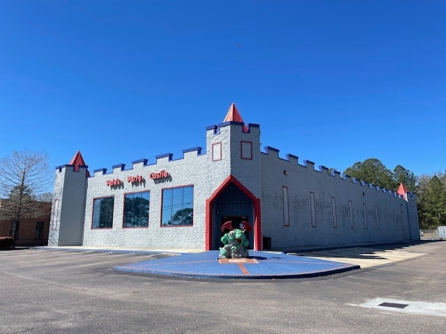


Property Detail
2040 Schillinger Rd S
Mobile, AL
LOT 1 GREEN FARMETTS WEST MBK 85 P 14 #SEC 36 T4S R3W #MP27 07 36 4 000
27-07-36-4-000-024.002
Mobile
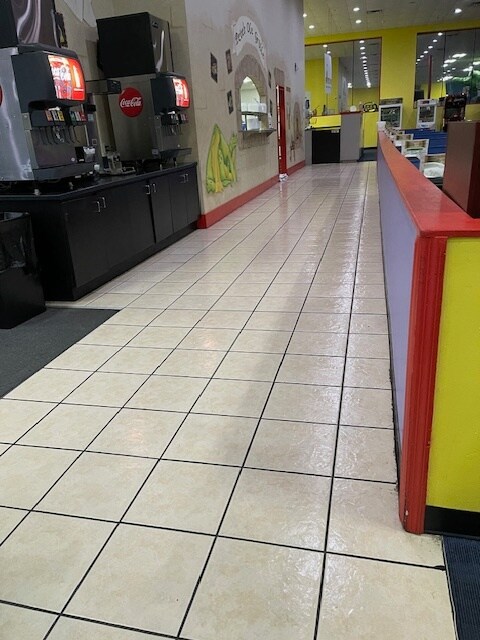
Amusementarcade
Alabama
B and X Area of moderate flood hazard, usually the area between the limits of the 100-year and 500-year floods.
1
2025
1.57 AC
2025
Outlying Mobile County
006408
Mobile
11,514 SF
NEARBY LISTINGS FOR SALE OR LEASE
DEMOGRAPHICS near 2040 Schillinger Rd S
1 mile
3 mile
5 mile
2025 Total Population
5,774
50,086
115,891
2030 Population
5,585
48,967
113,734
Pop Growth 2025-2030
(3.27%)
(2.23%)
(1.86%)
Average Age
39
40
39
2025 Total Households
2,289
20,761
46,512
HH Growth 2025-2030
(3.32%)
(2.26%)
(1.95%)
Median Household Inc
$80,208
$67,168
$63,251
Avg Household Size
2.50
2.40
2.40
2025 Avg HH Vehicles
2.00
2.00
2.00
Median Home Value
$258,346
$254,806
$237,404
Median Year Built
1997
1992
1986
Nearby Places
Map Layers
Map Styles
 Street
 Aerial
Layers
 Traffic
 Biking
Places
Listings with unknown addresses are not visible on the map
- Restaurants
- Banks
- Shops
- Fitness
- Groceries
PUBLIC TRANSPORTATION
AIRPORT
Mobile Regional
Drive
Walk
Distance
Mobile Regional
12 min
4.7 mi
Mobile International
Drive
Walk
Distance
Mobile International
26 min
15.5 mi
SALE & LEASE HISTORY
LISTING DATE
SALE/LEASE

Mar 20, 2025
For Sale
Mar 18, 2025
For Lease
Mar 18, 2025
For Lease
Jun 02, 2023
For Sale
Apr 11, 2023
For Lease
Nearby Properties
Address
Land Use
TOTAL SIZE
Lot Size
Zoning
Address
Land Use
TOTAL SIZE
Lot Size
Zoning
549,081 SF
15.70 AC
Address
Land Use
TOTAL SIZE
Lot Size
Zoning
32,394 SF
40 AC
Address
Land Use
TOTAL SIZE
Lot Size
Zoning
230,009 SF
97.56 AC
Address
Land Use
TOTAL SIZE
Lot Size
Zoning
250,368 SF
317 AC
Address
Land Use
TOTAL SIZE
Lot Size
Zoning
27,732 SF
34 AC
Address
Land Use
TOTAL SIZE
Lot Size
Zoning
34,801 SF
21.88 AC
Address
Land Use
TOTAL SIZE
Lot Size
Zoning
6,172 SF
23.43 AC
Address
Land Use
TOTAL SIZE
Lot Size
Zoning
26,400 SF
256.19 AC
Address
Land Use
TOTAL SIZE
Lot Size
Zoning
105,921 SF
17.90 AC
Address
Land Use
TOTAL SIZE
Lot Size
Zoning
88,588 SF
13.01 AC
Address
Land Use
TOTAL SIZE
Lot Size
Zoning
31,608 SF
20.30 AC
Address
Land Use
TOTAL SIZE
Lot Size
Zoning
18,368 SF
14.70 AC
Address
Land Use
TOTAL SIZE
Lot Size
Zoning
19,536 SF
14.68 AC
Address
Land Use
TOTAL SIZE
Lot Size
Zoning
179,142 SF
17.12 AC
Address
Land Use
TOTAL SIZE
Lot Size
Zoning
17,240 SF
12 AC
Address
Land Use
TOTAL SIZE
Lot Size
Zoning
200,001 SF
20 AC
Address
Land Use
TOTAL SIZE
Lot Size
Zoning
31,728 SF
8.10 AC
Address
Land Use
TOTAL SIZE
Lot Size
Zoning
10,256 SF
17.90 AC
Address
Land Use
TOTAL SIZE
Lot Size
Zoning
54,089 SF
14 AC
Address
Land Use
TOTAL SIZE
Lot Size
Zoning
280.05 AC
Address
Land Use
TOTAL SIZE
Lot Size
Zoning
185,520 SF
50.74 AC
Address
Land Use
TOTAL SIZE
Lot Size
Zoning
19,340 SF
17.45 AC
Address
Land Use
TOTAL SIZE
Lot Size
Zoning
4,958 SF
14.09 AC
Address
Land Use
TOTAL SIZE
Lot Size
Zoning
60,138 SF
10.45 AC
Address
Land Use
TOTAL SIZE
Lot Size
Zoning
159,052 SF
1.21 AC
Address
Land Use
TOTAL SIZE
Lot Size
Zoning
128,832 SF
18.79 AC
Address
Land Use
TOTAL SIZE
Lot Size
Zoning
10,224 SF
12 AC
Address
Land Use
TOTAL SIZE
Lot Size
Zoning
15,756 SF
6.20 AC
Address
Land Use
TOTAL SIZE
Lot Size
Zoning
159,221 SF
24.12 AC
Address
Land Use
TOTAL SIZE
Lot Size
Zoning
23,882 SF
12.50 AC
The World's #1 Commercial Real Estate Marketplace
Connect with us
© 2026 CoStar Group
The information above has been obtained from sources believed reliable. While we do not doubt its accuracy we have not verified it and make no guarantee, warranty or representation about it. It is your responsibility to independently confirm its accuracy and completeness. Any projections, opinions, assumptions, or estimates used are for example only and do not represent the current or future performance of the property. The value of this transaction to you depends on tax and other factors which should be evaluated by your tax, financial, and legal advisors. You and your advisors should conduct a careful, independent investigation of the property to determine to your satisfaction the suitability of the property for your needs.