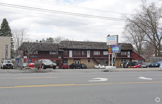
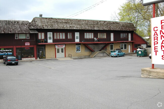
Property Record
2040 State St, Schenectady, NY 12304

NEARBY LISTINGS FOR SALE OR LEASE
Property Detail
2040 State St
060-056-0002-007-001-0000
24,25,26,P/O23 2 BLK AND WD AND STR
Warehouse
Schenectady
X
New York
36001C0044D
7.001
2025
0.65 AC
2024
Outer Schenectady County
021802
Albany/Schenectady/Troy
11,904 SF
Albany-Schenectady-Troy, NY
DEMOGRAPHICS near 2040 State St
1 Mile
3 Mile
5 Mile
2024 Total Population
8,060
75,288
151,501
2029 Population
8,440
78,262
157,518
Pop Growth 2024-2029
+ 4.71%
+ 3.95%
+ 3.97%
Average Age
44
40
41
2024 Total Households
3,549
30,133
61,865
HH Growth 2024-2029
+ 4.79%
+ 4.10%
+ 4.23%
Median Household Inc
$75,589
$76,396
$75,314
Avg Household Size
2.20
2.40
2.30
2024 Avg HH Vehicles
2.00
2.00
2.00
Median Home Value
$167,586
$191,836
$206,047
Median Year Built
1957
1954
1956
Nearby Places
Map Layers
Map Styles
 Street
 Aerial
- Restaurants
- Banks
- Shops
- Fitness
- Groceries
PUBLIC TRANSPORTATION
COMMUTER RAIL
DRIVE
WALK
Distance
10 min
4.8 mi
AIRPORT
Albany International
DRIVE
WALK
Distance
Albany International
17 min
8.4 mi
SALE & LEASE HISTORY
LISTING DATE
SALE/LEASE

Sep 25, 2016
For Lease
Nearby Properties
Address
Land Use
TOTAL SIZE
Lot Size
Zoning
Address
Land Use
TOTAL SIZE
Lot Size
Zoning
11,700 SF
43.80 AC
R2
Address
Land Use
TOTAL SIZE
Lot Size
Zoning
184,878 SF
15.58 AC
03 - MULTI
Address
Land Use
TOTAL SIZE
Lot Size
Zoning
102,862 SF
32.45 AC
CS
Address
Land Use
TOTAL SIZE
Lot Size
Zoning
120,755 SF
33.88 AC
R1
Address
Land Use
TOTAL SIZE
Lot Size
Zoning
234,485 SF
42.50 AC
02 - SINGL
Address
Land Use
TOTAL SIZE
Lot Size
Zoning
284,171 SF
16.40 AC
03 - MULTI
Address
Land Use
TOTAL SIZE
Lot Size
Zoning
67,526 SF
9.40 AC
R1
Address
Land Use
TOTAL SIZE
Lot Size
Zoning
4,680 SF
11.39 AC
CH
Address
Land Use
TOTAL SIZE
Lot Size
Zoning
78,326 SF
27.47 AC
R40
Address
Land Use
TOTAL SIZE
Lot Size
Zoning
117,074 SF
25.30 AC
CN
Address
Land Use
TOTAL SIZE
Lot Size
Zoning
93,846 SF
3 AC
R2
Address
Land Use
TOTAL SIZE
Lot Size
Zoning
Address
Land Use
TOTAL SIZE
Lot Size
Zoning
86,049 SF
17.10 AC
RO30
Address
Land Use
TOTAL SIZE
Lot Size
Zoning
45,896 SF
10.20 AC
03 - MULTI
Address
Land Use
TOTAL SIZE
Lot Size
Zoning
202,050 SF
20.75 AC
B-2
Address
Land Use
TOTAL SIZE
Lot Size
Zoning
79,041 SF
13.20 AC
CN
Address
Land Use
TOTAL SIZE
Lot Size
Zoning
7,216 SF
15.90 AC
03 - MULTI
Address
Land Use
TOTAL SIZE
Lot Size
Zoning
120,373 SF
9.68 AC
CS
Address
Land Use
TOTAL SIZE
Lot Size
Zoning
58,918 SF
4.35 AC
CN
Address
Land Use
TOTAL SIZE
Lot Size
Zoning
97,440 SF
8.15 AC
B-2
Address
Land Use
TOTAL SIZE
Lot Size
Zoning
111,915 SF
15.04 AC
05 - COMME
Address
Land Use
TOTAL SIZE
Lot Size
Zoning
117 AC
06 - INDUS
Address
Land Use
TOTAL SIZE
Lot Size
Zoning
78,240 SF
10.55 AC
B-2
Address
Land Use
TOTAL SIZE
Lot Size
Zoning
68,080 SF
6.22 AC
CS
Address
Land Use
TOTAL SIZE
Lot Size
Zoning
10,864 SF
17.90 AC
03 - MULTI
Address
Land Use
TOTAL SIZE
Lot Size
Zoning
6,889 SF
284.30 AC
F
Address
Land Use
TOTAL SIZE
Lot Size
Zoning
37,572 SF
1.70 AC
RP
Address
Land Use
TOTAL SIZE
Lot Size
Zoning
3,630 SF
174.59 AC
08 - GOVER
Address
Land Use
TOTAL SIZE
Lot Size
Zoning
13,568 SF
11.54 AC
R2
Address
Land Use
TOTAL SIZE
Lot Size
Zoning
6,944 SF
13.02 AC
R3
The World's #1 Commercial Real Estate Marketplace
Connect with us
© 2025 CoStar Group
The information above has been obtained from sources believed reliable. While we do not doubt its accuracy we have not verified it and make no guarantee, warranty or representation about it. It is your responsibility to independently confirm its accuracy and completeness. Any projections, opinions, assumptions, or estimates used are for example only and do not represent the current or future performance of the property. The value of this transaction to you depends on tax and other factors which should be evaluated by your tax, financial, and legal advisors. You and your advisors should conduct a careful, independent investigation of the property to determine to your satisfaction the suitability of the property for your needs.