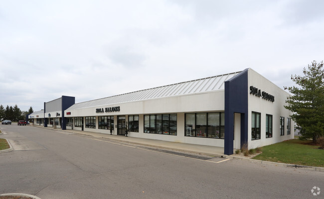
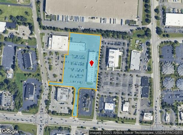
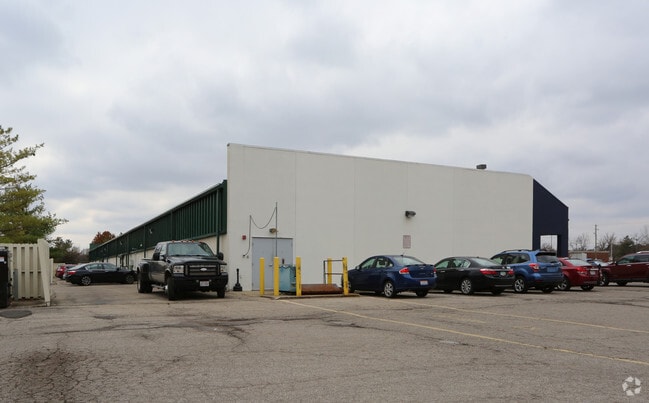
Property Record
2040 Stringtown Rd, Grove City, OH 43123
NEARBY LISTINGS FOR SALE OR LEASE
Property Detail
2040 Stringtown Rd
Columbus, OH
Park Square
040-009219
MCDOWELL ROAD PARK SQUARES LOT 4 4.5070 ACS
Regionalshoppingcenterormallwithanchorstore
Franklin
X
Ohio
39049C0318K
4 4
2024
4.51 AC
2025
Southwest
009756
Columbus
30,600 SF
DEMOGRAPHICS near 2040 Stringtown Rd
1 mile
3 mile
5 mile
2024 Total Population
8,520
55,953
146,334
2029 Population
8,530
56,194
146,848
Pop Growth 2024-2029
+ 0.12%
+ 0.43%
+ 0.35%
Average Age
42
40
39
2024 Total Households
3,601
21,620
55,735
HH Growth 2024-2029
+ 0.08%
+ 0.44%
+ 0.31%
Median Household Inc
$74,942
$79,300
$65,338
Avg Household Size
2.30
2.50
2.50
2024 Avg HH Vehicles
2.00
2.00
2.00
Median Home Value
$245,992
$233,002
$188,353
Median Year Built
1989
1992
1976
Nearby Places
Map Layers
Map Styles
 Street
 Aerial
Transit
 Traffic
 Biking
Places
Listings with unknown addresses are not visible on the map
- Restaurants
- Banks
- Shops
- Fitness
- Groceries
PUBLIC TRANSPORTATION
AIRPORT
Rickenbacker International
Drive
Walk
Distance
Rickenbacker International
21 min
11.6 mi
John Glenn Columbus International
Drive
Walk
Distance
John Glenn Columbus International
23 min
15.1 mi
SALE & LEASE HISTORY
LISTING DATE
SALE/LEASE

Sep 25, 2016
For Lease
Feb 21, 2017
For Lease
Aug 10, 2017
For Lease
Aug 01, 2019
For Lease
Nearby Properties
Address
Land Use
TOTAL SIZE
Lot Size
Zoning
Address
Land Use
TOTAL SIZE
Lot Size
Zoning
844,679 SF
61.71 AC
Address
Land Use
TOTAL SIZE
Lot Size
Zoning
382.42 AC
Address
Land Use
TOTAL SIZE
Lot Size
Zoning
1,058 SF
0.03 AC
Address
Land Use
TOTAL SIZE
Lot Size
Zoning
125,467 SF
20.61 AC
Address
Land Use
TOTAL SIZE
Lot Size
Zoning
928,228 SF
39.80 AC
Address
Land Use
TOTAL SIZE
Lot Size
Zoning
1,178,014 SF
152.63 AC
Address
Land Use
TOTAL SIZE
Lot Size
Zoning
170,028 SF
13.66 AC
Address
Land Use
TOTAL SIZE
Lot Size
Zoning
749,152 SF
41.23 AC
Address
Land Use
TOTAL SIZE
Lot Size
Zoning
128,263 SF
6.59 AC
Address
Land Use
TOTAL SIZE
Lot Size
Zoning
169,252 SF
22.06 AC
Address
Land Use
TOTAL SIZE
Lot Size
Zoning
227,844 SF
21.57 AC
Address
Land Use
TOTAL SIZE
Lot Size
Zoning
493,000 SF
29.55 AC
Address
Land Use
TOTAL SIZE
Lot Size
Zoning
46,692 SF
22.40 AC
Address
Land Use
TOTAL SIZE
Lot Size
Zoning
122,159 SF
2.77 AC
Address
Land Use
TOTAL SIZE
Lot Size
Zoning
322,000 SF
22.14 AC
Address
Land Use
TOTAL SIZE
Lot Size
Zoning
408,294 SF
26.64 AC
Address
Land Use
TOTAL SIZE
Lot Size
Zoning
322,000 SF
18.83 AC
Address
Land Use
TOTAL SIZE
Lot Size
Zoning
542,043 SF
30.41 AC
Address
Land Use
TOTAL SIZE
Lot Size
Zoning
407,124 SF
41.33 AC
Address
Land Use
TOTAL SIZE
Lot Size
Zoning
227,576 SF
52.33 AC
Address
Land Use
TOTAL SIZE
Lot Size
Zoning
377,124 SF
19.58 AC
Address
Land Use
TOTAL SIZE
Lot Size
Zoning
399,784 SF
20.86 AC
Address
Land Use
TOTAL SIZE
Lot Size
Zoning
60,893 SF
19.92 AC
Address
Land Use
TOTAL SIZE
Lot Size
Zoning
137,488 SF
13.44 AC
Address
Land Use
TOTAL SIZE
Lot Size
Zoning
227,826 SF
15.68 AC
Address
Land Use
TOTAL SIZE
Lot Size
Zoning
132,379 SF
15.46 AC
Address
Land Use
TOTAL SIZE
Lot Size
Zoning
61,595 SF
9.75 AC
Address
Land Use
TOTAL SIZE
Lot Size
Zoning
36,877 SF
21.13 AC
Address
Land Use
TOTAL SIZE
Lot Size
Zoning
221,616 SF
10.62 AC
Address
Land Use
TOTAL SIZE
Lot Size
Zoning
81,687 SF
10.19 AC
The World's #1 Commercial Real Estate Marketplace
Connect with us
© 2026 CoStar Group
The information above has been obtained from sources believed reliable. While we do not doubt its accuracy we have not verified it and make no guarantee, warranty or representation about it. It is your responsibility to independently confirm its accuracy and completeness. Any projections, opinions, assumptions, or estimates used are for example only and do not represent the current or future performance of the property. The value of this transaction to you depends on tax and other factors which should be evaluated by your tax, financial, and legal advisors. You and your advisors should conduct a careful, independent investigation of the property to determine to your satisfaction the suitability of the property for your needs.