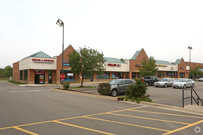
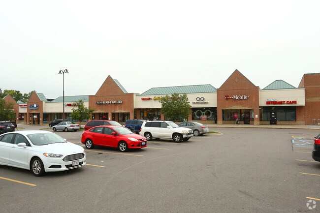
Property Record
2040 Whittaker Rd, Ypsilanti, MI 48197
NEARBY LISTINGS FOR SALE OR LEASE
Property Detail
2040 Whittaker Rd
11-21-200-041
COMMING AT THE WEST 1/4 CORNER OF SECTION 21, THENCE N 01-39-27 W 367.32' ALONG THE WEST LINE OF SAID SECTION 21; THENCE N
Commercialnec
Washtenaw
X
Michigan
26161C0430E
6.69 AC
0
Washtenaw E of 23
2025
Detroit
413403
Ann Arbor, MI
26,840 SF
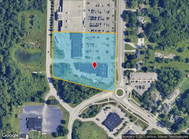
DEMOGRAPHICS near 2040 Whittaker Rd
1 Mile
3 Mile
5 Mile
2024 Total Population
1,717
61,909
122,028
2029 Population
1,697
61,112
120,618
Pop Growth 2024-2029
(1.16%)
(1.29%)
(1.16%)
Average Age
41
37
38
2024 Total Households
642
25,365
50,395
HH Growth 2024-2029
(1.25%)
(1.41%)
(1.32%)
Median Household Inc
$112,640
$62,875
$59,610
Avg Household Size
2.60
2.30
2.30
2024 Avg HH Vehicles
2.00
2.00
2.00
Median Home Value
$255,078
$214,857
$215,077
Median Year Built
1981
1973
1975
Nearby Places
Map Layers
Map Styles
 Street
 Aerial
- Restaurants
- Banks
- Shops
- Fitness
- Groceries
PUBLIC TRANSPORTATION
AIRPORT
Detroit Metro Wayne County
DRIVE
WALK
Distance
Detroit Metro Wayne County
28 min
19.7 mi
Windsor International
DRIVE
WALK
Distance
Windsor International
66 min
45.2 mi
Freight Ports
DRIVE
WALK
Distance
74 min
59.5 mi
SALE & LEASE HISTORY
LISTING DATE
SALE/LEASE

Mar 24, 2017
For Lease
Nearby Properties
Address
Land Use
TOTAL SIZE
Lot Size
Zoning
Address
Land Use
TOTAL SIZE
Lot Size
Zoning
38,001 SF
177.04 AC
BA
Address
Land Use
TOTAL SIZE
Lot Size
Zoning
17,672 SF
33.37 AC
BI
Address
Land Use
TOTAL SIZE
Lot Size
Zoning
27,603 SF
35.42 AC
BI
Address
Land Use
TOTAL SIZE
Lot Size
Zoning
13,224 SF
24.30 AC
BI
Address
Land Use
TOTAL SIZE
Lot Size
Zoning
97.69 AC
Address
Land Use
TOTAL SIZE
Lot Size
Zoning
18,110 SF
14.80 AC
BI
Address
Land Use
TOTAL SIZE
Lot Size
Zoning
1,344 SF
18.17 AC
SPLIT
Address
Land Use
TOTAL SIZE
Lot Size
Zoning
26,146 SF
7.35 AC
BI
Address
Land Use
TOTAL SIZE
Lot Size
Zoning
12,747 SF
22.86 AC
BA
Address
Land Use
TOTAL SIZE
Lot Size
Zoning
19,692 SF
21.22 AC
BA
Address
Land Use
TOTAL SIZE
Lot Size
Zoning
6,192 SF
19.02 AC
BA
Address
Land Use
TOTAL SIZE
Lot Size
Zoning
32,974 SF
29.96 AC
BA
Address
Land Use
TOTAL SIZE
Lot Size
Zoning
11,630 SF
17.36 AC
BA
Address
Land Use
TOTAL SIZE
Lot Size
Zoning
259,778 SF
25.39 AC
Address
Land Use
TOTAL SIZE
Lot Size
Zoning
48,756 SF
5 AC
CN
Address
Land Use
TOTAL SIZE
Lot Size
Zoning
12,747 SF
17.90 AC
BA
Address
Land Use
TOTAL SIZE
Lot Size
Zoning
1,960 SF
59.97 AC
Address
Land Use
TOTAL SIZE
Lot Size
Zoning
69,790 SF
6.35 AC
II
Address
Land Use
TOTAL SIZE
Lot Size
Zoning
Address
Land Use
TOTAL SIZE
Lot Size
Zoning
19,008 SF
9.68 AC
Address
Land Use
TOTAL SIZE
Lot Size
Zoning
11.42 AC
Address
Land Use
TOTAL SIZE
Lot Size
Zoning
76,719 SF
11.69 AC
HHS
Address
Land Use
TOTAL SIZE
Lot Size
Zoning
4,636 SF
18.91 AC
Address
Land Use
TOTAL SIZE
Lot Size
Zoning
3.87 AC
R-4
Address
Land Use
TOTAL SIZE
Lot Size
Zoning
Address
Land Use
TOTAL SIZE
Lot Size
Zoning
79,744 SF
5.39 AC
Address
Land Use
TOTAL SIZE
Lot Size
Zoning
12,747 SF
7.37 AC
BA
Address
Land Use
TOTAL SIZE
Lot Size
Zoning
12,316 SF
5.51 AC
BA
Address
Land Use
TOTAL SIZE
Lot Size
Zoning
29,610 SF
9.10 AC
BA
Address
Land Use
TOTAL SIZE
Lot Size
Zoning
59,484 SF
4.06 AC
R-4
The World's #1 Commercial Real Estate Marketplace
Connect with us
© 2026 CoStar Group
The information above has been obtained from sources believed reliable. While we do not doubt its accuracy we have not verified it and make no guarantee, warranty or representation about it. It is your responsibility to independently confirm its accuracy and completeness. Any projections, opinions, assumptions, or estimates used are for example only and do not represent the current or future performance of the property. The value of this transaction to you depends on tax and other factors which should be evaluated by your tax, financial, and legal advisors. You and your advisors should conduct a careful, independent investigation of the property to determine to your satisfaction the suitability of the property for your needs.