Property Record
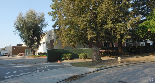
20400 Mariani Ave, Cupertino, CA 95014


NEARBY LISTINGS FOR SALE OR LEASE
Property Detail
20400 Mariani Ave
316-22-018
LOT 2
Scientificpharmaceuticalmedicalresearchfacility
Santa Clara
X
California
06087C0050E
2
2024
6.68 AC
2025
Cupertino
508101
South Bay/San Jose
103,910 SF
San Jose-Sunnyvale-Santa Clara, CA
DEMOGRAPHICS near 20400 Mariani Ave
1 Mile
3 Mile
5 Mile
2024 Total Population
27,476
212,233
484,219
2029 Population
26,467
204,426
468,433
Pop Growth 2024-2029
(3.67%)
(3.68%)
(3.26%)
Average Age
38
40
40
2024 Total Households
9,638
74,117
176,132
HH Growth 2024-2029
(3.95%)
(3.94%)
(3.43%)
Median Household Inc
$186,143
$186,236
$171,970
Avg Household Size
2.80
2.80
2.70
2024 Avg HH Vehicles
2.00
2.00
2.00
Median Home Value
$1,137,375
$1,137,625
$1,131,839
Median Year Built
1974
1969
1969
Nearby Places
Map Layers
Map Styles
 Street
 Aerial
- Restaurants
- Banks
- Shops
- Fitness
- Groceries
PUBLIC TRANSPORTATION
COMMUTER RAIL
Sunnyvale (Caltrain - Caltrain (Caltrain))
DRIVE
WALK
Distance
Sunnyvale (Caltrain - Caltrain (Caltrain))
10 min
3.8 mi
Lawrence (Caltrain - Caltrain (Caltrain))
DRIVE
WALK
Distance
Lawrence (Caltrain - Caltrain (Caltrain))
12 min
5.6 mi
AIRPORT
Norman Y Mineta San Jose International
DRIVE
WALK
Distance
Norman Y Mineta San Jose International
16 min
10.2 mi
San Francisco International
DRIVE
WALK
Distance
San Francisco International
41 min
31.5 mi
Metro Oakland International
DRIVE
WALK
Distance
Metro Oakland International
54 min
40.3 mi
Nearby Properties
Address
Land Use
TOTAL SIZE
Lot Size
Zoning
Address
Land Use
TOTAL SIZE
Lot Size
Zoning
2,819,800 SF
91.85 AC
CU
Address
Land Use
TOTAL SIZE
Lot Size
Zoning
57,096 SF
58.04 AC
PM0
Address
Land Use
TOTAL SIZE
Lot Size
Zoning
196,100 SF
1.32 AC
PCMR
Address
Land Use
TOTAL SIZE
Lot Size
Zoning
833,956 SF
55.15 AC
PD
Address
Land Use
TOTAL SIZE
Lot Size
Zoning
531,132 SF
21.33 AC
R4PD
Address
Land Use
TOTAL SIZE
Lot Size
Zoning
304,000 SF
6.79 AC
PM0
Address
Land Use
TOTAL SIZE
Lot Size
Zoning
146,390 SF
9.04 AC
MP
Address
Land Use
TOTAL SIZE
Lot Size
Zoning
211,024 SF
9.92 AC
P
Address
Land Use
TOTAL SIZE
Lot Size
Zoning
32.93 AC
PC
Address
Land Use
TOTAL SIZE
Lot Size
Zoning
1,016,763 SF
7.63 AC
CC
Address
Land Use
TOTAL SIZE
Lot Size
Zoning
381,064 SF
20.42 AC
R322
Address
Land Use
TOTAL SIZE
Lot Size
Zoning
141,232 SF
7.98 AC
P(CGM
Address
Land Use
TOTAL SIZE
Lot Size
Zoning
174,405 SF
9.24 AC
ML
Address
Land Use
TOTAL SIZE
Lot Size
Zoning
161,956 SF
1.30 AC
PD
Address
Land Use
TOTAL SIZE
Lot Size
Zoning
346,857 SF
4.26 AC
PD-MC
Address
Land Use
TOTAL SIZE
Lot Size
Zoning
135,840 SF
1.54 AC
PD
Address
Land Use
TOTAL SIZE
Lot Size
Zoning
342,432 SF
3.99 AC
PD-MC
Address
Land Use
TOTAL SIZE
Lot Size
Zoning
77,375 SF
8.41 AC
P(ML)
Address
Land Use
TOTAL SIZE
Lot Size
Zoning
161,375 SF
9.27 AC
PD
Address
Land Use
TOTAL SIZE
Lot Size
Zoning
182,558 SF
0.84 AC
PD
Address
Land Use
TOTAL SIZE
Lot Size
Zoning
183,074 SF
0.84 AC
PD
Address
Land Use
TOTAL SIZE
Lot Size
Zoning
15.11 AC
PC
Address
Land Use
TOTAL SIZE
Lot Size
Zoning
280,876 SF
3.10 AC
PD
Address
Land Use
TOTAL SIZE
Lot Size
Zoning
50,244 SF
6.35 AC
P(ML)
Address
Land Use
TOTAL SIZE
Lot Size
Zoning
194,053 SF
9.42 AC
R3
Address
Land Use
TOTAL SIZE
Lot Size
Zoning
5,930 SF
10.97 AC
CP
Address
Land Use
TOTAL SIZE
Lot Size
Zoning
152,462 SF
10.12 AC
R3
Address
Land Use
TOTAL SIZE
Lot Size
Zoning
226,256 SF
6.41 AC
PM
Address
Land Use
TOTAL SIZE
Lot Size
Zoning
129,898 SF
1.49 AC
PMD
The World's #1 Commercial Real Estate Marketplace
Connect with us
© 2025 CoStar Group
The information above has been obtained from sources believed reliable. While we do not doubt its accuracy we have not verified it and make no guarantee, warranty or representation about it. It is your responsibility to independently confirm its accuracy and completeness. Any projections, opinions, assumptions, or estimates used are for example only and do not represent the current or future performance of the property. The value of this transaction to you depends on tax and other factors which should be evaluated by your tax, financial, and legal advisors. You and your advisors should conduct a careful, independent investigation of the property to determine to your satisfaction the suitability of the property for your needs.