Property Record
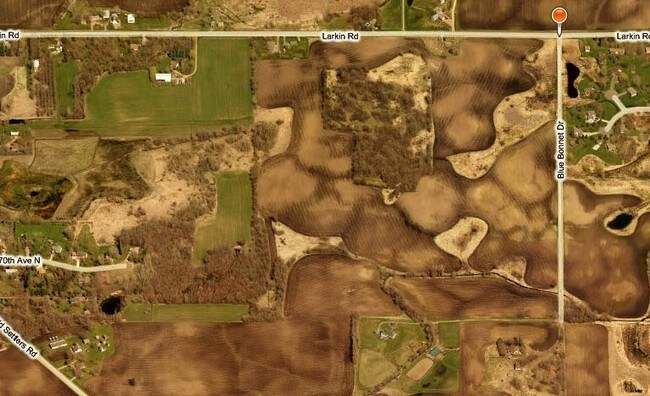
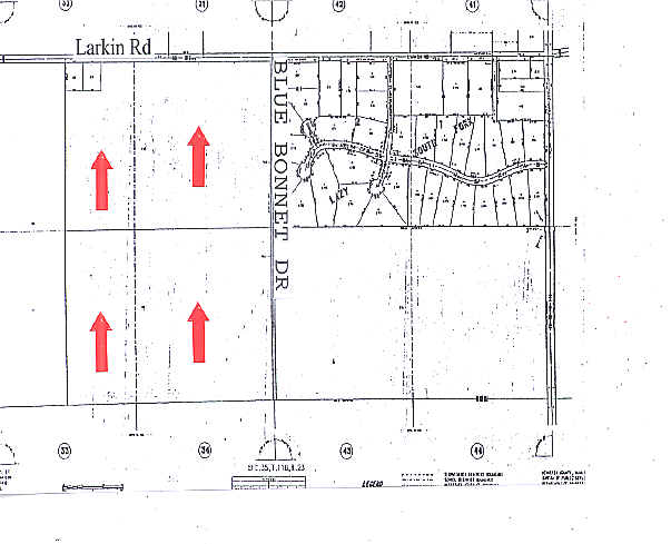
20417 Larkin Rd, Hamel, MN 55340
Property Detail
20417 Larkin Rd
Minneapolis-St. Paul-Bloomington, MN-WI
UNPLATTED 26 119 23 THAT PART OF N 1/2 OF E 3/4 OF SW 1/4 LYING S OF N 248 91/100 FT THEREOF ALSO THAT PART OF N 248 91/100 FT OF E 3/4 OF SW 1/4 T IRREGULAR
26-119-23-31-0001
HENNEPIN
Farms
Minnesota
A Areas with a 1% annual chance of flooding and a 26% chance of flooding over the life of a 30-year mortgage.
57.31 AC
2024
Northwest
2024
Minneapolis/St Paul
027102
NEARBY LISTINGS FOR SALE OR LEASE
-
-
View all Hamel listings for sale on LoopNet.com
DEMOGRAPHICS near 20417 Larkin Rd
1 mile
3 mile
5 mile
2025 Total Population
858
22,923
69,693
2030 Population
912
23,542
70,689
Pop Growth 2025-2030
+ 6.29%
+ 2.70%
+ 1.43%
Average Age
41
38
39
2025 Total Households
310
7,468
23,688
HH Growth 2025-2030
+ 6.13%
+ 2.65%
+ 1.33%
Median Household Inc
$126,000
$186,684
$168,418
Avg Household Size
2.80
3.00
2.90
2025 Avg HH Vehicles
2.00
2.00
2.00
Median Home Value
$570,988
$635,582
$573,273
Median Year Built
1996
2006
2001
Nearby Places
Map Layers
Map Styles
 Street
 Aerial
Layers
 Traffic
 Biking
Places
Listings with unknown addresses are not visible on the map
- Restaurants
- Banks
- Shops
- Fitness
- Groceries
PUBLIC TRANSPORTATION
AIRPORT
Minneapolis-St Paul International/Wold-Chamberlain
Drive
Walk
Distance
Minneapolis-St Paul International/Wold-Chamberlain
45 min
30.7 mi
Freight Ports
Port Milwaukee
Drive
Walk
Distance
Port Milwaukee
403 min
360.5 mi
Nearby Properties
Address
Land Use
TOTAL SIZE
Lot Size
Zoning
Address
Land Use
TOTAL SIZE
Lot Size
Zoning
Address
Land Use
TOTAL SIZE
Lot Size
Zoning
Address
Land Use
TOTAL SIZE
Lot Size
Zoning
21.09 AC
Address
Land Use
TOTAL SIZE
Lot Size
Zoning
Address
Land Use
TOTAL SIZE
Lot Size
Zoning
25.53 AC
Address
Land Use
TOTAL SIZE
Lot Size
Zoning
32.70 AC
Address
Land Use
TOTAL SIZE
Lot Size
Zoning
25.11 AC
Address
Land Use
TOTAL SIZE
Lot Size
Zoning
12.89 AC
Address
Land Use
TOTAL SIZE
Lot Size
Zoning
11.19 AC
Address
Land Use
TOTAL SIZE
Lot Size
Zoning
33.02 AC
Address
Land Use
TOTAL SIZE
Lot Size
Zoning
Address
Land Use
TOTAL SIZE
Lot Size
Zoning
Address
Land Use
TOTAL SIZE
Lot Size
Zoning
Address
Land Use
TOTAL SIZE
Lot Size
Zoning
42.54 AC
Address
Land Use
TOTAL SIZE
Lot Size
Zoning
26.54 AC
Address
Land Use
TOTAL SIZE
Lot Size
Zoning
11.52 AC
Address
Land Use
TOTAL SIZE
Lot Size
Zoning
10.79 AC
Address
Land Use
TOTAL SIZE
Lot Size
Zoning
9.82 AC
Address
Land Use
TOTAL SIZE
Lot Size
Zoning
3.85 AC
Address
Land Use
TOTAL SIZE
Lot Size
Zoning
Address
Land Use
TOTAL SIZE
Lot Size
Zoning
5.39 AC
Address
Land Use
TOTAL SIZE
Lot Size
Zoning
198.87 AC
Address
Land Use
TOTAL SIZE
Lot Size
Zoning
16.62 AC
Address
Land Use
TOTAL SIZE
Lot Size
Zoning
5.07 AC
Address
Land Use
TOTAL SIZE
Lot Size
Zoning
131.60 AC
Address
Land Use
TOTAL SIZE
Lot Size
Zoning
Address
Land Use
TOTAL SIZE
Lot Size
Zoning
Address
Land Use
TOTAL SIZE
Lot Size
Zoning
5.06 AC
Address
Land Use
TOTAL SIZE
Lot Size
Zoning
Address
Land Use
TOTAL SIZE
Lot Size
Zoning
10.01 AC
The World's #1 Commercial Real Estate Marketplace
Connect with us
© 2026 CoStar Group
The information above has been obtained from sources believed reliable. While we do not doubt its accuracy we have not verified it and make no guarantee, warranty or representation about it. It is your responsibility to independently confirm its accuracy and completeness. Any projections, opinions, assumptions, or estimates used are for example only and do not represent the current or future performance of the property. The value of this transaction to you depends on tax and other factors which should be evaluated by your tax, financial, and legal advisors. You and your advisors should conduct a careful, independent investigation of the property to determine to your satisfaction the suitability of the property for your needs.