Property Record
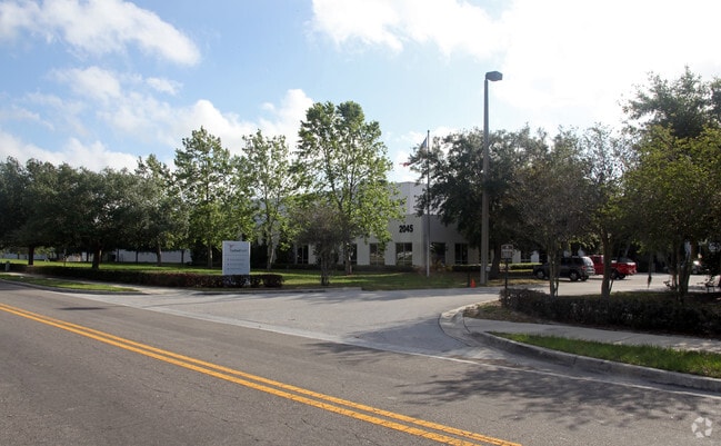
2045 Interstate Dr, Lakeland, FL 33805


NEARBY LISTINGS FOR SALE OR LEASE
Property Detail
2045 Interstate Dr
Lakeland-Winter Haven, FL
Lakeland Interstate Business Park
23-28-02-020501-000032
LAKELAND INTERSTATE BUSINESS PARK PB 81 PGS 44 THRU 48 PART OF LOT 3 DESC AS BEG SW COR OF LOT 3 & CURVE RUN NELY ALONG CURVE 2.8 FT TO REVERSE CURVE CONT NELY ALONG CURVE 166.09 FT N 613 FT E 783.81 FT S 511.38 FT S 82 DEG 34 MIN 41 SEC W 248.75 FT
Lightindustrial
Polk
X
Florida
12105C0303G
3
2024
12.08 AC
2025
Polk County
011204
Tampa/St Petersburg
202,637 SF
DEMOGRAPHICS near 2045 Interstate Dr
1 Mile
3 Mile
5 Mile
2024 Total Population
8,305
62,951
146,936
2029 Population
9,982
75,457
175,275
Pop Growth 2024-2029
+ 20.19%
+ 19.87%
+ 19.29%
Average Age
35
40
40
2024 Total Households
2,915
25,129
57,608
HH Growth 2024-2029
+ 20.10%
+ 19.92%
+ 19.53%
Median Household Inc
$34,175
$42,591
$51,077
Avg Household Size
2.70
2.30
2.40
2024 Avg HH Vehicles
1.00
1.00
2.00
Median Home Value
$149,040
$158,324
$179,786
Median Year Built
1982
1983
1983
Nearby Places
Map Layers
Map Styles
 Street
 Aerial
- Restaurants
- Banks
- Shops
- Fitness
- Groceries
PUBLIC TRANSPORTATION
COMMUTER RAIL
DRIVE
WALK
Distance
7 min
3.2 mi
AIRPORT
Tampa International
DRIVE
WALK
Distance
Tampa International
51 min
39.4 mi
Freight Ports
Port of Tampa Bay
DRIVE
WALK
Distance
Port of Tampa Bay
44 min
33.6 mi
Nearby Properties
Address
Land Use
TOTAL SIZE
Lot Size
Zoning
Address
Land Use
TOTAL SIZE
Lot Size
Zoning
2,325,080 SF
27.05 AC
PUD
Address
Land Use
TOTAL SIZE
Lot Size
Zoning
1,091,160 SF
133.41 AC
PUD
Address
Land Use
TOTAL SIZE
Lot Size
Zoning
414,112 SF
13.60 AC
MF22
Address
Land Use
TOTAL SIZE
Lot Size
Zoning
363,693 SF
22.54 AC
R2
Address
Land Use
TOTAL SIZE
Lot Size
Zoning
333,455 SF
11.90 AC
Address
Land Use
TOTAL SIZE
Lot Size
Zoning
263,185 SF
32.20 AC
C6
Address
Land Use
TOTAL SIZE
Lot Size
Zoning
1,004,426 SF
93.42 AC
C4
Address
Land Use
TOTAL SIZE
Lot Size
Zoning
279,726 SF
19.09 AC
C3
Address
Land Use
TOTAL SIZE
Lot Size
Zoning
246,838 SF
24.57 AC
PUD
Address
Land Use
TOTAL SIZE
Lot Size
Zoning
568,801 SF
37.13 AC
C4
Address
Land Use
TOTAL SIZE
Lot Size
Zoning
762,259 SF
24.95 AC
PUD
Address
Land Use
TOTAL SIZE
Lot Size
Zoning
295,706 SF
1.19 AC
Address
Land Use
TOTAL SIZE
Lot Size
Zoning
394,631 SF
32.27 AC
XX
Address
Land Use
TOTAL SIZE
Lot Size
Zoning
208,898 SF
17.62 AC
PUD
Address
Land Use
TOTAL SIZE
Lot Size
Zoning
297,600 SF
27.53 AC
XX
Address
Land Use
TOTAL SIZE
Lot Size
Zoning
309,334 SF
41.64 AC
Address
Land Use
TOTAL SIZE
Lot Size
Zoning
84,824 SF
163.73 AC
I2
Address
Land Use
TOTAL SIZE
Lot Size
Zoning
258,946 SF
11.73 AC
O3
Address
Land Use
TOTAL SIZE
Lot Size
Zoning
79,697 SF
6.37 AC
C2
Address
Land Use
TOTAL SIZE
Lot Size
Zoning
169,546 SF
14.40 AC
PUD
Address
Land Use
TOTAL SIZE
Lot Size
Zoning
226,953 SF
34.42 AC
Address
Land Use
TOTAL SIZE
Lot Size
Zoning
425,986 SF
45.72 AC
C5
Address
Land Use
TOTAL SIZE
Lot Size
Zoning
165,743 SF
17.11 AC
PUD
Address
Land Use
TOTAL SIZE
Lot Size
Zoning
171,525 SF
40.58 AC
RC
Address
Land Use
TOTAL SIZE
Lot Size
Zoning
682,828 SF
36.01 AC
Address
Land Use
TOTAL SIZE
Lot Size
Zoning
342,987 SF
16.81 AC
Address
Land Use
TOTAL SIZE
Lot Size
Zoning
115,608 SF
11.44 AC
RC
Address
Land Use
TOTAL SIZE
Lot Size
Zoning
96,412 SF
11.03 AC
I1
Address
Land Use
TOTAL SIZE
Lot Size
Zoning
156,987 SF
51.52 AC
Address
Land Use
TOTAL SIZE
Lot Size
Zoning
101,501 SF
16.54 AC
The World's #1 Commercial Real Estate Marketplace
Connect with us
© 2025 CoStar Group
The information above has been obtained from sources believed reliable. While we do not doubt its accuracy we have not verified it and make no guarantee, warranty or representation about it. It is your responsibility to independently confirm its accuracy and completeness. Any projections, opinions, assumptions, or estimates used are for example only and do not represent the current or future performance of the property. The value of this transaction to you depends on tax and other factors which should be evaluated by your tax, financial, and legal advisors. You and your advisors should conduct a careful, independent investigation of the property to determine to your satisfaction the suitability of the property for your needs.