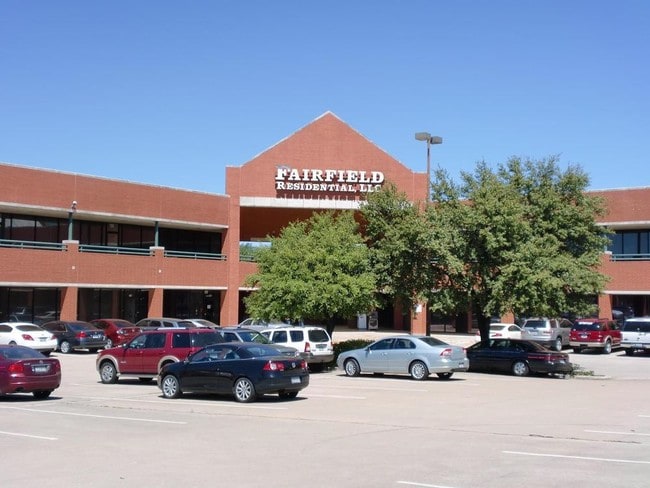
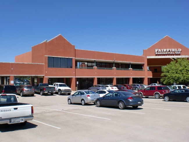
Property Record
2045 N State Highway 360, Grand Prairie, TX 75050

NEARBY LISTINGS FOR SALE OR LEASE
Property Detail
2045 N State Highway 360
Dallas-Fort Worth-Arlington, TX
Heather Ridge Addition
05767083
HEATHER RIDGE ADDITION BLOCK 6 LOT 2
Commercialnec
Tarrant
X
Texas
48439C0245L
2
2024
3.90 AC
2025
North Arlington
113116
Dallas/Ft Worth
44,453 SF
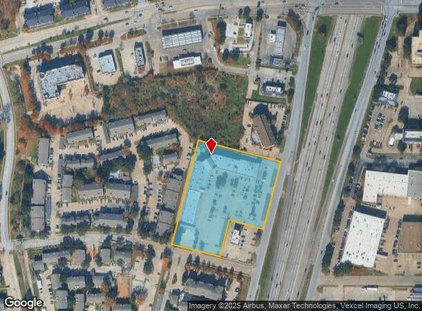
DEMOGRAPHICS near 2045 N State Highway 360
1 Mile
3 Mile
5 Mile
2024 Total Population
13,956
79,387
243,207
2029 Population
14,648
83,314
253,193
Pop Growth 2024-2029
+ 4.96%
+ 4.95%
+ 4.11%
Average Age
34
35
35
2024 Total Households
6,869
36,908
94,587
HH Growth 2024-2029
+ 5.07%
+ 5.02%
+ 4.26%
Median Household Inc
$53,136
$57,522
$53,195
Avg Household Size
2.00
2.10
2.50
2024 Avg HH Vehicles
2.00
2.00
2.00
Median Home Value
$332,908
$308,675
$242,560
Median Year Built
1987
1987
1983
Nearby Places
Map Layers
Map Styles
 Street
 Aerial
- Restaurants
- Banks
- Shops
- Fitness
- Groceries
PUBLIC TRANSPORTATION
COMMUTER RAIL
Centre Port/Dfw (TRINITY RAILWAY - Dallas Area Rapid Transit (DART), Trinity Railway Express - Dallas Area Rapid Transit (DART))
DRIVE
WALK
Distance
Centre Port/Dfw (TRINITY RAILWAY - Dallas Area Rapid Transit (DART), Trinity Railway Express - Dallas Area Rapid Transit (DART))
9 min
4.3 mi
West Tex Yard Limit (TRINITY RAILWAY - Dallas Area Rapid Transit (DART))
DRIVE
WALK
Distance
West Tex Yard Limit (TRINITY RAILWAY - Dallas Area Rapid Transit (DART))
13 min
5.3 mi
AIRPORT
Dallas-Fort Worth International
DRIVE
WALK
Distance
Dallas-Fort Worth International
17 min
10.5 mi
Dallas Love Field
DRIVE
WALK
Distance
Dallas Love Field
29 min
19.3 mi
Freight Ports
Port of Shreveport
DRIVE
WALK
Distance
Port of Shreveport
233 min
213.8 mi
SALE & LEASE HISTORY
LISTING DATE
SALE/LEASE

Sep 24, 2016
For Lease
Sep 24, 2016
For Sale
Oct 19, 2018
For Sale
Apr 19, 2019
For Lease
Nearby Properties
Address
Land Use
TOTAL SIZE
Lot Size
Zoning
Address
Land Use
TOTAL SIZE
Lot Size
Zoning
1,700,000 SF
8.23 AC
Address
Land Use
TOTAL SIZE
Lot Size
Zoning
1,400,000 SF
15.30 AC
Address
Land Use
TOTAL SIZE
Lot Size
Zoning
3,204,300 SF
124.04 AC
Address
Land Use
TOTAL SIZE
Lot Size
Zoning
378,182 SF
5.02 AC
Address
Land Use
TOTAL SIZE
Lot Size
Zoning
467,694 SF
24.03 AC
Address
Land Use
TOTAL SIZE
Lot Size
Zoning
458,819 SF
15.88 AC
Address
Land Use
TOTAL SIZE
Lot Size
Zoning
516,974 SF
23.81 AC
Address
Land Use
TOTAL SIZE
Lot Size
Zoning
485,911 SF
54.76 AC
Address
Land Use
TOTAL SIZE
Lot Size
Zoning
521,200 SF
7.99 AC
Address
Land Use
TOTAL SIZE
Lot Size
Zoning
548,095 SF
7.19 AC
Address
Land Use
TOTAL SIZE
Lot Size
Zoning
522,294 SF
18.35 AC
Address
Land Use
TOTAL SIZE
Lot Size
Zoning
1,261,810 SF
80.53 AC
Address
Land Use
TOTAL SIZE
Lot Size
Zoning
294,296 SF
12.08 AC
Address
Land Use
TOTAL SIZE
Lot Size
Zoning
324,303 SF
23.15 AC
Address
Land Use
TOTAL SIZE
Lot Size
Zoning
450,535 SF
27.23 AC
Address
Land Use
TOTAL SIZE
Lot Size
Zoning
139,821 SF
Address
Land Use
TOTAL SIZE
Lot Size
Zoning
342,583 SF
23.87 AC
Address
Land Use
TOTAL SIZE
Lot Size
Zoning
339,965 SF
15.59 AC
Address
Land Use
TOTAL SIZE
Lot Size
Zoning
576,000 SF
55.36 AC
Z123
Address
Land Use
TOTAL SIZE
Lot Size
Zoning
539,000 SF
3.91 AC
Address
Land Use
TOTAL SIZE
Lot Size
Zoning
300,915 SF
24.90 AC
Address
Land Use
TOTAL SIZE
Lot Size
Zoning
285,194 SF
15.91 AC
Address
Land Use
TOTAL SIZE
Lot Size
Zoning
313,349 SF
15.39 AC
Address
Land Use
TOTAL SIZE
Lot Size
Zoning
520,000 SF
28.92 AC
Z123
Address
Land Use
TOTAL SIZE
Lot Size
Zoning
345,216 SF
21.64 AC
Address
Land Use
TOTAL SIZE
Lot Size
Zoning
137,878 SF
189.88 AC
Address
Land Use
TOTAL SIZE
Lot Size
Zoning
334,660 SF
17.59 AC
Address
Land Use
TOTAL SIZE
Lot Size
Zoning
253,710 SF
11.50 AC
Address
Land Use
TOTAL SIZE
Lot Size
Zoning
500,256 SF
25.64 AC
Z123
Address
Land Use
TOTAL SIZE
Lot Size
Zoning
267,684 SF
11.01 AC
The World's #1 Commercial Real Estate Marketplace
Connect with us
© 2025 CoStar Group
The information above has been obtained from sources believed reliable. While we do not doubt its accuracy we have not verified it and make no guarantee, warranty or representation about it. It is your responsibility to independently confirm its accuracy and completeness. Any projections, opinions, assumptions, or estimates used are for example only and do not represent the current or future performance of the property. The value of this transaction to you depends on tax and other factors which should be evaluated by your tax, financial, and legal advisors. You and your advisors should conduct a careful, independent investigation of the property to determine to your satisfaction the suitability of the property for your needs.