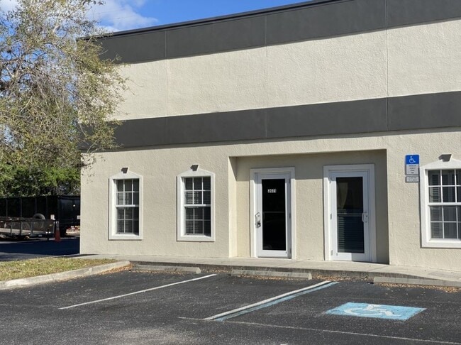
Property Record
2055 Global Ct, Sarasota, FL 34240
NEARBY LISTINGS FOR SALE OR LEASE
Property Detail
2055 Global Ct
0209-02-1201
Global Court Commons Building 2
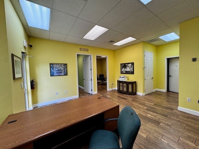
Industrialcondominium
UNIT 201, GLOBAL COURT COMMONS BUILDING 2
X
Sarasota
12115C0156G
Florida
2024
0.34 AC
2025
Sarasota Outlying
002725
Tampa/St Petersburg
1,888 SF
North Port-Sarasota-Bradenton, FL
DEMOGRAPHICS near 2055 Global Ct
1 Mile
3 Mile
5 Mile
2024 Total Population
2,017
15,380
74,085
2029 Population
2,514
18,206
85,797
Pop Growth 2024-2029
+ 24.64%
+ 18.37%
+ 15.81%
Average Age
47
47
48
2024 Total Households
796
6,256
31,891
HH Growth 2024-2029
+ 24.87%
+ 18.16%
+ 15.55%
Median Household Inc
$108,867
$104,141
$91,132
Avg Household Size
2.40
2.30
2.20
2024 Avg HH Vehicles
2.00
2.00
2.00
Median Home Value
$542,241
$461,122
$410,279
Median Year Built
2011
2004
1998
Nearby Places
- Restaurants
- Banks
- Shops
- Fitness
- Groceries
PUBLIC TRANSPORTATION
AIRPORT
Sarasota/Bradenton International
DRIVE
WALK
Distance
Sarasota/Bradenton International
27 min
15.3 mi
Freight Ports
Port Manatee
DRIVE
WALK
Distance
Port Manatee
40 min
27.8 mi
SALE & LEASE HISTORY
LISTING DATE
SALE/LEASE

Sep 25, 2016
For Lease
Jan 30, 2025
For Lease
Feb 10, 2021
For Lease
Nearby Properties
Address
Land Use
TOTAL SIZE
Lot Size
Zoning
Address
Land Use
TOTAL SIZE
Lot Size
Zoning
92,398 SF
178.58 AC
OUE1
Address
Land Use
TOTAL SIZE
Lot Size
Zoning
343,370 SF
10.77 AC
VPD
Address
Land Use
TOTAL SIZE
Lot Size
Zoning
359,089 SF
16.72 AC
PCD
Address
Land Use
TOTAL SIZE
Lot Size
Zoning
349,363 SF
22.58 AC
VPD
Address
Land Use
TOTAL SIZE
Lot Size
Zoning
343,100 SF
13.67 AC
VPD
Address
Land Use
TOTAL SIZE
Lot Size
Zoning
332,686 SF
37.78 AC
VPD
Address
Land Use
TOTAL SIZE
Lot Size
Zoning
350,210 SF
13.36 AC
PED
Address
Land Use
TOTAL SIZE
Lot Size
Zoning
268,645 SF
9.38 AC
VPD
Address
Land Use
TOTAL SIZE
Lot Size
Zoning
228,240 SF
23.48 AC
Address
Land Use
TOTAL SIZE
Lot Size
Zoning
334,284 SF
30.55 AC
RMF3
Address
Land Use
TOTAL SIZE
Lot Size
Zoning
122,380 SF
26.49 AC
VPD
Address
Land Use
TOTAL SIZE
Lot Size
Zoning
374,477 SF
15.55 AC
PED
Address
Land Use
TOTAL SIZE
Lot Size
Zoning
204,843 SF
27.48 AC
PCD
Address
Land Use
TOTAL SIZE
Lot Size
Zoning
206,326 SF
5.01 AC
VPD
Address
Land Use
TOTAL SIZE
Lot Size
Zoning
120,140 SF
5.09 AC
VPD
Address
Land Use
TOTAL SIZE
Lot Size
Zoning
128,638 SF
59.55 AC
PCD
Address
Land Use
TOTAL SIZE
Lot Size
Zoning
76,844 SF
6.79 AC
PCD
Address
Land Use
TOTAL SIZE
Lot Size
Zoning
139,916 SF
10.05 AC
PCD
Address
Land Use
TOTAL SIZE
Lot Size
Zoning
86,651 SF
22.68 AC
PED
Address
Land Use
TOTAL SIZE
Lot Size
Zoning
75,197 SF
6.46 AC
PCD
Address
Land Use
TOTAL SIZE
Lot Size
Zoning
143,277 SF
21.39 AC
PCD
Address
Land Use
TOTAL SIZE
Lot Size
Zoning
64,454 SF
2.56 AC
PED
Address
Land Use
TOTAL SIZE
Lot Size
Zoning
119,960 SF
27.91 AC
PID
Address
Land Use
TOTAL SIZE
Lot Size
Zoning
84,858 SF
6.75 AC
PCD
Address
Land Use
TOTAL SIZE
Lot Size
Zoning
78,000 SF
6.81 AC
PCD
Address
Land Use
TOTAL SIZE
Lot Size
Zoning
77,072 SF
10.17 AC
PCD
Address
Land Use
TOTAL SIZE
Lot Size
Zoning
107,734 SF
32.85 AC
GU
Address
Land Use
TOTAL SIZE
Lot Size
Zoning
146,176 SF
33.37 AC
PID
Address
Land Use
TOTAL SIZE
Lot Size
Zoning
88,921 SF
8.14 AC
RE1
Address
Land Use
TOTAL SIZE
Lot Size
Zoning
45,040 SF
3.84 AC
PCD
The World's #1 Commercial Real Estate Marketplace
Connect with us
© 2025 CoStar Group
The information above has been obtained from sources believed reliable. While we do not doubt its accuracy we have not verified it and make no guarantee, warranty or representation about it. It is your responsibility to independently confirm its accuracy and completeness. Any projections, opinions, assumptions, or estimates used are for example only and do not represent the current or future performance of the property. The value of this transaction to you depends on tax and other factors which should be evaluated by your tax, financial, and legal advisors. You and your advisors should conduct a careful, independent investigation of the property to determine to your satisfaction the suitability of the property for your needs.