Property Record
2047 Kutztown Rd, Reading, PA 19605
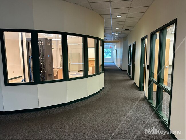
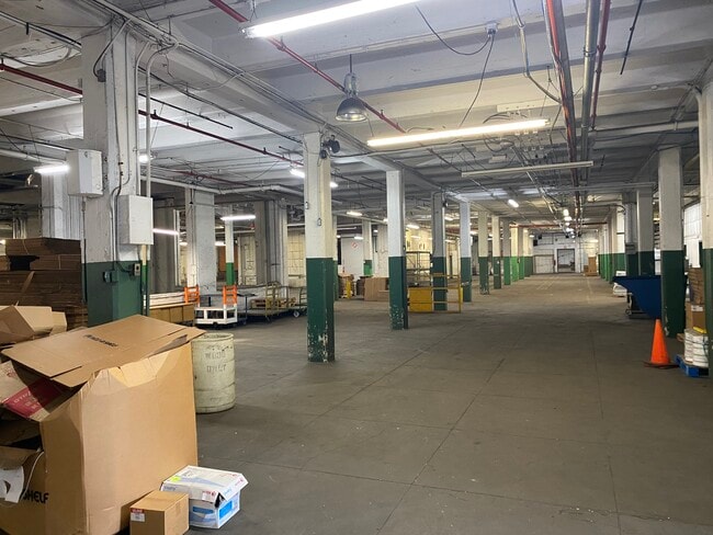
Property Detail
2047 Kutztown Rd
Officebuilding
BERKS
B and X Area of moderate flood hazard, usually the area between the limits of the 100-year and 500-year floods.
Pennsylvania
2025
Berks
2025
Philadelphia
000700
Reading, PA
16,572 SF
17-5318-17-01-5771-C01
NEARBY LISTINGS FOR SALE OR LEASE
DEMOGRAPHICS near 2047 Kutztown Rd
1 mile
3 mile
5 mile
2025 Total Population
16,718
121,351
188,182
2030 Population
17,010
123,468
192,027
Pop Growth 2025-2030
+ 1.75%
+ 1.74%
+ 2.04%
Average Age
35
37
39
2025 Total Households
5,310
43,405
68,918
HH Growth 2025-2030
+ 1.66%
+ 1.77%
+ 2.09%
Median Household Inc
$61,863
$53,093
$61,750
Avg Household Size
2.80
2.60
2.60
2025 Avg HH Vehicles
2.00
1.00
2.00
Median Home Value
$156,433
$160,228
$198,743
Median Year Built
1948
1948
1955
Nearby Places
Map Layers
Map Styles
 Street
 Aerial
Transit
 Traffic
 Biking
Places
Listings with unknown addresses are not visible on the map
- Restaurants
- Banks
- Shops
- Fitness
- Groceries
PUBLIC TRANSPORTATION
AIRPORT
Lehigh Valley International
Drive
Walk
Distance
Lehigh Valley International
57 min
37.8 mi
Freight Ports
Port of Wilmington, RI
Drive
Walk
Distance
Port of Wilmington, RI
91 min
60.7 mi
SALE & LEASE HISTORY
LISTING DATE
SALE/LEASE

Aug 15, 2024
For Sale
Nearby Properties
Address
Land Use
TOTAL SIZE
Lot Size
Zoning
Address
Land Use
TOTAL SIZE
Lot Size
Zoning
33,761 SF
4.38 AC
Address
Land Use
TOTAL SIZE
Lot Size
Zoning
609,600 SF
37.91 AC
Address
Land Use
TOTAL SIZE
Lot Size
Zoning
99,065 SF
81.29 AC
Address
Land Use
TOTAL SIZE
Lot Size
Zoning
342,332 SF
3.30 AC
Address
Land Use
TOTAL SIZE
Lot Size
Zoning
144,696 SF
7.43 AC
Address
Land Use
TOTAL SIZE
Lot Size
Zoning
141,767 SF
124.26 AC
Address
Land Use
TOTAL SIZE
Lot Size
Zoning
250,600 SF
37.61 AC
Address
Land Use
TOTAL SIZE
Lot Size
Zoning
88,576 SF
1.80 AC
Address
Land Use
TOTAL SIZE
Lot Size
Zoning
386,194 SF
29.21 AC
Address
Land Use
TOTAL SIZE
Lot Size
Zoning
209,584 SF
24.33 AC
Address
Land Use
TOTAL SIZE
Lot Size
Zoning
45,138 SF
20.34 AC
Address
Land Use
TOTAL SIZE
Lot Size
Zoning
241,410 SF
44.78 AC
Address
Land Use
TOTAL SIZE
Lot Size
Zoning
80,864 SF
10.38 AC
Address
Land Use
TOTAL SIZE
Lot Size
Zoning
178,280 SF
19.15 AC
Address
Land Use
TOTAL SIZE
Lot Size
Zoning
104,559 SF
14.14 AC
Address
Land Use
TOTAL SIZE
Lot Size
Zoning
71,271 SF
1.42 AC
Address
Land Use
TOTAL SIZE
Lot Size
Zoning
174,046 SF
6.92 AC
Address
Land Use
TOTAL SIZE
Lot Size
Zoning
116,788 SF
13.11 AC
Address
Land Use
TOTAL SIZE
Lot Size
Zoning
402,006 SF
32.46 AC
Address
Land Use
TOTAL SIZE
Lot Size
Zoning
27,055 SF
1.77 AC
Address
Land Use
TOTAL SIZE
Lot Size
Zoning
347,124 SF
19.93 AC
Address
Land Use
TOTAL SIZE
Lot Size
Zoning
158,736 SF
12.71 AC
Address
Land Use
TOTAL SIZE
Lot Size
Zoning
42,496 SF
10.43 AC
Address
Land Use
TOTAL SIZE
Lot Size
Zoning
105,272 SF
2.19 AC
Address
Land Use
TOTAL SIZE
Lot Size
Zoning
129,050 SF
Address
Land Use
TOTAL SIZE
Lot Size
Zoning
177,756 SF
13.04 AC
Address
Land Use
TOTAL SIZE
Lot Size
Zoning
57,750 SF
4.07 AC
Address
Land Use
TOTAL SIZE
Lot Size
Zoning
116,236 SF
9.39 AC
Address
Land Use
TOTAL SIZE
Lot Size
Zoning
164,648 SF
14.13 AC
Address
Land Use
TOTAL SIZE
Lot Size
Zoning
20,481 SF
1.07 AC
The World's #1 Commercial Real Estate Marketplace
Connect with us
© 2026 CoStar Group
The information above has been obtained from sources believed reliable. While we do not doubt its accuracy we have not verified it and make no guarantee, warranty or representation about it. It is your responsibility to independently confirm its accuracy and completeness. Any projections, opinions, assumptions, or estimates used are for example only and do not represent the current or future performance of the property. The value of this transaction to you depends on tax and other factors which should be evaluated by your tax, financial, and legal advisors. You and your advisors should conduct a careful, independent investigation of the property to determine to your satisfaction the suitability of the property for your needs.