Property Record
20481 E Rittenhouse Rd, Queen Creek, AZ 85142
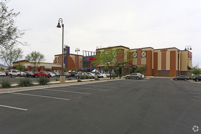

Property Detail
20481 E Rittenhouse Rd
304-67-947
QUEEN CREEK MP PHASE 1 LOTS 22 AND 23 MCR 1180-08
Regionalshoppingcenterormallwithanchorstore
MARICOPA
C-G
Arizona
C and X Area of minimal flood hazard, usually depicted on FIRMs as above the 500-year flood level.
22
2025
13.60 AC
2025
Queen Creek
816800
Phoenix
89,669 SF
Phoenix-Mesa-Chandler, AZ
NEARBY LISTINGS FOR SALE OR LEASE
-
-
-
-
No Photo
-
View all Queen Creek listings for sale on LoopNet.com
DEMOGRAPHICS near 20481 E Rittenhouse Rd
1 mile
3 mile
5 mile
2025 Total Population
9,893
58,883
165,108
2030 Population
10,585
62,843
178,840
Pop Growth 2025-2030
+ 6.99%
+ 6.73%
+ 8.32%
Average Age
35
37
37
2025 Total Households
2,913
17,346
50,476
HH Growth 2025-2030
+ 7.07%
+ 6.69%
+ 8.39%
Median Household Inc
$154,406
$138,283
$132,325
Avg Household Size
3.30
3.30
3.20
2025 Avg HH Vehicles
2.00
2.00
2.00
Median Home Value
$720,430
$676,089
$645,347
Median Year Built
2011
2010
2010
Nearby Places
Map Layers
Map Styles
 Street
 Aerial
Layers
 Traffic
 Biking
Places
Listings with unknown addresses are not visible on the map
- Restaurants
- Banks
- Shops
- Fitness
- Groceries
PUBLIC TRANSPORTATION
AIRPORT
Phoenix-Mesa Gateway
Drive
Walk
Distance
Phoenix-Mesa Gateway
9 min
4.5 mi
Phoenix Sky Harbor International
Drive
Walk
Distance
Phoenix Sky Harbor International
48 min
34.0 mi
Freight Ports
Port of San Diego
Drive
Walk
Distance
Port of San Diego
418 min
375.7 mi
Nearby Properties
Address
Land Use
TOTAL SIZE
Lot Size
Zoning
Address
Land Use
TOTAL SIZE
Lot Size
Zoning
284.14 AC
Address
Land Use
TOTAL SIZE
Lot Size
Zoning
64.72 AC
LI
Address
Land Use
TOTAL SIZE
Lot Size
Zoning
1,200,340 SF
85.82 AC
Address
Land Use
TOTAL SIZE
Lot Size
Zoning
32,858 SF
13.76 AC
C-G
Address
Land Use
TOTAL SIZE
Lot Size
Zoning
53,995 SF
10.12 AC
Address
Land Use
TOTAL SIZE
Lot Size
Zoning
1,069,038 SF
69.72 AC
Address
Land Use
TOTAL SIZE
Lot Size
Zoning
477,934 SF
24.18 AC
MU
Address
Land Use
TOTAL SIZE
Lot Size
Zoning
227,555 SF
53.44 AC
R-43
Address
Land Use
TOTAL SIZE
Lot Size
Zoning
225,990 SF
26.23 AC
I-1
Address
Land Use
TOTAL SIZE
Lot Size
Zoning
254,314 SF
23.55 AC
R-43
Address
Land Use
TOTAL SIZE
Lot Size
Zoning
21,010 SF
2.72 AC
I-1
Address
Land Use
TOTAL SIZE
Lot Size
Zoning
20,053 SF
3.86 AC
R-43
Address
Land Use
TOTAL SIZE
Lot Size
Zoning
139,348 SF
16.39 AC
R-12
Address
Land Use
TOTAL SIZE
Lot Size
Zoning
187,208 SF
34.75 AC
MDR
Address
Land Use
TOTAL SIZE
Lot Size
Zoning
614,544 SF
35.40 AC
Address
Land Use
TOTAL SIZE
Lot Size
Zoning
269,550 SF
63.63 AC
Address
Land Use
TOTAL SIZE
Lot Size
Zoning
6.02 AC
I-1
Address
Land Use
TOTAL SIZE
Lot Size
Zoning
420,631 SF
23.19 AC
Address
Land Use
TOTAL SIZE
Lot Size
Zoning
178,266 SF
16.32 AC
Address
Land Use
TOTAL SIZE
Lot Size
Zoning
121,297 SF
27.91 AC
Address
Land Use
TOTAL SIZE
Lot Size
Zoning
270,126 SF
12.65 AC
C-TC
Address
Land Use
TOTAL SIZE
Lot Size
Zoning
335,066 SF
20.82 AC
Address
Land Use
TOTAL SIZE
Lot Size
Zoning
163,373 SF
16.44 AC
MDR
Address
Land Use
TOTAL SIZE
Lot Size
Zoning
127,184 SF
14.80 AC
R-43
Address
Land Use
TOTAL SIZE
Lot Size
Zoning
325,706 SF
16.32 AC
M-M
Address
Land Use
TOTAL SIZE
Lot Size
Zoning
117,552 SF
30.35 AC
R143
Address
Land Use
TOTAL SIZE
Lot Size
Zoning
110,880 SF
4.03 AC
R-C
Address
Land Use
TOTAL SIZE
Lot Size
Zoning
216,568 SF
22.18 AC
C-G
Address
Land Use
TOTAL SIZE
Lot Size
Zoning
95,413 SF
11.30 AC
R-43
The World's #1 Commercial Real Estate Marketplace
Connect with us
© 2026 CoStar Group
The information above has been obtained from sources believed reliable. While we do not doubt its accuracy we have not verified it and make no guarantee, warranty or representation about it. It is your responsibility to independently confirm its accuracy and completeness. Any projections, opinions, assumptions, or estimates used are for example only and do not represent the current or future performance of the property. The value of this transaction to you depends on tax and other factors which should be evaluated by your tax, financial, and legal advisors. You and your advisors should conduct a careful, independent investigation of the property to determine to your satisfaction the suitability of the property for your needs.