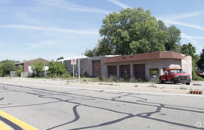
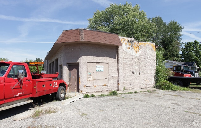
Property Record
20496 Capital Ave Ne, Battle Creek, MI 49017

NEARBY LISTINGS FOR SALE OR LEASE
-
-
View all Battle Creek listings for sale on LoopNet.com
Property Detail
20496 Capital Ave Ne
18-020-575-10
PENNFIELD CHARTER TOWNSHIP T1S R7W SEC 20 THAT PART OF THE NE 1/4 OF SEC 20 PENNFIELD TOWNSHIP COMMENCING AT THE EAST 1/4 COR
Storebuilding
Calhoun
X
Michigan
26025C0182C
1.78 AC
2024
Battle Crk/W Calhoun Cnty
2025
West Michigan
002300
Battle Creek, MI
9,100 SF
DEMOGRAPHICS near 20496 Capital Ave Ne
1 Mile
3 Mile
5 Mile
2024 Total Population
638
13,285
46,314
2029 Population
625
13,059
46,057
Pop Growth 2024-2029
(2.04%)
(1.70%)
(0.55%)
Average Age
42
42
39
2024 Total Households
256
5,538
18,721
HH Growth 2024-2029
(1.95%)
(1.70%)
(0.61%)
Median Household Inc
$73,928
$52,137
$45,979
Avg Household Size
2.50
2.30
2.40
2024 Avg HH Vehicles
2.00
2.00
2.00
Median Home Value
$150,352
$130,241
$99,478
Median Year Built
1962
1960
1957
Nearby Places
Map Layers
Map Styles
 Street
 Aerial
- Restaurants
- Banks
- Shops
- Fitness
- Groceries
PUBLIC TRANSPORTATION
COMMUTER RAIL
Battle Creek (Blue Water - Amtrak, Wolverine - Amtrak)
DRIVE
WALK
Distance
Battle Creek (Blue Water - Amtrak, Wolverine - Amtrak)
12 min
5.6 mi
AIRPORT
Kalamazoo/Battle Creek International
DRIVE
WALK
Distance
Kalamazoo/Battle Creek International
46 min
30.5 mi
Freight Ports
Port of Toledo
DRIVE
WALK
Distance
Port of Toledo
162 min
127.2 mi
SALE & LEASE HISTORY
LISTING DATE
SALE/LEASE

Sep 23, 2016
For Sale
Nearby Properties
Address
Land Use
TOTAL SIZE
Lot Size
Zoning
Address
Land Use
TOTAL SIZE
Lot Size
Zoning
52,764 SF
3.52 AC
AG
Address
Land Use
TOTAL SIZE
Lot Size
Zoning
158,786 SF
22.52 AC
HDR
Address
Land Use
TOTAL SIZE
Lot Size
Zoning
60,544 SF
5.96 AC
HDR
Address
Land Use
TOTAL SIZE
Lot Size
Zoning
48,192 SF
1.86 AC
T3
Address
Land Use
TOTAL SIZE
Lot Size
Zoning
25,200 SF
1.39 AC
MFR
Address
Land Use
TOTAL SIZE
Lot Size
Zoning
41,795 SF
2.55 AC
MFR
Address
Land Use
TOTAL SIZE
Lot Size
Zoning
14,550 SF
1.10 AC
T3
Address
Land Use
TOTAL SIZE
Lot Size
Zoning
52,441 SF
5.21 AC
GC
Address
Land Use
TOTAL SIZE
Lot Size
Zoning
40,918 SF
97.87 AC
LI
Address
Land Use
TOTAL SIZE
Lot Size
Zoning
14,866 SF
1.84 AC
T3
Address
Land Use
TOTAL SIZE
Lot Size
Zoning
14,376 SF
13.82 AC
LMR
Address
Land Use
TOTAL SIZE
Lot Size
Zoning
46,500 SF
6.90 AC
GC
Address
Land Use
TOTAL SIZE
Lot Size
Zoning
5,784 SF
1.86 AC
GC
Address
Land Use
TOTAL SIZE
Lot Size
Zoning
10,680 SF
2.06 AC
GC
Address
Land Use
TOTAL SIZE
Lot Size
Zoning
36,864 SF
4.72 AC
HDR
Address
Land Use
TOTAL SIZE
Lot Size
Zoning
13,120 SF
0.60 AC
MFR
Address
Land Use
TOTAL SIZE
Lot Size
Zoning
13,803 SF
0.66 AC
MFR
Address
Land Use
TOTAL SIZE
Lot Size
Zoning
35,712 SF
7.51 AC
HDR
Address
Land Use
TOTAL SIZE
Lot Size
Zoning
57,808 SF
6.92 AC
GC
Address
Land Use
TOTAL SIZE
Lot Size
Zoning
10,520 SF
0.96 AC
T3
Address
Land Use
TOTAL SIZE
Lot Size
Zoning
12,409 SF
1.47 AC
T3
Address
Land Use
TOTAL SIZE
Lot Size
Zoning
187 AC
RR
Address
Land Use
TOTAL SIZE
Lot Size
Zoning
9,240 SF
4.35 AC
LI
Address
Land Use
TOTAL SIZE
Lot Size
Zoning
9,471 SF
1.40 AC
T3
Address
Land Use
TOTAL SIZE
Lot Size
Zoning
20,784 SF
2.76 AC
HDR
Address
Land Use
TOTAL SIZE
Lot Size
Zoning
13,524 SF
0.80 AC
R3
Address
Land Use
TOTAL SIZE
Lot Size
Zoning
2,799 SF
1.30 AC
GC
Address
Land Use
TOTAL SIZE
Lot Size
Zoning
3,913 SF
0.58 AC
T3
Address
Land Use
TOTAL SIZE
Lot Size
Zoning
9,170 SF
1.46 AC
R1B
The World's #1 Commercial Real Estate Marketplace
Connect with us
© 2026 CoStar Group
The information above has been obtained from sources believed reliable. While we do not doubt its accuracy we have not verified it and make no guarantee, warranty or representation about it. It is your responsibility to independently confirm its accuracy and completeness. Any projections, opinions, assumptions, or estimates used are for example only and do not represent the current or future performance of the property. The value of this transaction to you depends on tax and other factors which should be evaluated by your tax, financial, and legal advisors. You and your advisors should conduct a careful, independent investigation of the property to determine to your satisfaction the suitability of the property for your needs.