Property Record
205 Blanton Rd, Lakeland, FL 33809
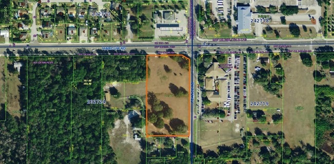

Property Detail
205 Blanton Rd
23-27-24-000000-011009
N1/2 OF E 330 FT OF NE1/4 OF NE1/4 LESS E 20 FT FOR RD & LESS MAINT R/W FOR MARCUM RD & LESS ADDL RD R/W & LESS ADDL R/W FOR MARCUM RD AS DESC IN OR 5045 PG 1026
Residentialacreage
Polk
RE1
Florida
B and X Area of moderate flood hazard, usually the area between the limits of the 100-year and 500-year floods.
0.75 AC
2025
Polk County
2025
Tampa/St Petersburg
012208
Lakeland-Winter Haven, FL
1,104 SF
NEARBY LISTINGS FOR SALE OR LEASE
DEMOGRAPHICS near 205 Blanton Rd
1 mile
3 mile
5 mile
2025 Total Population
7,732
58,143
105,609
2030 Population
8,676
65,944
119,898
Pop Growth 2025-2030
+ 12.21%
+ 13.42%
+ 13.53%
Average Age
42
42
41
2025 Total Households
3,082
23,225
40,673
HH Growth 2025-2030
+ 12.52%
+ 13.67%
+ 13.80%
Median Household Inc
$63,663
$72,593
$69,028
Avg Household Size
2.50
2.40
2.50
2025 Avg HH Vehicles
2.00
2.00
2.00
Median Home Value
$273,869
$319,580
$296,169
Median Year Built
1987
1994
1994
Nearby Places
Map Layers
Map Styles
 Street
 Aerial
Layers
 Traffic
 Biking
Places
Listings with unknown addresses are not visible on the map
- Restaurants
- Banks
- Shops
- Fitness
- Groceries
PUBLIC TRANSPORTATION
COMMUTER RAIL
Lakeland (Silver Star - Amtrak)
Drive
Walk
Distance
Lakeland (Silver Star - Amtrak)
13 min
6.9 mi
Freight Ports
Port of Tampa Bay
Drive
Walk
Distance
Port of Tampa Bay
49 min
38.4 mi
SALE & LEASE HISTORY
LISTING DATE
SALE/LEASE

Sep 24, 2016
For Sale
Nov 07, 2019
For Sale
Nearby Properties
Address
Land Use
TOTAL SIZE
Lot Size
Zoning
Address
Land Use
TOTAL SIZE
Lot Size
Zoning
493,501 SF
39.01 AC
MF12
Address
Land Use
TOTAL SIZE
Lot Size
Zoning
470,032 SF
23.21 AC
Address
Land Use
TOTAL SIZE
Lot Size
Zoning
1,091,160 SF
133.41 AC
PUD
Address
Land Use
TOTAL SIZE
Lot Size
Zoning
363,693 SF
22.54 AC
R2
Address
Land Use
TOTAL SIZE
Lot Size
Zoning
358,929 SF
65.46 AC
XX
Address
Land Use
TOTAL SIZE
Lot Size
Zoning
361,669 SF
12.73 AC
Address
Land Use
TOTAL SIZE
Lot Size
Zoning
245,853 SF
20.09 AC
Address
Land Use
TOTAL SIZE
Lot Size
Zoning
246,838 SF
24.57 AC
PUD
Address
Land Use
TOTAL SIZE
Lot Size
Zoning
762,259 SF
24.95 AC
PUD
Address
Land Use
TOTAL SIZE
Lot Size
Zoning
338,930 SF
24.33 AC
Address
Land Use
TOTAL SIZE
Lot Size
Zoning
208,898 SF
17.62 AC
PUD
Address
Land Use
TOTAL SIZE
Lot Size
Zoning
324,191 SF
23.37 AC
PUD
Address
Land Use
TOTAL SIZE
Lot Size
Zoning
169,546 SF
14.40 AC
PUD
Address
Land Use
TOTAL SIZE
Lot Size
Zoning
226,953 SF
34.42 AC
Address
Land Use
TOTAL SIZE
Lot Size
Zoning
425,986 SF
45.72 AC
C5
Address
Land Use
TOTAL SIZE
Lot Size
Zoning
171,525 SF
40.58 AC
RC
Address
Land Use
TOTAL SIZE
Lot Size
Zoning
115,608 SF
11.44 AC
RC
Address
Land Use
TOTAL SIZE
Lot Size
Zoning
142,936 SF
26.38 AC
Address
Land Use
TOTAL SIZE
Lot Size
Zoning
101,501 SF
16.54 AC
Address
Land Use
TOTAL SIZE
Lot Size
Zoning
226,634 SF
27.21 AC
C3
Address
Land Use
TOTAL SIZE
Lot Size
Zoning
183,800 SF
19.26 AC
Address
Land Use
TOTAL SIZE
Lot Size
Zoning
206,724 SF
66.04 AC
RC
Address
Land Use
TOTAL SIZE
Lot Size
Zoning
118,250 SF
23.12 AC
Address
Land Use
TOTAL SIZE
Lot Size
Zoning
152,004 SF
15.81 AC
PUD
Address
Land Use
TOTAL SIZE
Lot Size
Zoning
149,871 SF
7.45 AC
PUD
Address
Land Use
TOTAL SIZE
Lot Size
Zoning
97,055 SF
7.21 AC
R4
Address
Land Use
TOTAL SIZE
Lot Size
Zoning
100,740 SF
17.62 AC
RC
Address
Land Use
TOTAL SIZE
Lot Size
Zoning
76,912 SF
7.09 AC
PUD
Address
Land Use
TOTAL SIZE
Lot Size
Zoning
96,768 SF
13.49 AC
C4
Address
Land Use
TOTAL SIZE
Lot Size
Zoning
122,079 SF
11.92 AC
The World's #1 Commercial Real Estate Marketplace
Connect with us
© 2026 CoStar Group
The information above has been obtained from sources believed reliable. While we do not doubt its accuracy we have not verified it and make no guarantee, warranty or representation about it. It is your responsibility to independently confirm its accuracy and completeness. Any projections, opinions, assumptions, or estimates used are for example only and do not represent the current or future performance of the property. The value of this transaction to you depends on tax and other factors which should be evaluated by your tax, financial, and legal advisors. You and your advisors should conduct a careful, independent investigation of the property to determine to your satisfaction the suitability of the property for your needs.