Property Record
205 Calhoun St, Cincinnati, OH 45219
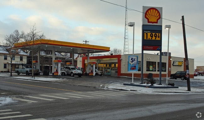


Property Detail
205 Calhoun St
102-0005-0228
OHIO CALHOUN 177.60X125 LT 1THR5 PT LOT 6-7 M A STOUTS SUB PARS 228TH233-313-307 CONS
Servicestationmarket
Hamilton
CCM
Ohio
B and X Area of moderate flood hazard, usually the area between the limits of the 100-year and 500-year floods.
1,6-7
2025
0.46 AC
2025
Clifton/Midtown
002500
Cincinnati/Dayton
2,094 SF
Cincinnati, OH-KY-IN
NEARBY LISTINGS FOR SALE OR LEASE
DEMOGRAPHICS near 205 Calhoun St
1 mile
3 mile
5 mile
2025 Total Population
34,675
153,341
346,309
2030 Population
35,768
158,368
354,450
Pop Growth 2025-2030
+ 3.15%
+ 3.28%
+ 2.35%
Average Age
29
36
37
2025 Total Households
12,549
69,029
153,317
HH Growth 2025-2030
+ 3.90%
+ 3.53%
+ 2.47%
Median Household Inc
$40,405
$52,392
$56,938
Avg Household Size
2.00
1.90
2.10
2025 Avg HH Vehicles
1.00
1.00
1.00
Median Home Value
$263,712
$282,820
$253,269
Median Year Built
1950
1948
1949
Nearby Places
Map Layers
Map Styles
 Street
 Aerial
Transit
 Traffic
 Biking
Places
Listings with unknown addresses are not visible on the map
- Restaurants
- Banks
- Shops
- Fitness
- Groceries
PUBLIC TRANSPORTATION
TRANSIT/SUBWAY
Brewery District Station - Elm & Henry (Streetcar - OTR - Banks - Southwest Ohio Regional Transit Authority)
Drive
Walk
Distance
Brewery District Station - Elm & Henry (Streetcar - OTR - Banks - Southwest Ohio Regional Transit Authority)
4 min
18 min
0.9 mi
Findlay Market-Race Station - Race & Elder (Streetcar - OTR - Banks - Southwest Ohio Regional Transit Authority)
Drive
Walk
Distance
Findlay Market-Race Station - Race & Elder (Streetcar - OTR - Banks - Southwest Ohio Regional Transit Authority)
3 min
19 min
1.0 mi
COMMUTER RAIL
Cincinnati Union Terminal (Cardinal - Amtrak)
Drive
Walk
Distance
Cincinnati Union Terminal (Cardinal - Amtrak)
8 min
2.5 mi
AIRPORT
Cincinnati/Northern Kentucky International
Drive
Walk
Distance
Cincinnati/Northern Kentucky International
32 min
17.0 mi
Freight Ports
Port of Toledo
Drive
Walk
Distance
Port of Toledo
240 min
203.2 mi
Nearby Properties
Address
Land Use
TOTAL SIZE
Lot Size
Zoning
Address
Land Use
TOTAL SIZE
Lot Size
Zoning
77.73 AC
IR
Address
Land Use
TOTAL SIZE
Lot Size
Zoning
6.35 AC
IR
Address
Land Use
TOTAL SIZE
Lot Size
Zoning
39.99 AC
MG
Address
Land Use
TOTAL SIZE
Lot Size
Zoning
11.82 AC
Address
Land Use
TOTAL SIZE
Lot Size
Zoning
11.62 AC
Address
Land Use
TOTAL SIZE
Lot Size
Zoning
19.36 AC
Address
Land Use
TOTAL SIZE
Lot Size
Zoning
17.10 AC
DD
Address
Land Use
TOTAL SIZE
Lot Size
Zoning
1.97 AC
DD
Address
Land Use
TOTAL SIZE
Lot Size
Zoning
62.10 AC
Address
Land Use
TOTAL SIZE
Lot Size
Zoning
11.41 AC
IR
Address
Land Use
TOTAL SIZE
Lot Size
Zoning
22.45 AC
Address
Land Use
TOTAL SIZE
Lot Size
Zoning
13.80 AC
Address
Land Use
TOTAL SIZE
Lot Size
Zoning
2.60 AC
Address
Land Use
TOTAL SIZE
Lot Size
Zoning
9.55 AC
Address
Land Use
TOTAL SIZE
Lot Size
Zoning
3.09 AC
Address
Land Use
TOTAL SIZE
Lot Size
Zoning
2.80 AC
IR
Address
Land Use
TOTAL SIZE
Lot Size
Zoning
3.40 AC
IR
Address
Land Use
TOTAL SIZE
Lot Size
Zoning
89,500 SF
0.58 AC
Address
Land Use
TOTAL SIZE
Lot Size
Zoning
Address
Land Use
TOTAL SIZE
Lot Size
Zoning
290,233 SF
Address
Land Use
TOTAL SIZE
Lot Size
Zoning
3.51 AC
DD
Address
Land Use
TOTAL SIZE
Lot Size
Zoning
Address
Land Use
TOTAL SIZE
Lot Size
Zoning
153,312 SF
4 AC
Address
Land Use
TOTAL SIZE
Lot Size
Zoning
9.14 AC
Address
Land Use
TOTAL SIZE
Lot Size
Zoning
298,611 SF
Address
Land Use
TOTAL SIZE
Lot Size
Zoning
2.46 AC
Address
Land Use
TOTAL SIZE
Lot Size
Zoning
7.14 AC
Address
Land Use
TOTAL SIZE
Lot Size
Zoning
256,000 SF
Address
Land Use
TOTAL SIZE
Lot Size
Zoning
1.95 AC
Address
Land Use
TOTAL SIZE
Lot Size
Zoning
The World's #1 Commercial Real Estate Marketplace
Connect with us
© 2026 CoStar Group
The information above has been obtained from sources believed reliable. While we do not doubt its accuracy we have not verified it and make no guarantee, warranty or representation about it. It is your responsibility to independently confirm its accuracy and completeness. Any projections, opinions, assumptions, or estimates used are for example only and do not represent the current or future performance of the property. The value of this transaction to you depends on tax and other factors which should be evaluated by your tax, financial, and legal advisors. You and your advisors should conduct a careful, independent investigation of the property to determine to your satisfaction the suitability of the property for your needs.