Property Record
205 E 5Th St, Eureka, MO 63025
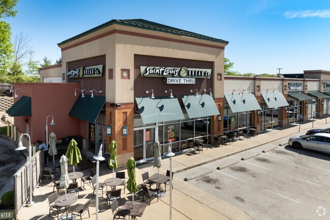

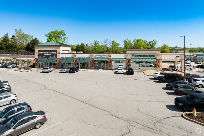
Property Detail
205 E 5Th St
29U-41-0149
BYERLY LOT 1 & SURVEY 2071-44-4 BDY ADJ (AKA EUREKA POINTE) LOT 1
Regionalshoppingcenterormallwithanchorstore
Saint Louis
H
Missouri
B and X Area of moderate flood hazard, usually the area between the limits of the 100-year and 500-year floods.
1
2024
8.25 AC
2025
Outer St Louis County
221502
St. Louis
85,759 SF
St. Louis, MO-IL
NEARBY LISTINGS FOR SALE OR LEASE
DEMOGRAPHICS near 205 E 5Th St
1 mile
3 mile
5 mile
2025 Total Population
3,084
16,981
34,046
2030 Population
3,078
17,185
34,279
Pop Growth 2025-2030
(0.19%)
+ 1.20%
+ 0.68%
Average Age
41
40
41
2025 Total Households
1,051
5,616
11,822
HH Growth 2025-2030
(0.29%)
+ 1.14%
+ 0.67%
Median Household Inc
$112,912
$133,885
$134,181
Avg Household Size
2.60
2.80
2.70
2025 Avg HH Vehicles
2.00
2.00
2.00
Median Home Value
$359,294
$404,029
$412,068
Median Year Built
1991
1997
1995
Nearby Places
Map Layers
Map Styles
 Street
 Aerial
Layers
 Traffic
 Biking
Places
Listings with unknown addresses are not visible on the map
- Restaurants
- Banks
- Shops
- Fitness
- Groceries
PUBLIC TRANSPORTATION
AIRPORT
St Louis Lambert International
Drive
Walk
Distance
St Louis Lambert International
44 min
30.4 mi
Nearby Properties
Address
Land Use
TOTAL SIZE
Lot Size
Zoning
Address
Land Use
TOTAL SIZE
Lot Size
Zoning
20,594 SF
1,905.12 AC
NU
Address
Land Use
TOTAL SIZE
Lot Size
Zoning
12,274 SF
86.91 AC
R1
Address
Land Use
TOTAL SIZE
Lot Size
Zoning
78.78 AC
107NU
Address
Land Use
TOTAL SIZE
Lot Size
Zoning
207,499 SF
10.11 AC
98R-5
Address
Land Use
TOTAL SIZE
Lot Size
Zoning
13.13 AC
Address
Land Use
TOTAL SIZE
Lot Size
Zoning
39.97 AC
98PI
Address
Land Use
TOTAL SIZE
Lot Size
Zoning
153,647 SF
22.80 AC
98C
Address
Land Use
TOTAL SIZE
Lot Size
Zoning
250,959 SF
22.13 AC
98M-1
Address
Land Use
TOTAL SIZE
Lot Size
Zoning
203,960 SF
12.88 AC
NU
Address
Land Use
TOTAL SIZE
Lot Size
Zoning
7.50 AC
98R-1
Address
Land Use
TOTAL SIZE
Lot Size
Zoning
8.30 AC
Address
Land Use
TOTAL SIZE
Lot Size
Zoning
29,960 SF
14.54 AC
NU
Address
Land Use
TOTAL SIZE
Lot Size
Zoning
899 SF
1.41 AC
R3
Address
Land Use
TOTAL SIZE
Lot Size
Zoning
27,588 SF
11.07 AC
H
Address
Land Use
TOTAL SIZE
Lot Size
Zoning
7.26 AC
R3
Address
Land Use
TOTAL SIZE
Lot Size
Zoning
7.48 AC
R4
Address
Land Use
TOTAL SIZE
Lot Size
Zoning
46,777 SF
71 AC
107NU
Address
Land Use
TOTAL SIZE
Lot Size
Zoning
46,615 SF
6.91 AC
98C
Address
Land Use
TOTAL SIZE
Lot Size
Zoning
1,530 SF
0.89 AC
Address
Land Use
TOTAL SIZE
Lot Size
Zoning
60,655 SF
2.95 AC
R-5
Address
Land Use
TOTAL SIZE
Lot Size
Zoning
99.75 AC
R1
Address
Land Use
TOTAL SIZE
Lot Size
Zoning
26,024 SF
2.65 AC
98PC
Address
Land Use
TOTAL SIZE
Lot Size
Zoning
69,225 SF
2.45 AC
98C
Address
Land Use
TOTAL SIZE
Lot Size
Zoning
9.10 AC
98R-1
Address
Land Use
TOTAL SIZE
Lot Size
Zoning
36,184 SF
13.15 AC
98R-5
Address
Land Use
TOTAL SIZE
Lot Size
Zoning
2,870 SF
245 AC
NU
Address
Land Use
TOTAL SIZE
Lot Size
Zoning
9,538 SF
17.04 AC
98M-1
Address
Land Use
TOTAL SIZE
Lot Size
Zoning
43,052 SF
112.19 AC
107NU
Address
Land Use
TOTAL SIZE
Lot Size
Zoning
76,588 SF
8.99 AC
98C
The World's #1 Commercial Real Estate Marketplace
Connect with us
© 2026 CoStar Group
The information above has been obtained from sources believed reliable. While we do not doubt its accuracy we have not verified it and make no guarantee, warranty or representation about it. It is your responsibility to independently confirm its accuracy and completeness. Any projections, opinions, assumptions, or estimates used are for example only and do not represent the current or future performance of the property. The value of this transaction to you depends on tax and other factors which should be evaluated by your tax, financial, and legal advisors. You and your advisors should conduct a careful, independent investigation of the property to determine to your satisfaction the suitability of the property for your needs.