Property Record
205 E Ash St, Junction City, KS 66441
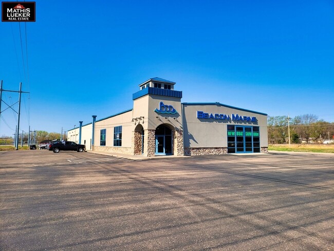

Property Detail
205 E Ash St
Manhattan, KS
JOHNSON'S 2ND ADD, POB NW COR LOT 2 E ON ROW 233; SE 166.23; SW 251.99'; W 62.66 SW 48.39; W 185.12; NE 427.17 TO POB SECTION
116-13-0-20-07-002.01-0
Geary
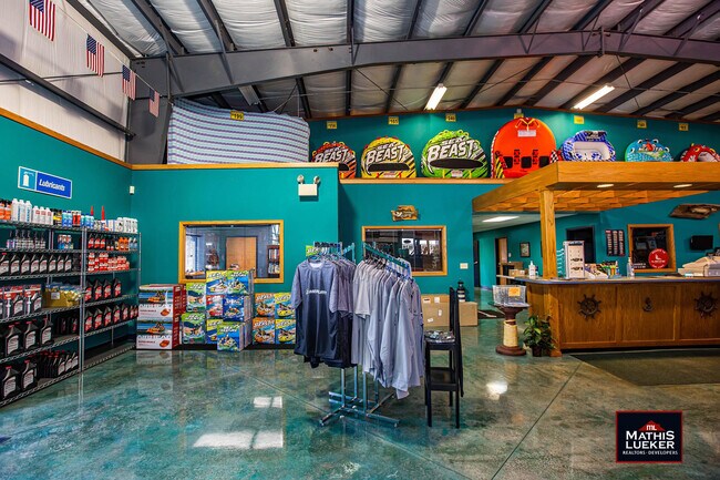
Vehiclerentalsvehiclesales
Kansas
AE The base floodplain where base flood elevations are provided. AE Zones are now used on new format FIRMs instead of A1-A30 Zones.
2
2025
2.74 AC
2025
I-70 Corridor
000500
Other Market Areas
5,460 SF
NEARBY LISTINGS FOR SALE OR LEASE
DEMOGRAPHICS near 205 E Ash St
1 mile
3 mile
5 mile
2025 Total Population
4,110
22,804
31,214
2030 Population
4,067
22,567
30,722
Pop Growth 2025-2030
(1.05%)
(1.04%)
(1.58%)
Average Age
37
35
32
2025 Total Households
1,765
9,125
11,439
HH Growth 2025-2030
(1.25%)
(1.27%)
(1.68%)
Median Household Inc
$57,490
$56,914
$55,521
Avg Household Size
2.20
2.40
2.50
2025 Avg HH Vehicles
2.00
2.00
2.00
Median Home Value
$161,632
$161,724
$163,947
Median Year Built
1961
1980
1985
Nearby Places
Map Layers
Map Styles
 Street
 Aerial
Layers
 Traffic
 Biking
Places
Listings with unknown addresses are not visible on the map
- Restaurants
- Banks
- Shops
- Fitness
- Groceries
PUBLIC TRANSPORTATION
AIRPORT
Manhattan Regional
Drive
Walk
Distance
Manhattan Regional
23 min
14.1 mi
SALE & LEASE HISTORY
LISTING DATE
SALE/LEASE

May 11, 2022
For Sale
Dec 05, 2022
For Sale
Nearby Properties
Address
Land Use
TOTAL SIZE
Lot Size
Zoning
Address
Land Use
TOTAL SIZE
Lot Size
Zoning
67,133 SF
15.71 AC
RG
Address
Land Use
TOTAL SIZE
Lot Size
Zoning
177,550 SF
68.20 AC
A
Address
Land Use
TOTAL SIZE
Lot Size
Zoning
228,233 SF
19.18 AC
Address
Land Use
TOTAL SIZE
Lot Size
Zoning
60,167 SF
15.68 AC
Address
Land Use
TOTAL SIZE
Lot Size
Zoning
126,667 SF
3.17 AC
RM
Address
Land Use
TOTAL SIZE
Lot Size
Zoning
28,589 SF
85 AC
IL
Address
Land Use
TOTAL SIZE
Lot Size
Zoning
78,174 SF
35.10 AC
RM
Address
Land Use
TOTAL SIZE
Lot Size
Zoning
18,321 SF
0.67 AC
Address
Land Use
TOTAL SIZE
Lot Size
Zoning
16,850 SF
0.59 AC
CCS
Address
Land Use
TOTAL SIZE
Lot Size
Zoning
11,679 SF
49.73 AC
Address
Land Use
TOTAL SIZE
Lot Size
Zoning
62,043 SF
3.17 AC
CS
Address
Land Use
TOTAL SIZE
Lot Size
Zoning
34,700 SF
1.51 AC
RM
Address
Land Use
TOTAL SIZE
Lot Size
Zoning
17,388 SF
0.44 AC
Address
Land Use
TOTAL SIZE
Lot Size
Zoning
8,828 SF
6.30 AC
RS
Address
Land Use
TOTAL SIZE
Lot Size
Zoning
56,611 SF
9.20 AC
CR
Address
Land Use
TOTAL SIZE
Lot Size
Zoning
56,546 SF
7.39 AC
RG
Address
Land Use
TOTAL SIZE
Lot Size
Zoning
20,898 SF
5.87 AC
CR
Address
Land Use
TOTAL SIZE
Lot Size
Zoning
29,248 SF
6.20 AC
RS
Address
Land Use
TOTAL SIZE
Lot Size
Zoning
15,452 SF
0.42 AC
Address
Land Use
TOTAL SIZE
Lot Size
Zoning
184,351 SF
29.28 AC
IL
Address
Land Use
TOTAL SIZE
Lot Size
Zoning
58,662 SF
3.34 AC
Address
Land Use
TOTAL SIZE
Lot Size
Zoning
16,235 SF
5.90 AC
Address
Land Use
TOTAL SIZE
Lot Size
Zoning
36,456 SF
2.72 AC
CS
Address
Land Use
TOTAL SIZE
Lot Size
Zoning
93,469 SF
12.98 AC
Address
Land Use
TOTAL SIZE
Lot Size
Zoning
35,825 SF
6.14 AC
RS
Address
Land Use
TOTAL SIZE
Lot Size
Zoning
43,404 SF
2.80 AC
Address
Land Use
TOTAL SIZE
Lot Size
Zoning
35,160 SF
2.30 AC
RS
Address
Land Use
TOTAL SIZE
Lot Size
Zoning
13,920 SF
1.47 AC
CCS
Address
Land Use
TOTAL SIZE
Lot Size
Zoning
41,330 SF
3.22 AC
RD
Address
Land Use
TOTAL SIZE
Lot Size
Zoning
832 SF
189 AC
AP
The World's #1 Commercial Real Estate Marketplace
Connect with us
© 2026 CoStar Group
The information above has been obtained from sources believed reliable. While we do not doubt its accuracy we have not verified it and make no guarantee, warranty or representation about it. It is your responsibility to independently confirm its accuracy and completeness. Any projections, opinions, assumptions, or estimates used are for example only and do not represent the current or future performance of the property. The value of this transaction to you depends on tax and other factors which should be evaluated by your tax, financial, and legal advisors. You and your advisors should conduct a careful, independent investigation of the property to determine to your satisfaction the suitability of the property for your needs.