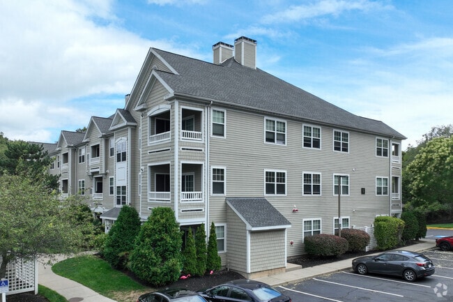
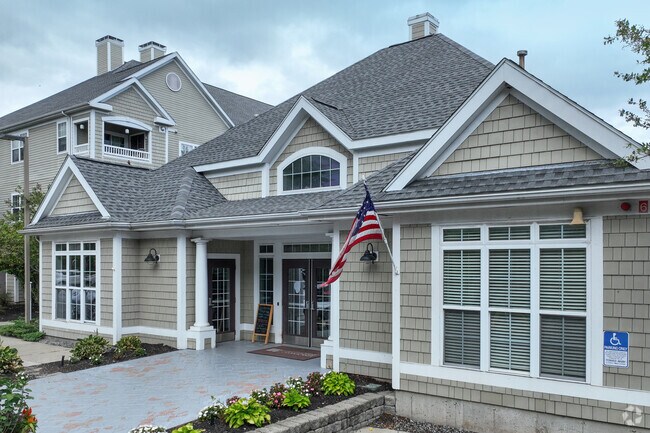
Property Record
205 Highland Ave, Salem, MA 01970
NEARBY LISTINGS FOR SALE OR LEASE
Property Detail
205 Highland Ave
SALE-000013-000000-000004
Essex
Apartment
Massachusetts
X
12
25009C0418H
5 AC
2025
South Salem
2025
Boston
204701
Boston-Cambridge-Newton, MA-NH
DEMOGRAPHICS near 205 Highland Ave
1 mile
3 mile
5 mile
2024 Total Population
12,250
146,169
276,208
2029 Population
12,242
144,377
273,624
Pop Growth 2024-2029
(0.07%)
(1.23%)
(0.94%)
Average Age
41
40
41
2024 Total Households
4,765
56,492
108,666
HH Growth 2024-2029
(0.17%)
(1.35%)
(0.98%)
Median Household Inc
$77,603
$83,529
$79,817
Avg Household Size
2.40
2.50
2.40
2024 Avg HH Vehicles
2.00
2.00
2.00
Median Home Value
$463,257
$498,290
$497,332
Median Year Built
1976
1949
1953
Nearby Places
Map Layers
Map Styles
 Street
 Aerial
Transit
 Traffic
 Biking
Places
Listings with unknown addresses are not visible on the map
- Restaurants
- Banks
- Shops
- Fitness
- Groceries
PUBLIC TRANSPORTATION
COMMUTER RAIL
Salem (Newburyport/Rockport Line - Massachusetts Bay Transportation Authority Commuter Rail (Purple Line))
Drive
Walk
Distance
Salem (Newburyport/Rockport Line - Massachusetts Bay Transportation Authority Commuter Rail (Purple Line))
4 min
2.2 mi
Swampscott (Newburyport/Rockport Line - Massachusetts Bay Transportation Authority Commuter Rail (Purple Line))
Drive
Walk
Distance
Swampscott (Newburyport/Rockport Line - Massachusetts Bay Transportation Authority Commuter Rail (Purple Line))
7 min
2.8 mi
AIRPORT
General Edward Lawrence Logan International
Drive
Walk
Distance
General Edward Lawrence Logan International
24 min
13.1 mi
Freight Ports
Port of Boston
Drive
Walk
Distance
Port of Boston
30 min
15.8 mi
Nearby Properties
Address
Land Use
TOTAL SIZE
Lot Size
Zoning
Address
Land Use
TOTAL SIZE
Lot Size
Zoning
10,368 SF
33.83 AC
R3
Address
Land Use
TOTAL SIZE
Lot Size
Zoning
14.69 AC
I
Address
Land Use
TOTAL SIZE
Lot Size
Zoning
9,860 SF
17.80 AC
R1
Address
Land Use
TOTAL SIZE
Lot Size
Zoning
192,341 SF
2.10 AC
B5
Address
Land Use
TOTAL SIZE
Lot Size
Zoning
29.12 AC
I
Address
Land Use
TOTAL SIZE
Lot Size
Zoning
154,524 SF
5.90 AC
B3
Address
Land Use
TOTAL SIZE
Lot Size
Zoning
190,000 SF
24.42 AC
N/A
Address
Land Use
TOTAL SIZE
Lot Size
Zoning
9.71 AC
BR
Address
Land Use
TOTAL SIZE
Lot Size
Zoning
153,855 SF
6.08 AC
A-2
Address
Land Use
TOTAL SIZE
Lot Size
Zoning
151.89 AC
PC
Address
Land Use
TOTAL SIZE
Lot Size
Zoning
38,440 SF
8.95 AC
I
Address
Land Use
TOTAL SIZE
Lot Size
Zoning
18.72 AC
R1
Address
Land Use
TOTAL SIZE
Lot Size
Zoning
224,826 SF
2.21 AC
LI
Address
Land Use
TOTAL SIZE
Lot Size
Zoning
223,689 SF
11.60 AC
R1
Address
Land Use
TOTAL SIZE
Lot Size
Zoning
205,353 SF
18.74 AC
Address
Land Use
TOTAL SIZE
Lot Size
Zoning
59.99 AC
IP
Address
Land Use
TOTAL SIZE
Lot Size
Zoning
25.72 AC
IP
Address
Land Use
TOTAL SIZE
Lot Size
Zoning
98,516 SF
5.01 AC
R1
Address
Land Use
TOTAL SIZE
Lot Size
Zoning
4.14 AC
NRCC
Address
Land Use
TOTAL SIZE
Lot Size
Zoning
28.30 AC
IP
Address
Land Use
TOTAL SIZE
Lot Size
Zoning
9.58 AC
R3
Address
Land Use
TOTAL SIZE
Lot Size
Zoning
14.50 AC
R1
Address
Land Use
TOTAL SIZE
Lot Size
Zoning
123,588 SF
1.50 AC
B5
Address
Land Use
TOTAL SIZE
Lot Size
Zoning
125,862 SF
5.30 AC
R1
Address
Land Use
TOTAL SIZE
Lot Size
Zoning
77,392 SF
6.82 AC
B3
Address
Land Use
TOTAL SIZE
Lot Size
Zoning
80,069 SF
3.13 AC
A-2
Address
Land Use
TOTAL SIZE
Lot Size
Zoning
229,416 SF
14.81 AC
N/A
Address
Land Use
TOTAL SIZE
Lot Size
Zoning
76,589 SF
4.57 AC
R4
Address
Land Use
TOTAL SIZE
Lot Size
Zoning
7.28 AC
R3
The World's #1 Commercial Real Estate Marketplace
Connect with us
© 2026 CoStar Group
The information above has been obtained from sources believed reliable. While we do not doubt its accuracy we have not verified it and make no guarantee, warranty or representation about it. It is your responsibility to independently confirm its accuracy and completeness. Any projections, opinions, assumptions, or estimates used are for example only and do not represent the current or future performance of the property. The value of this transaction to you depends on tax and other factors which should be evaluated by your tax, financial, and legal advisors. You and your advisors should conduct a careful, independent investigation of the property to determine to your satisfaction the suitability of the property for your needs.