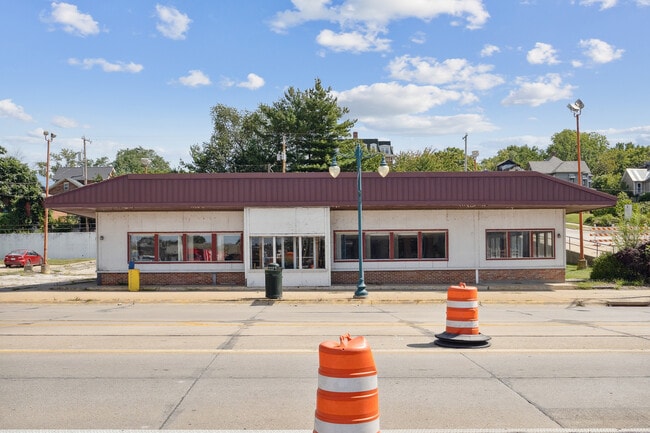
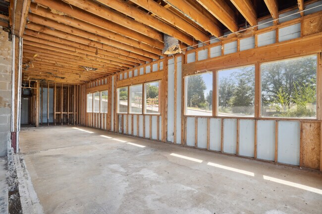
Property Record
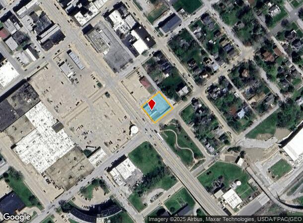
205 Main St, Keokuk, IA 52632
NEARBY LISTINGS FOR SALE OR LEASE
Property Detail
205 Main St
Fort Madison-Keokuk, IA-IL-MO
Sporkman-Bentler Addition
04-45-21-25-481-0020
MALL #260-AA KKK E27 2/3' OF LOT 10 ALL LOTS 11 & 12 BLK 27
Storebuilding
Lee
X
Iowa
29045C0220E
10-12
2024
0.41 AC
2025
Iowa Southeast Area
490900
Other Market Areas
3,589 SF
DEMOGRAPHICS near 205 Main St
1 Mile
3 Mile
5 Mile
2024 Total Population
4,925
13,348
16,395
2029 Population
5,027
13,304
16,290
Pop Growth 2024-2029
+ 2.07%
(0.33%)
(0.64%)
Average Age
40
42
42
2024 Total Households
2,079
5,604
6,895
HH Growth 2024-2029
+ 2.02%
(0.34%)
(0.67%)
Median Household Inc
$36,853
$46,470
$49,509
Avg Household Size
2.20
2.30
2.30
2024 Avg HH Vehicles
2.00
2.00
2.00
Median Home Value
$69,249
$86,180
$90,255
Median Year Built
1946
1953
1956
Nearby Places
Map Layers
Map Styles
 Street
 Aerial
- Restaurants
- Banks
- Shops
- Fitness
- Groceries
SALE & LEASE HISTORY
LISTING DATE
SALE/LEASE

Sep 06, 2024
For Sale
Nearby Properties
Address
Land Use
TOTAL SIZE
Lot Size
Zoning
Address
Land Use
TOTAL SIZE
Lot Size
Zoning
0.27 AC
Address
Land Use
TOTAL SIZE
Lot Size
Zoning
189,640 SF
24.72 AC
Address
Land Use
TOTAL SIZE
Lot Size
Zoning
10,656 SF
12.58 AC
Address
Land Use
TOTAL SIZE
Lot Size
Zoning
23,971 SF
1.52 AC
Address
Land Use
TOTAL SIZE
Lot Size
Zoning
18,853 SF
3.21 AC
Address
Land Use
TOTAL SIZE
Lot Size
Zoning
58,393 SF
6.84 AC
Address
Land Use
TOTAL SIZE
Lot Size
Zoning
8,100 SF
6.48 AC
Address
Land Use
TOTAL SIZE
Lot Size
Zoning
26,181 SF
1.68 AC
Address
Land Use
TOTAL SIZE
Lot Size
Zoning
90,147 SF
1.50 AC
Address
Land Use
TOTAL SIZE
Lot Size
Zoning
8,953 SF
3.07 AC
Address
Land Use
TOTAL SIZE
Lot Size
Zoning
26,185 SF
16.74 AC
Address
Land Use
TOTAL SIZE
Lot Size
Zoning
31,935 SF
1.59 AC
Address
Land Use
TOTAL SIZE
Lot Size
Zoning
11,705 SF
2.07 AC
Address
Land Use
TOTAL SIZE
Lot Size
Zoning
36,393 SF
4.59 AC
Address
Land Use
TOTAL SIZE
Lot Size
Zoning
8,620 SF
0.24 AC
Address
Land Use
TOTAL SIZE
Lot Size
Zoning
16,816 SF
3.25 AC
Address
Land Use
TOTAL SIZE
Lot Size
Zoning
57,144 SF
4.41 AC
Address
Land Use
TOTAL SIZE
Lot Size
Zoning
26,410 SF
2.07 AC
Address
Land Use
TOTAL SIZE
Lot Size
Zoning
13,312 SF
4.24 AC
Address
Land Use
TOTAL SIZE
Lot Size
Zoning
23,950 SF
2.03 AC
Address
Land Use
TOTAL SIZE
Lot Size
Zoning
5,280 SF
33.98 AC
Address
Land Use
TOTAL SIZE
Lot Size
Zoning
14,412 SF
1.96 AC
Address
Land Use
TOTAL SIZE
Lot Size
Zoning
5,188 SF
0.86 AC
Address
Land Use
TOTAL SIZE
Lot Size
Zoning
14,800 SF
2.08 AC
Address
Land Use
TOTAL SIZE
Lot Size
Zoning
23,022 SF
1.51 AC
Address
Land Use
TOTAL SIZE
Lot Size
Zoning
84,282 SF
8.74 AC
Address
Land Use
TOTAL SIZE
Lot Size
Zoning
40,018 SF
2.81 AC
Address
Land Use
TOTAL SIZE
Lot Size
Zoning
7,410 SF
10.67 AC
Address
Land Use
TOTAL SIZE
Lot Size
Zoning
10,240 SF
1.04 AC
The World's #1 Commercial Real Estate Marketplace
Connect with us
© 2025 CoStar Group
The information above has been obtained from sources believed reliable. While we do not doubt its accuracy we have not verified it and make no guarantee, warranty or representation about it. It is your responsibility to independently confirm its accuracy and completeness. Any projections, opinions, assumptions, or estimates used are for example only and do not represent the current or future performance of the property. The value of this transaction to you depends on tax and other factors which should be evaluated by your tax, financial, and legal advisors. You and your advisors should conduct a careful, independent investigation of the property to determine to your satisfaction the suitability of the property for your needs.